|
|
|
Metadata
|
|
ID
|
N-O1-06-LA
|
|
Abstract
|
United States Geological Survey, Menlo Park, California.
Chief Scientist: Brian Collins. Terrestrial LIDAR data
(lidar, GPS) of field activity N-O1-06-LA in New Orleans,
Louisiana from 03/13/2006 to 03/17/2006
|
|
Organization
|
United States Geological Survey, Menlo Park, California
|
|
Project/Theme
|
Terrestrial Lidar Imagery of Failed Levees During Hurricane Katrina
Coastal Change Hazards
|
|
Chief Scientist
|
Brian Collins
|
|
Activity Type
|
Terrestrial LIDAR
|
|
Area of Operation
|
New Orleans, Louisiana
|
|
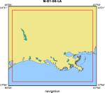
Location map
|
|
|
Bounding Coordinates
|
33.25000
-94.75000 -88.25000
28.25000
|
|
Ports
|
LEAVE Menlo Park, CA
ARRIVE Menlo Park, CA
|
|
Dates
|
03/13/2006 (JD 072) to 03/17/2006 (JD 076)
|
|
Analog Materials
|
No analog holdings.
|
|
Index map

|
|
|
Information Specialist
|
|
|
Crew
|
|
Tom Reiss
|
|
Brian Collins
|
|
Diane Minasian
|
|
|
Equipment Used
|
|
|
Purpose
|
|
Document and analyze geotechnical and structural deformations of failed levee
|
|
sections that occurred during Hurricane Katrina that led to the flooding of New
|
|
Orleans.
|
|
|
Information to be Derived
|
|
laser scanning data and GPS survey control coordinates
|
|
|
Notes
|
|
Equipment used: terrestrial lidar unit and differential GPS equipment
|
|
|
Publications
|
|
Collins, Brian, Minasian, Diane, Reiss, Tom, and Gibbons, Helen, 2006, USGS
|
|
Scientists Revisit New Orleans Levee Breaks to Collect High-Accuracy Survey Data, Sound Waves, May, 2006:
|
|
http://soundwaves.usgs.gov/2006/05/
|
|
|
Got Help?
|
For N-O1-06-LA, we would appreciate any information on -- analog materials, contract, days at sea, dive count, funding, kms of navigation, national plan, NGDC Info, owner, platform, project number, scanned materials, seismic description, station count, station description, submersible, summary, tabulated info.
|
|


