|
|
|
Metadata
|
|
ID
|
02055
|
|
Also Known As
|
02055
R-2-02-MA
R202MA
|
|
Abstract
|
Chief Scientist: Dave Foster. Data (bathymetry, GPS,
3dot5khz, sidescansonar) of field activity 02055 (R-2-02-MA)
in Nantucket Sound, Cape Cod, Massachusetts, United States,
North America, North Atlantic from 10/15/2002 to 10/29/2002
|
|
Project/Theme
|
Seafloor Mapping
|
|
Chief Scientist
|
Dave Foster
|
|
Platform
|
Rafael
|
|
Area of Operation
|
Nantucket Sound, Cape Cod, Massachusetts, United States, North America, North Atlantic
|
|
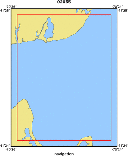
Location map
|

|
|
Bounding Coordinates
|
41.58333
-70.58333 -70.41667
41.41667
|
|
Ports
|
leave Woods Hole
arrive Woods Hole
|
|
Dates
|
10/15/2002 (JD 288) to 10/29/2002 (JD 302)
|
|
Analog Materials
|
No analog holdings.
|
|
Index map
|
|
|
Crew
|
|
Dave Foster
|
Chief Scientist, USGS Woods Hole
|
|
Barry Irwin
|
unspecified, USGS Woods Hole
|
|
Bill Danforth
|
unspecified, USGS Woods Hole
|
|
Chuck Worley
|
Captain
|
|
|
Equipment Used
|
|
bathymetry
|
|
GPS
|
|
3dot5khz
|
|
sidescansonar
|
|
|
Purpose
|
|
We will be testing equipment and mapping areas of interest in Nantucket
|
|
Sound in the area of Horseshoe Shoal. The survey will include high- resolution
|
|
subbottom, bathymetry, and sidescan sonar acquisition.
|
|
|
Got Help?
|
For 02055, we would appreciate any information on -- activity type, analog materials, contract, days at sea, dive count, funding, information specialist, information to be derived, kms of navigation, national plan, NGDC Info, notes, organization, owner, project number, publications, scanned materials, seismic description, station count, station description, submersible, summary, tabulated info.
|
|


