
|
|
|
|
Metadata
|
|
ID
|
08012
|
|
Also Known As
|
R-1-08-MY
08012
|
|
Abstract
|
United States Geological Survey, Woods Hole, Massachusetts.
Chief Scientist: Larry Poppe. Sampling,Hy data (SEABOSS, The
miniSEABOSS equipped with a digital still camera was used.)
of field activity 08012 (R-1-08-MY) in Edgartown Harbor,
Nantucket Sound, Marthas Vineyard, Massachusetts, United
States, North America, North Atlantic from 09/08/2008 to
09/09/2008
|
|
Organization
|
United States Geological Survey, Woods Hole, Massachusetts
|
|
Project/Theme
|
Sea and Lake Floor Mapping
|
|
Chief Scientist
|
Larry Poppe
|
|
Activity Type
|
Sampling
Photography
|
|
Platform
|
Rafael
|
|
Area of Operation
|
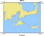
Edgartown Harbor, Nantucket Sound, Marthas Vineyard, Massachusetts, United States, North America, North Atlantic
|
|
Location map
|
|
|
Bounding Coordinates
|
41.46000
-70.58500 -70.43000
41.32500
|
|
Ports
|
LEAVE Woods Hole, MA
ARRIVE Woods Hole, MA
|
|
Dates
|
09/08/2008 (JD 252) to 09/09/2008 (JD 253)
|
|
Analog Materials
|
No analog holdings.
|
|
Index map

|
|
|
Information Specialist
|
|
Nancy Soderberg/Larry Poppe
|
|
|
Crew
|
|
Larry Poppe
|
Chief Scientist
|
|
Barry Irwin (Boat Operator)
|
|
Dann Blackwood (Photographer/SEABOSS Operator)
|
|
Kate McMullen (Field Technician)
|
|
|
Equipment Used
|
|
SEABOSS
|
|
The miniSEABOSS equipped
|
(with a digital still camera was used.)
|
|
|
Purpose
|
|
Ground-truth NOAA survey H11346 of the entrance to
|
|
Edgartown, Massachusetts with bottom sampling and photography.
|
|
Field work was focused on the sampling/photography.
|
|
|
Summary
|
|
Thirty seven stations were occupied (28 sites on September
|
|
8, 2008 9 sites on September 9, 2008). Still photographs and video
|
|
were collected at all stations sediment samples were collected at 34
|
|
of the stations. Sediment samples were not collected at the 3
|
|
stations where boulders and dense shells were present.
|
|
|
Notes
|
|
2 days at sea.
|
|
Data types: Notes/logs Photos Video Samples/cores Sediment samples, DVDs
|
|
and 8-mm tapes of bottom video and still photography
|
|
Navigation technique: dgps
|
|
Occupied 37 stations.
|
|
|
Project Number
|
|
|
Funding
|
|
|
Got Help?
|
For 08012, we would appreciate any information on -- analog materials, contract, days at sea, dive count, information to be derived, kms of navigation, national plan, NGDC Info, owner, publications, scanned materials, seismic description, station count, station description, submersible, tabulated info.
|
|


