|
! Converted to time format with year at start.
|
|
!
|
|
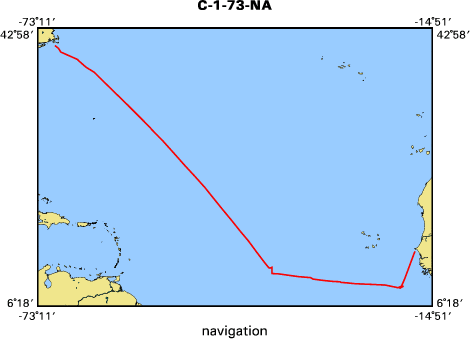
DATA COLLECTION OVERVIEW (use NGDC GEODAS CD to retrieve data)
|
|
|
|
MCG Data Collection ID --- C173NA
|
|
Institution Data Collection ID --- CH115L01
|
|
NGDC ID --- 02010061
|
|
Funding --- NSF
|
|
Project, Cruise & Leg --- CRUISE 115, LEG1
|
|
Study region --- +41.00000, +8.00000, -71.00000, -17.00000
|
|
Chief Scientist(s) --- DR.ELIZABETH BUNCE
|
|
Name of vessel --- CHAIN (surface ship)
|
|
Date field data collection started --- 11/20/73 WOODS HOLE U.S.A.
|
|
Date field data collection ended --- 12/10/73 DAKAR,SENEGAL
|
|
Parameters surveyed ---
|
|
Bathymetry: surveyed, contained in data file
|
|
Magnetics: surveyed, contained in data file
|
|
Gravity: surveyed, contained in data file
|
|
High-resolution seismics: (unspecified)
|
|
Deep penetration seismics: (unspecified)
|
|
Format --- (I1,A8,F5.2,4I2,F5.3,F8.5,F9.5,I1,F6.4,F6.1,I2,i1,3F6.1,I1,F5.1,F6.0,F7.1,F6.1,F5.1,A8,4I1)
|
|
Date of data input to NGDC --- 05/24/82
|
|
Contributing institution --- WOODS HOLE OCEANOGRAPHIC INSTITUTION
|
|
Country --- U.S.A.
|
|
|
|
Navigation instrumentation --- SATELLITE RECEIVER, DR
|
|
Position determination method --- SAT.AND DR MERGED WITH SHIP VELOCITY
|
|
|
|
Bathymetry instrumentation --- PRIM-3.5,SEC-12,WIDE BEAM 1 SEC SWEEP
|
|
Additional forms of bathymetric data --- ANALOG RECORDS, PUNCHED TAPE
|
|
General rate of bathymetry in file --- 5.0 minutes
|
|
General collection rate of bathymetry --- ONE/SECOND
|
|
Assumed sound velocity --- 1463.0 m/sec
|
|
Bathymetric datum code --- No correction applied (sea level)
|
|
Bathmetry interpolation scheme --- 5-MINUTES AND BREAK SLOPE
|
|
|
|
Magnetics instrumentation --- VARIAN PROTON-PRECESSION MAGNATOMETER
|
|
Additional forms of magnetics data --- ANALOG RECORDS, PUNCHED TAPE
|
|
General rate of magnetics in file --- 5.0 minutes
|
|
General collection rate of magnetics --- 60 seconds
|
|
Magnetic sensor tow distance --- 250 meters
|
|
Magnetic sensor depth --- (unspecified)
|
|
Two sensor horizontal separation --- (unspecified)
|
|
Residual magnetics reference field --- IGRF-65
|
|
Method of applying residual field --- LINER INTERPOLATION WHITIN DEGREE SQUARE
|
|
|
|
Gravity instrumentation --- ARPA VIBRATING STRING ACCELEROMETER
|
|
Additional forms of gravity data --- ANALOG RECORDS , PUNCHED TAPES
|
|
General rate of gravity in file --- 5.0 minutes
|
|
General collection rate of gravity --- 60 seconds
|
|
Theoretical gravity formula --- IAG System 1967
|
|
Reference system --- Potsdam system
|
|
Corrections applied --- DRIFT=-1.04MGAL/DAY BIAS=-.6
|
|
Starting land tie --- 980326.0 WHOI BASE STATION 611/317
|
|
Ending land tie --- 978481.6 WHOI BASE STATION 856/317
|
|
|
|
Seismic instrumentation --- (unspecified)
|
|
Formats of seismic data --- (unspecified)
|