|
|
|
Metadata
|
|
ID
|
B-1-98-SC
|
|
Abstract
|
United States Geological Survey, Menlo Park, California.
Chief Scientist: Guy Cochrane. Seismic and Sidescan Sonar and
Video data (YoNav, Kleinsidescan, underwatercamera) of field
activity B-1-98-SC in Santa Barbara Coast and Channel Islands
from 06/14/1998 to 06/29/1998
|
|
Organization
|
United States Geological Survey, Menlo Park, California
|
|
Project/Theme
|
Nearshore Benthic Habitats Project
|
|
National Plan
|
Environment
|
|
Chief Scientist
|
Guy Cochrane
|
|
Activity Type
|
Seismic and Sidescan Sonar and Video
|
|
Platform
|
Ballena
|
|
Area of Operation
|
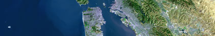
Santa Barbara Coast and Channel Islands
|
|
Location map
|

|
|
Bounding Coordinates
|
34.40898
-119.69134 -118.83857
34.00000
|
|
Dates
|
06/14/1998 (JD 165) to 06/29/1998 (JD 180)
|
|
Analog Materials
|
list
|
|
Index map

|
|
|
Crew
|
|
Guy Cochrane
|
Chief Scientist, USGS Western Region
|
|
Mike Boyle
|
Electronic Technician, USGS Western Region
|
|
|
Equipment Used
|
|
YoNav
|
|
Kleinsidescan
|
|
underwatercamera
|
|
|
Purpose
|
|
Nearshore Benthic Habitats mapping
|
|
|
Information to be Derived
|
|
2048 samples were recorded per channel over a swath width of 400 m yielding a pixel size of 0.1 m of seafloor area for the side-scan data.
|
|
|
Summary
|
|
We used the R/V Ballena, owned by the Channel Islands National Marine
|
|
Sanctuary, for our geophysical surveying. Combined sidescan-sonar imaging,
|
|
seismic reflection profiling, and towed bottom camera work began on June 15
|
|
after a day of mobilization, and ended June 26 with one day of demobilization.
|
|
Data was collected in nearshore waters, here defined as 0 to 100 meters in
|
|
depth. Two areas were surveyed in 1998, a 59 square km area north of Anacapa
|
|
Island, and a 113 square km area surrounding the Big Sycamore Canyon Reserve, on
|
|
the California coast, northwest of Pt. Dume. Approximately 6 hours of bottom
|
|
video was recorded in each of the two areas for groundtruthing the sidescan.The
|
|
geophysical surveying done in this and future years will be combined with
|
|
existing population studies, sediment sampling, ROV, submersible, and bottom
|
|
video camera observations to better understand benthic habitat - faunal
|
|
relationships. Navigation Systems - The 1998 survey was navigated with a Leica
|
|
Differential Global Positioning System (DGPS) which provided a ship position
|
|
with accuracy of 1-5 m in DGPS mode. At times during the cruise differential
|
|
signal was interrupted. In non-differential mode, the receiver provided a
|
|
position with 30-50 m accuracy. A KVH Industries Inc. azimuth digital
|
|
gyro-compass provided ship headings with 0.5 degree accuracy. Navigation data
|
|
were recorded using Yo-Nav version 1.19 (Gann, 1992). The sidescan fish is
|
|
towed approximately 20 m above the seafloor. The distance behind the ship of the
|
|
fish was not known during this survey and must be estimated when the data is
|
|
processed in order to produce the sidescan image mosaics. Sidescan Surveying
|
|
System - A Klein 2000 sidescan system was used for geophysical surveying. The
|
|
unit features 8 channels of processed data, 7 subsurface from the towfish (5
|
|
sonar and 2 instrumentation) and 1 surface (external analog input). Two sonar
|
|
channels each were devoted to 100 KHz and 500 KHz sidescan data and a fifth
|
|
sonar channel was used for 4 KHz subbottom profiling. The resolution of the
|
|
profiler data is approximately 0.15 m of sub-bottom thickness (penetration of
|
|
tens of meters is typical in unconsolidated sediment). A Triton Elics Isis
|
|
brand side-scan data recording system was used on the cruise. The Isis system
|
|
simultaneously records 5 channels of data; port and starboard 100 KHz side-scan
|
|
data, port and starboard 500 KHz side-scan data, and profiler data. Side-scan
|
|
data shown in this report are 100 KHz data. Typically, 2048 samples were
|
|
recorded per channel over a swath width of 400 m yielding a pixel size of 0.1 m
|
|
of seafloor area for the side-scan data.
|
|
|
Notes
|
|
Associated cruises in southern California:
|
|
|
B-1-98-SC
|
|
B-1-99-SC
|
|
B-2-99-SC
|
|
M-1-99-SC
|
|
M-1-00-SC
|
|
J-1-02-SC
|
|
M-1-02-SC
|
|
M-1-03-SC
|
|
S-5-04-SC
|
|
|
June 26, 1998
|
|
TIDBIT FROM THE CHANNEL ISLANDS
|
|
This from Guy Cochrane, via phone mail from the R/V Ballena: "Shot 40 sq km of
|
|
side-scan with the Klein system off the north side of Anacapa Island, working
|
|
with Channel Islands Marine Sanctuary people and the National Marine Fisheries
|
|
Service. We've also done a day and a half of bottom video using Hank's camera
|
|
sled, so we have about two hours of video tape. We've had really great weather.
|
|
Conditions have been perfect for both side-scan and bottom video. Mike Boyle and
|
|
I are doing okay."
|
|
|
|
July 10, 1998
|
|
CHANNEL ISLANDS BENTHIC HABITATS CRUISE
|
|
Mike Boyle and I finished the two-week Channel Islands/Santa Barbara benthic
|
|
habitats cruise on Saturday, June 27, and off-loaded on Sunday, June 28. We
|
|
sidescanned a 40-sq-km area of Anacapa Island and a 60-sq-km area on the coast
|
|
south of Ventura. Both areas contain state fish reserve areas and are in the
|
|
Channel Islands National Marine Sanctuary, or the National Park. We also have
|
|
about 8 hours of bottom video from both areas, thanks to very cooperative
|
|
weather. We did have some trouble with Differential GPS reception and will try
|
|
to improve our system prior to returning to the area. Guy Cochrane
|
|
|
Publications
|
|
Cochrane, G.R., and Lafferty, K.D., 2000, Activities and Preliminary Results of Nearshore Benthic
|
Habitat Mapping in Southern California, 1998, U.S. Geological Survey Open File Report 2000-321:
|
|
http://pubs.er.usgs.gov/usgspubs/ofr/ofr00321
|
|
|
Cochrane, G.R., Nasby, N.M., Reid, J.A., Waltenberger, B., and Lee, K.M., 2003, Nearshore
|
|
Benthic Habitat GIS for the Channel Islands National Marine Sanctuary and Southern California State
|
Fisheries Reserves Volume 1, U.S. Geological Survey Open File Report 2003-85:
|
|
http://pubs.er.usgs.gov/usgspubs/ofr/ofr0385
|
|
|
Got Help?
|
For B-1-98-SC, we would appreciate any information on -- contract, days at sea, dive count, funding, information specialist, kms of navigation, NGDC Info, owner, ports, project number, scanned materials, seismic description, station count, station description, submersible, tabulated info.
|
|