|
|
|
Metadata
|
|
ID
|
E-1-54-AA
|
|
Abstract
|
Chief Scientist: G.D. Fraser. Data of field activity
E-1-54-AA in Unalaska Island, Aleutian Islands, Alaska from
00/00/1954 to 00/00/1954
|
|
Chief Scientist
|
G.D. Fraser
|
|
Platform
|
Eider
|
|
Area of Operation
|
Unalaska Island, Aleutian Islands, Alaska
|
|
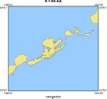
Location map
|
|
|
Bounding Coordinates
|
59.75000
165.25000 -150.25000
45.25000
|
|
Dates
|
00/00/1954 (JD 000) to 00/00/1954 (JD 000)
|
|
Analog Materials
|
No analog holdings.
|
|
Index map

|
|
|
Crew
|
|
G.D. Fraser
|
|
|
G.L. Snyder
|
|
|
H.F. Barnett
|
|
|
Harald Drewes
|
|
|
R.P. Plattr
|
|
|
H.B. Smith
|
|
|
W.B. Bryan
|
|
|
C.E. Chapin
|
|
|
Carl Velvelstad
|
captain
|
|
Charles Best
|
engineer
|
|
|
Notes
|
|
Geological reconnaissance of Unalaska Island occurred during the summer of 1954
|
|
|
Publications
|
|
Drewes, Harald, Fraser, G.D., Snyder, G.L., and Barnett, H.F. Jr., 1961,
|
|
Investigations of Alaskan Volcanoes; Geology of Unalaska Island and Adjacent
|
|
Insular Shelf, Aleutian Islands, Alaska, U.S. Geological Survey Bulletin
|
|
1028-S, p 583-676
|
|
|
Got Help?
|
For E-1-54-AA, we would appreciate any information on -- activity type, analog materials, contract, days at sea, dive count, equipment used, funding, information specialist, information to be derived, kms of navigation, national plan, NGDC Info, organization, owner, ports, project, project number, purpose, scanned materials, seismic description, station count, station description, submersible, summary, tabulated info.
|
|