|
|
|
|
Metadata
|
|
ID
|
04049
|
|
Also Known As
|
04049
T-1-04-CD
T-0904
|
|
Abstract
|
United States Geological Survey, Woods Hole,
Massachusetts,Woods Hole Oceanographic Institution. Chief
Scientists: Mike Bothner, Bill Martin. Geological data
(underwatertelevision, slowcore, GPS) of field activity 04049
(T-1-04-CD) in Cape Cod Bay, Massachusetts, United States,
North America, NorthAtlantic from 09/08/2004 to 09/08/2004
|
|
Organization
|
United States Geological Survey, Woods Hole, Massachusetts
Woods Hole Oceanographic Institution
|
|
Project/Theme
|
Nutrient, metal fluxes from contaminated sediments
|
|
Chief Scientist
|
Mike Bothner
Bill Martin
|
|
Activity Type
|
Geological
|
|
Platform
|
Tioga
|
|
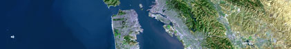
Area of Operation
|
Cape Cod Bay, Massachusetts, United States, North America, North
Atlantic
|
|
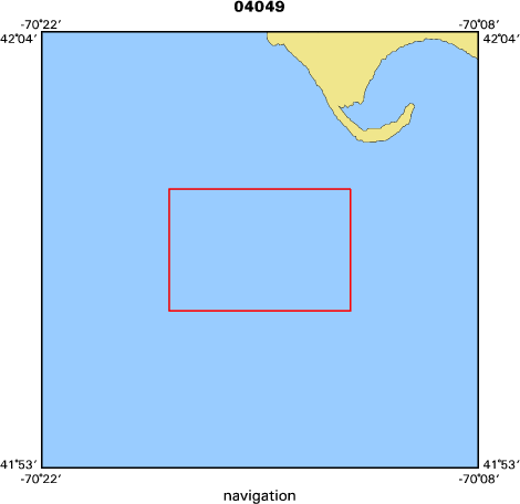
Location map
|

|
|
Bounding Coordinates
|
42.00000
-70.30000 -70.20000
41.95000
|
|
Ports
|
leave Woods Hole, MA
arrive Woods Hole, MA
|
|
Dates
|
09/08/2004 (JD 252) to 09/08/2004 (JD 252)
|
|
Analog Materials
|
No analog holdings.
|
|
Index map
|
|
|
Information Specialist
|
|
|
Crew
|
|
Mike Bothner
|
Chief Scientist, USGS Woods Hole
|
|
Bill Martin
|
Chief Scientist, WHOI
|
|
Michael Casso
|
USGS Woods Hole
|
|
Rick Rendigs
|
USGS Woods Hole
|
|
Joanne Goudreau
|
WHOI
|
|
|
Equipment Used
|
|
underwatertelevision
|
|
slowcore
|
|
GPS
|
|
|
Purpose
|
|
To deployed oxygen profiler and benthic chambers, and collect 6 cores
|
|
from Station 7 (in Cape Cod Bay SW of Provincetown). The slow corer will be used
|
|
in the gravity mode and the piston mode.
|
|
|
Information to be Derived
|
|
Samples and Chemical Analysis; Grain size analysis.
|
|
|
Summary
|
|
Deployed oxygen profiler and two benthic chambers, and collected 6
|
|
cores from Station 7 (in Cape Cod Bay SW of Provincetown). The slow corer was
|
|
used in the gravity mode and the piston mode. 1 Station Occupied.
|
|
|
Publications
|
|
Related Web Sites:
|
|
http://woodshole.er.usgs.gov/project-pages/bostonharbor/
|
|
|
Got Help?
|
For 04049, we would appreciate any information on -- analog materials, contract, days at sea, dive count, funding, kms of navigation, national plan, NGDC Info, notes, owner, project number, scanned materials, seismic description, station count, station description, submersible, tabulated info.
|
|