|
|
|
Metadata
|
|
ID
|
07034
|
|
Also Known As
|
R-3-07-MA
07034
|
|
Abstract
|
United States Geological Survey, Woods Hole, Massachusetts.
Chief Scientist: Larry Poppe. Sampling,Rofiling,Hy data
(DGPS, SEABOSS, Seismic reflection) of field activity 07034
(R-3-07-MA) in Woods Hole, Cape Cod, Massachusetts, United
States, North America, North Atlantic from 11/14/2007 to
11/19/2007
|
|
Organization
|
United States Geological Survey, Woods Hole, Massachusetts
|
|
Project/Theme
|
Sea and Lake Floor Mapping
|
|
Chief Scientist
|
Larry Poppe
|
|
Activity Type
|
Sampling
Seismic profiling
Photography
|
|
Platform
|
Rafael
|
|
Owner
|
Cmg Usgs
|
|
Area of Operation
|
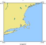
Woods Hole, Cape Cod, Massachusetts, United States, North America, North Atlantic
|
|
Location map
|
|
|
Bounding Coordinates
|
41.52778
-70.69167 -70.65556
41.50556
|
|
Ports
|
LEAVE Woods Hole, MA
ARRIVE Woods Hole, MA
|
|
Dates
|
11/14/2007 (JD 318) to 11/19/2007 (JD 323)
|
|
Analog Materials
|
No analog holdings.
|
|
Index map

|
|
|
Information Specialist
|
|
Larry Poppe
|
|
Nancy Soderberg
|
|
|
Crew
|
|
Larry Poppe
|
Chief Scientist
|
|
Dave Foster
|
ship operator, seismic technician
|
|
Chuck Worley
|
ship operator, seismic technician
|
|
Dann Blackwood
|
photographer, SEABOSS operator
|
|
Kate McMullen
|
field technician, watch stander
|
|
|
Equipment Used
|
|
DGPS
|
|
SEABOSS
|
|
Seismic reflection
|
(512i CHIRP)
|
|
|
Purpose
|
|
Ground-truth NOAA survey of Woods Hole (H11077) with
|
|
subbottom profiles and bottom sampling and photography.
|
|
|
Information to be Derived
|
|
Grain size analysis
|
|
Sea Floor Map
|
|
Bathymetric Maps
|
|
|
Summary
|
|
A total of 58 stations were occupied (44 sampling and
|
|
photography; 14 photography only). Chirp high-resolution
|
|
seismic-reflection data were collected along 12.6 km of tracklines.
|
|
|
Notes
|
|
2 days at sea.
|
|
Data types: Sediment samples, digital seismic-profile datafiles, video
|
|
and digital still photography (8-mm tapes and DVDs)
|
|
Occupied 58 stations.
|
|
12.6 km of continuous data.
|
|
Cruise plans involved 0.5 days of seismic profiling and 1.5
|
|
days of bottom sampling and photography.
|
|
|
Project Number
|
|
|
Funding
|
|
|
Got Help?
|
For 07034, we would appreciate any information on -- analog materials, contract, days at sea, dive count, kms of navigation, national plan, NGDC Info, publications, scanned materials, seismic description, station count, station description, submersible, tabulated info.
|
|


