|
|
|
|
Metadata
|
|
ID
|
03023
|
|
Also Known As
|
3023
WHOI OC387
O-2-03-MA
O203MA
|
|
Abstract
|
United States Geological Survey, Woods Hole,
Massachusetts,Woods Hole Oceanographic Institution. Chief
Scientists: Page Valentine, Hanu Singh, Cabell Davis, Scott
Gallegher, James Lindholm. Geological data (underwatercamera)
of field activity 03023 (O-2-03-MA) in Stellwagen Bank,
Massachusetts, United States, North America, Gulf ofMaine,
North Atlantic from 03/23/2003 to 03/26/2003
|
|
Organization
|
United States Geological Survey, Woods Hole, Massachusetts
Woods Hole Oceanographic Institution
|
|
Project/Theme
|
Stellwagen Bank Benthic Habitats Studies
|
|
Chief Scientist
|
Page Valentine
Hanu Singh
Cabell Davis
Scott Gallegher
James Lindholm
|
|
Activity Type
|
Geological
|
|
Platform
|
Oceanus
|
|
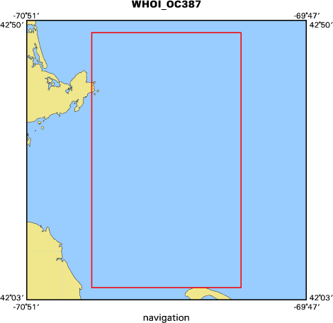
Area of Operation
|
Stellwagen Bank, Massachusetts, United States, North America, Gulf of
Maine, North Atlantic
|
|
Location map
|

|
|
Bounding Coordinates
|
42.80000
-70.60000 -70.03333
42.08333
|
|
Ports
|
leave Woods Hole, MA
arrive Woods Hole, MA
|
|
Dates
|
03/23/2003 (JD 082) to 03/26/2003 (JD 085)
|
|
Analog Materials
|
No analog holdings.
|
|
Index map
|
|
|
Information Specialist
|
|
|
Crew
|
|
Page Valentine
|
Chief Scientist, USGS Woods Hole
|
|
Hanu Singh
|
WHOI
|
|
Cabell Davis
|
WHOI
|
|
Scott Gallegher
|
WHOI
|
|
James Lindholm
|
SBNMS
|
|
Soupy Alexander
|
USGS Woods Hole
|
|
|
Equipment Used
|
|
|
Purpose
|
|
Seabed photographic imagery and sidescan from AUVs for habitat mapping
|
|
and classification
|
|
|
Information to be Derived
|
|
|
Summary
|
|
Conducted 10 transects with the Seabed AUV over various seabed
|
|
(habitat)types, including gravel, boulder reefs, mobile and immobile sand, and
|
|
mud. AUV digital camera collected up to 2500 photos per transect. Original
|
|
data (photos, depth, temp data) archived at the Deep Submergence Lab at WHOI
|
|
|
Notes
|
|
No USGS equipment required. Two autonomous underwater vehicles (AUV)
|
|
were used: SeaBED and REMUS.
|
|
|
Got Help?
|
For 03023, we would appreciate any information on -- analog materials, contract, days at sea, dive count, funding, kms of navigation, national plan, NGDC Info, owner, project number, publications, scanned materials, seismic description, station count, station description, submersible, tabulated info.
|
|