|
|
|
Metadata
|
|
ID
|
00002
|
|
Also Known As
|
00002
HANA00002
H-2-00-MY
|
|
Abstract
|
United States Geological Survey, Woods Hole, Massachusetts.
Chief Scientist: Mike Bothner. Mooring and Photo and Sampling
data (navigation) of field activity 00002 (H-2-00-MY) in
Massachusetts Bay from 02/15/2000 to 02/16/2000
|
|
Organization
|
United States Geological Survey, Woods Hole, Massachusetts
|
|
Project/Theme
|
Mass Bay Longterm Study
|
|
Chief Scientist
|
Mike Bothner
|
|
Activity Type
|
Mooring and Photo and Sampling
|
|
Platform
|
Marcus Hanna
|
|
Owner
|
US Coast Guard, Portland, ME
|
|
Area of Operation
|
Massachusetts Bay
|
|
Location map
|
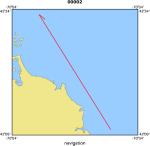
|
|
Bounding Coordinates
|
42.39022
-70.83063 -70.63990
42.16270
|
|
Ports
|
leave Boston, MA
arrive Boston, MA
|
|
Dates
|
02/15/2000 (JD 046) to 02/16/2000 (JD 047)
|
|
Analog Materials
|
No analog holdings.
|
|
Index map

|
|
|
Information Specialist
|
|
Michael Bothner; edited by Jessica Cote (mbothner@usgs.gov)
|
|
|
Crew
|
|
Mike Bothner
|
Chief Scientist, USGS Woods Hole
|
|
Richard Foy
|
Captain, USCG
|
|
Jonathan Borden
|
Unspecified, USGS Woods Hole
|
|
Brad Butman
|
Unspecified, USGS Woods Hole
|
|
Dann Blackwood
|
Unspecified, USGS Woods Hole
|
|
Mike Casso
|
Unspecified, USGS Woods Hole
|
|
Jessica Cote
|
Unspecified, USGS Woods Hole
|
|
D. Walsh
|
Unspecified, USGS Woods Hole
|
|
Marinna Martini
|
Unspecified, USGS Woods Hole
|
|
Rick Rendigs
|
Unspecified, USGS Woods Hole
|
|
Joe Newell
|
Mobilization, USGS Woods Hole
|
|
Bob Barton
|
Mobilization, USGS Woods Hole
|
|
Joanne Goudreau
|
Unspecified, WHOI
|
|
|
Equipment Used
|
|
|
Purpose
|
|
Exchange mooring 590-593, sample, dive
|
|
|
Information to be Derived
|
|
Times series data;Samples and Chemical Analysis;Suspended Sediment
|
|
Concentrations
|
|
|
Summary
|
|
Moorings deployed: 4(#611,612,613,614 all recovered #00003 MARCUS
|
|
HANNA May 9-10, 2000.)Moorings recovered: 3(#590,591,592 all deployed
|
|
#99009 MARCUS HANNA Sep 21-22, 1999.)
|
|
|
Notes
|
|
|
Project Number
|
|
67011 for RR, DB and MC. 67013 for others.
|
|
|
Funding
|
|
Joint Funding agreement between USGS and MWRA.
|
|
|
Publications
|
|
Cruise Report exists at Woods Hole
|
|
|
Got Help?
|
For 00002, we would appreciate any information on -- analog materials, contract, days at sea, dive count, kms of navigation, national plan, NGDC Info, scanned materials, seismic description, station count, station description, submersible, tabulated info.
|
|


