|
|
|
Metadata
|
|
ID
|
06SCC01
|
|
Also Known As
|
G106LA
DS-259
|
|
Abstract
|
United States Geological Survey, St. Petersburg, Florida.
Chief Scientist: Nick Ferina. Geophysical data (CHIRP,
subbottomprofiler) of field activity 06SCC01 (G-1-06-LA) in
Offshore of Isles Dernieres, Louisiana from 06/08/2006 to
06/30/2006
|
|
Organization
|
United States Geological Survey, St. Petersburg, Florida
|
|
Project/Theme
|
Subsidence and Coastal Change
Coastal Change Hazards
|
|
Chief Scientist
|
Nick Ferina
|
|
Activity Type
|
Geophysical
|
|
Platform
|
Gilbert
|
|
Area of Operation
|
Offshore of Isles Dernieres, Louisiana
|
|
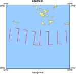
Location map
|
|
|
Bounding Coordinates
|
29.03352
-90.95203 -90.75776
28.98394
|
|
Ports
|
LEAVE Port Fourchon, LA
ARRIVE Port Fourchon, LA
|
|
Dates
|
06/08/2006 (JD 159) to 06/30/2006 (JD 181)
|
|
Analog Materials
|
list
|
|
Index map

|
|
|
Information Specialist
|
|
|
Crew
|
|
Nick F. Ferina
|
Geologist, Chief Scientist, USGS St. Petersburg, FL
|
|
Dana S. Wiese
|
Electronics Technician, USGS St. Petersburg, FL
|
|
Richard Young
|
Boat Captain, USGS St. Petersburg, FL
|
|
|
Equipment Used
|
|
|
Purpose
|
|
|
Information to be Derived
|
|
Post-Hurricane Katrina Barrier Island Coastal Monitoring
|
|
|
Summary
|
|
|
Notes
|
|
Digital 06SCC01 FACS logs were generated by A. Harrison in July of 2006
|
|
using the handwritten logs and personal accounts of the crew members. Barrier Island Coastal Monitoring (BICM)
|
|
EdgeTech, XStar, SB-424, Digital, Triton Imaging SBLogger, (FSSB)
|
|
acquisition, software, V. 1.6.421
|
|
|
Publications
|
|
Harrison, A.S., Dadisman, S.V., Ferina, N.F., Wiese, D.S., and Flocks, J.G.,
|
|
2007, Archive of Digital CHIRP Seismic Reflection Data Collected During
|
|
USGS Cruise 06SCC01 Offshore of Isles Dernieres, Louisiana, June 2006, US
|
|
Geological Survey Data Series 259
|
|
|
|
publication metadata
|
|
|
Got Help?
|
For 06SCC01, we would appreciate any information on -- contract, days at sea, dive count, funding, kms of navigation, national plan, NGDC Info, owner, project number, scanned materials, seismic description, station count, station description, submersible, tabulated info.
|
|


