|
|
|
|
Metadata
|
|
ID
|
04032
|
|
Also Known As
|
04032
B-1-04-MA
MH46-04
|
|
Abstract
|
United States Geological Survey, Woods Hole,
Massachusetts,Woods Hole Oceanographic Institution. Chief
Scientists: Mike Bothner, Bill Martin. Geological data
(tripod, underwatertelevision, slowcore, instrumentmooring,
sedimenttrap, tempsalinometer, pressuresensor, currentmeter,
GPS) of field activity 04032 (B-1-04-MA) in Massachusetts
Bay, Massachusetts, United States, North America,North
Atlantic from 09/22/2004 to 09/23/2004
|
|
Organization
|
United States Geological Survey, Woods Hole, Massachusetts
Woods Hole Oceanographic Institution
|
|
Project/Theme
|
Massachusetts Bay Circulation and Contaminant Transport
|
|
Chief Scientist
|
Mike Bothner
Bill Martin
|
|
Activity Type
|
Geological
|
|
Platform
|
Abbie Burgess
|
|
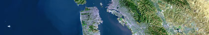
Area of Operation
|
Massachusetts Bay, Massachusetts, United States, North America,
North Atlantic
|
|
Location map
|

|
|
Bounding Coordinates
|
42.50000
-70.91000 -70.58000
42.25000
|
|
Ports
|
leave Boston, US Coast Guard Base
arrive Boston, US Coast Guard Base
|
|
Dates
|
09/22/2004 (JD 266) to 09/23/2004 (JD 267)
|
|
Analog Materials
|
No analog holdings.
|
|
Index map

|
|
|
Information Specialist
|
|
|
Crew
|
|
Mike Bothner
|
Chief Scientist, USGS Woods Hole
|
|
Bill Martin
|
Chief Scientist, WHOI
|
|
Dann Blackwood
|
instrument deployment and recovery, and sample collection, USGS Woods Hole
|
|
Jon Borden
|
instrument deployment and recovery, and sample collection, USGS Woods Hole
|
|
Mike Casso
|
instrument deployment and recovery, and sample collection, USGS Woods Hole
|
|
Dirk Koopmans
|
instrument deployment and recovery, and sample collection, USGS Woods Hole
|
|
Rick Rendigs
|
instrument deployment and recovery, and sample collection, USGS Woods Hole
|
|
Steve Ruane
|
instrument deployment and recovery, and sample collection, USGS Woods Hole, USGS Woods Hole
|
|
Brian Buczkowski
|
instrument deployment and recovery, and sample collection, USGS Woods Hole
|
|
Joanne Goudreau
|
investigator, WHOI
|
|
Paul Dilger
|
Captain
|
|
|
Equipment Used
|
|
tripod
|
|
underwatertelevision
|
|
slowcore
|
|
instrumentmooring
|
|
sedimenttrap
|
|
tempsalinometer
|
|
pressuresensor
|
|
currentmeter
|
|
GPS
|
|
|
Purpose
|
|
Exchanged long-term moorings at Station A off Boston. Collected 8
|
|
sediment cores. Deployed and recovered oxygen profiler. Deployed benthic
|
|
chambers.
|
|
|
Information to be Derived
|
|
Times series data, Samples and Chemical Analysis, Grain size analysis,
|
|
Suspended Sediment Concentrations.
|
|
|
Summary
|
|
Exchanged long-term moorings at Station A off Boston. Recovered 38
|
|
sediment trap samples. Collected 3 cores from Station 2 (sandy), and 5 cores
|
|
from Station 3 (muddy). 3 Stations Occupied.
|
|
|
Publications
|
|
Related Web Sites:
|
|
http://woodshole.er.usgs.gov/project-pages/bostonharbor/
|
|
|
Got Help?
|
For 04032, we would appreciate any information on -- analog materials, contract, days at sea, dive count, funding, kms of navigation, national plan, NGDC Info, notes, owner, project number, scanned materials, seismic description, station count, station description, submersible, tabulated info.
|
|