
|
|
|
|
Metadata
|
|
ID
|
S-5-04-SC
|
|
Abstract
|
United States Geological Survey, Menlo Park,
California,National Oceanic and Atmospheric
Administration,Channel Islands National Marine Sanctuary.
Chief Scientist: Guy Cochrane. Geological and Geophysical
data (Kleinsidescan, underwatertelevision, YoNav) of field
activity S-5-04-SC in Northern Channel Islands, Southern
California from 08/16/2004 to 08/27/2004
|
|
Organization
|
United States Geological Survey, Menlo Park, California
National Oceanic and Atmospheric Administration
Channel Islands National Marine Sanctuary
|
|
Project/Theme
|
Benthic Habitats
|
|
Chief Scientist
|
Guy Cochrane
|
|
Activity Type
|
Geological and Geophysical
|
|
Platform
|
Shearwater
|
|
Area of Operation
|
Northern Channel Islands, Southern California
|
|
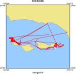
Location map
|
|
|
Bounding Coordinates
|
34.40881
-120.50362 -119.26316
33.93144
|
|
Ports
|
leave Santa Barbara, CA
arrive Santa Barbara, CA
|
|
Dates
|
08/16/2004 (JD 229) to 08/27/2004 (JD 240)
|
|
Analog Materials
|
list
|
|
Index map

|
|
|
Information Specialist
|
|
|
Crew
|
|
Guy Cochrane
|
Chief Scientist, USGS Menlo Park
|
|
Jamie Conrad
|
Geologist, USGS, CMG
|
|
Mike Boyle
|
ET, USGS, CMG
|
|
Sarah Fangman
|
Biologist, NOAA, CINMS
|
|
Margie Boyle
|
Camera technician, Volunteer
|
|
Lew Moody
|
Pilot, NOAA
|
|
Terrance Shinn
|
Pilot, NOAA
|
|
|
Equipment Used
|
|
Kleinsidescan
|
|
underwatertelevision
|
|
YoNav
|
|
|
Purpose
|
|
Seafloor mapping and habitat characterization.
|
|
|
Information to be Derived
|
|
Sidescan sonar backscatter surficial bottom imagery, and video
|
|
groundtruthing imagery.
|
|
|
Summary
|
|
Video: 5935 m S. Anacapa 13268m, Anacapa Passage, 3776 S. Santa Cruz.
|
|
Sidescan: 62 sq km N. San Miguel.
|
|
|
Notes
|
|
|
Got Help?
|
For S-5-04-SC, we would appreciate any information on -- contract, days at sea, dive count, funding, kms of navigation, national plan, NGDC Info, owner, project number, publications, scanned materials, seismic description, station count, station description, submersible, tabulated info.
|
|


