|
|
|
Metadata
|
|
ID
|
88014
|
|
Also Known As
|
88014
SIMS88-1
S-1-88-LM
|
|
Abstract
|
United States Geological Survey, Woods Hole, Massachusetts.
Chief Scientist: Colman. Data (navigation) of field activity
88014 (S-1-88-LM) in Lake Michigan from 09/06/1988 to
09/13/1988
|
|
Organization
|
United States Geological Survey, Woods Hole, Massachusetts
|
|
Project/Theme
|
Lake Level and Sediment History
|
|
Chief Scientist
|
Colman
|
|
Platform
|
Simons
|
|
Area of Operation
|
Lake Michigan
|
|
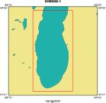
Location map
|
|
|
Bounding Coordinates
|
44.50000
-88.00000 -86.00000
41.50000
|
|
Dates
|
09/06/1988 (JD 250) to 09/13/1988 (JD 257)
|
|
Analog Materials
|
No analog holdings.
|
|
Index map

|
|
|
Crew
|
|
Steve Colman
|
Chief Scientist, USGS Woods Hole
|
|
Ron Ingram
|
Ship Captain, Roger R. Simons
|
|
Dave Foster
|
Technician, USGS Woods Hole
|
|
Bob Oldale
|
Technician, USGS Woods Hole
|
|
Ken Parolski
|
Technician, USGS Woods Hole
|
|
Barry Irwin
|
Navigation Specialist, USGS Woods Hole
|
|
Jim Clark
|
Unspecified, Calvin College
|
|
Jim Meer
|
Unspecified, U. Wisconsin
|
|
Jim Katsolis
|
coring party chief, Alpine Ocean Seismic Surveys
|
|
|
Equipment Used
|
|
|
Purpose
|
|
|
Publications
|
|
Cruise Report exists at Woods Hole
|
|
|
Got Help?
|
For 88014, we would appreciate any information on -- activity type, analog materials, contract, days at sea, dive count, funding, information specialist, information to be derived, kms of navigation, national plan, NGDC Info, notes, owner, ports, project number, scanned materials, seismic description, station count, station description, submersible, summary, tabulated info.
|
|


