|
|
|
Metadata
|
|
ID
|
01ASR02
|
|
Also Known As
|
B-2-01-FL
SFWMD_Canal_Survey
01ASR02
|
|
Abstract
|
United States Geological Survey, St. Petersburg,
Florida,South Florida Water Management District. Chief
Scientist: Jack Kindinger. High-Resolution Seismic data
(Geopulse, GPS, hydrophone, subbottomprofiler) of field
activity 01ASR02 (B-2-01-FL) in Miami Canals from 12/03/2001
to 12/05/2001
|
|
Organization
|
United States Geological Survey, St. Petersburg, Florida
South Florida Water Management District
|
|
Project/Theme
|
Aquifer Storage and Recovery
|
|
Chief Scientist
|
Jack Kindinger
|
|
Activity Type
|
High-Resolution Seismic
|
|
Platform
|
Boat
|
|
Area of Operation
|
Miami Canals
|
|
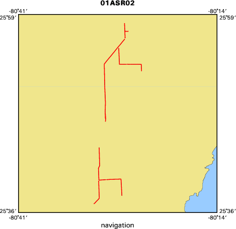
Location map
|

|
|
Bounding Coordinates
|
25.97315
-80.50852 -80.40368
25.61249
|
|
Ports
|
leave Miami, FL
arrive Miami, FL
|
|
Dates
|
12/03/2001 (JD 337) to 12/05/2001 (JD 339)
|
|
Analog Materials
|
list
|
|
Index map
|
|
|
Information Specialist
|
|
|
Crew
|
|
Jack Kindinger
|
Chief Scientist/Boat Driver, USGS St. Petersburg
|
|
Dana Wiese
|
Electronics Tech / Data Manager, USGS St. Petersburg
|
|
Chandra Dreher
|
Intern/Field Tech, USGS St. Petersburg
|
|
|
Equipment Used
|
|
Geopulse
|
|
GPS
|
|
hydrophone
|
|
subbottomprofiler
|
|
|
Purpose
|
|
Evaluate geology in relation to possible aquifer storage and recovery
|
|
|
Information to be Derived
|
|
|
Notes
|
|
Bounding Box:
|
|
NW : 26 00.000N, 80 30.000W NE : 26 00.000N, 80 00.000W
|
|
SW : 25 30.000N, 80 30.000W SE : 25 30.000N, 80 00.000W
|
|
WGS84
|
|
Using Generac 4000 generator for PC/Power Supply
|
|
Used 16' Johnboat.
|
|
|
Publications
|
|
Calderon, Karynna, Dadisman, Shawn V., Kindinger, Jack L., Wiese, Dana S., and
|
|
Flocks, James G., 2002, Archive of boomer seismic reflection data collected
|
|
during USGS field activities 01ASR01, 01ASR02, 02ASR01, and 02ASR02, Miami,
|
|
Florida, November 2001-January 2002: U.S. Geological Survey Open-File Report
|
|
02-408, CD-ROM:
|
|
http://pubs.usgs.gov/of/2002/of02-408/
|
|
|
|
publication metadata
|
|
|
Got Help?
|
For 01ASR02, we would appreciate any information on -- contract, days at sea, dive count, funding, kms of navigation, national plan, NGDC Info, owner, project number, scanned materials, seismic description, station count, station description, submersible, summary, tabulated info.
|
|