|
|
|
Metadata
|
|
ID
|
H-1-00-HW
|
|
Also Known As
|
HAPA
|
|
Abstract
|
United States Geological Survey, Menlo Park, California.
Chief Scientist: Monty Hampton. Geological data
(vibratingcore, GPS) of field activity H-1-00-HW in Oahu,
Hawaii from 06/24/2000 to 07/07/2000
|
|
Organization
|
United States Geological Survey, Menlo Park, California
|
|
Project/Theme
|
Hawaii Sand Resources
|
|
National Plan
|
Natural Resources
|
|
Chief Scientist
|
Monty Hampton
|
|
Activity Type
|
Geological
|
|
Platform
|
Hapa
|
|
Area of Operation
|
Oahu, Hawaii
|
|
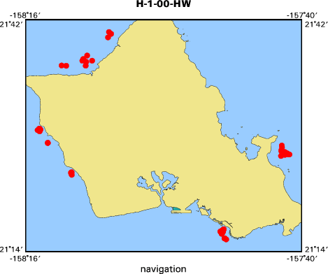
Location map
|

|
|
Bounding Coordinates
|
21.66700
-158.23502 -157.69675
21.25180
|
|
Dates
|
06/24/2000 (JD 176) to 07/07/2000 (JD 189)
|
|
Analog Materials
|
list
|
|
Index map
|
|
|
Crew
|
|
Monty Hampton
|
Chief Scientist, USGS Western Region
|
|
Justin Holl
|
Technician, Navigation, USGS Western Region
|
|
Kealoha Spinney
|
Ship's Captain, P&R Water Taxi
|
|
Alan Lee
|
Ship's Deckhand, P&R Water Taxi
|
|
Mark Mertz
|
Vibracoring Supervisor, Teg Ocean Services
|
|
Otto Elliot
|
Vibracoring Technician, Teg Ocean Services
|
|
Annick Tardif
|
Vibracoring Technician, Teg Ocean Services
|
|
|
Equipment Used
|
|
|
Purpose
|
|
Sample reef-front sediment deposits off Oahu to determine their potential as a source of sand for beach nourishment.
|
|
|
Information to be Derived
|
|
Grain size and composition
|
|
|
Summary
|
|
Collected 55 vibracores from sediment deposits
|
|
on the reef front
|
|
off Kialua Bay, the leeward and north shores, and Waikiki, Oahu.
|
|
|
Notes
|
|
TEG Oceanographic Services contract work
|
|
|
|
|
Got Help?
|
For H-1-00-HW, we would appreciate any information on -- contract, days at sea, dive count, funding, information specialist, kms of navigation, NGDC Info, owner, ports, project number, publications, scanned materials, seismic description, station count, station description, submersible, tabulated info.
|
|


