|
|
|
Metadata
|
|
ID
|
81038
|
|
Also Known As
|
OCNS108-1,2
O-8-81-GK
81038
BLM M-2
|
|
Abstract
|
Woods Hole Oceanographic Institution,Bureau of Land
Management. Chief Scientists: Rick Rendigs, Michael Rawson.
Data (navigation) of field activity 81038 (O-8-81-GK) in
Georges Bank from 11/09/1981 to 11/20/1981
|
|
Organization
|
Woods Hole Oceanographic Institution
Bureau of Land Management
|
|
Project/Theme
|
Georges Bank Lease Sale No. 42 Environmental Monitoring Project
|
|
Chief Scientist
|
Rick Rendigs
Michael Rawson
|
|
Platform
|
Oceanus
|
|
Area of Operation
|
Georges Bank
|
|
Location map
|
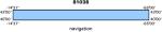
|
|
Bounding Coordinates
|
41.60000
-70.25000 -67.10000
40.35000
|
|
Dates
|
11/09/1981 (JD 313) to 11/20/1981 (JD 324)
|
|
Analog Materials
|
No analog holdings.
|
|
Index map

|
|
|
Crew
|
|
Rick Rendigs
|
Chief Scientist, USGS Woods Hole
|
|
Michael Rawson
|
Chief Scientist, LDGO
|
|
Carol Parmenter
|
Unspecified, USGS Woods Hole
|
|
Rick Rendigs
|
Unspecified, USGS Woods Hole
|
|
Bill Strahle
|
Unspecified, USGS Woods Hole
|
|
Paul Bowker
|
Unspecified, USGS Woods Hole
|
|
Dave Brewster
|
Unspecified, USGS Woods Hole
|
|
Larry Poppe
|
Unspecified, USGS Woods Hole
|
|
Phillip Thomas
|
Unspecified, OCS, NY
|
|
Jeffrey Hyland
|
Unspecified, OCS, NY
|
|
Rose Petrecca
|
Unspecified, WHOI
|
|
John Erhard
|
Unspecified, LDGO
|
|
Bill Hunneke
|
Unspecified, LDGO
|
|
|
Equipment Used
|
|
|
Purpose
|
|
Sampling, leg 2: 17th-20th
|
|
|
Got Help?
|
For 81038, we would appreciate any information on -- activity type, analog materials, contract, days at sea, dive count, funding, information specialist, information to be derived, kms of navigation, national plan, NGDC Info, notes, owner, ports, project number, publications, scanned materials, seismic description, station count, station description, submersible, summary, tabulated info.
|
|


