|
|
|
Metadata
|
|
ID
|
08032
|
|
Also Known As
|
D-32-08-MA
08032
|
|
Abstract
|
United States Geological Survey, Woods Hole, Massachusetts.
Chief Scientists: Sandy Baldwin, Denis LeBlanc. Data (Scuba)
of field activity 08032 (D-32-08-MA) in Ashumet Pond,
Mashpee, Massachusetts, United States, North America from
08/06/2008 to 08/06/2008
|
|
Organization
|
United States Geological Survey, Woods Hole, Massachusetts
|
|
Chief Scientist
|
Sandy Baldwin
Denis LeBlanc
|
|
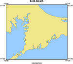
Area of Operation
|
Ashumet Pond, Mashpee, Massachusetts, United States, North America
|
|
Location map
|
|
|
Bounding Coordinates
|
41.80000
-70.78000 -70.33000
41.50000
|
|
Ports
|
LEAVE Ashumet Pond, Falmouth, MA
ARRIVE Ashumet Pond, Falmouth, MA
|
|
Dates
|
08/06/2008 (JD 219) to 08/06/2008 (JD 219)
|
|
Analog Materials
|
No analog holdings.
|
|
Index map

|
|
|
Information Specialist
|
|
|
Crew
|
|
Sandy Baldwin
|
Chief Scientist
|
|
Denis LeBlanc
|
WRD Northborough
|
|
|
Equipment Used
|
|
|
Purpose
|
|
Collaborate with USGS WRD-Northborough, MA office to
|
|
install sampling device to ground-water wells previously installed
|
|
in northern Ashumet Pond.
|
|
|
Information to be Derived
|
|
Samples and Chemical Analysis;
|
|
|
Summary
|
|
Installed sampling devices on a total of 8 wells in two
|
|
locations in the pond
|
|
|
Notes
|
|
Navigation technique: visual
|
|
1 day at sea.
|
|
Occupied 2 stations.
|
|
|
Project Number
|
|
|
Funding
|
|
|
Got Help?
|
For 08032, we would appreciate any information on -- activity type, analog materials, contract, days at sea, dive count, kms of navigation, national plan, NGDC Info, owner, platform, project, publications, scanned materials, seismic description, station count, station description, submersible, tabulated info.
|
|


