|
|
|
Metadata
|
|
ID
|
P-1-06-MB
|
|
Abstract
|
United States Geological Survey, Pacific Science Center.
Swathplus data (navigation) of field activity P-1-06-MB in
Pleasure Point, northern Monterey Bay from 04/10/2006 to
04/28/2006
|
|
Organization
|
United States Geological Survey, Pacific Science Center
|
|
Project/Theme
|
Benthic Habitats
|
|
Activity Type
|
Swathplus
|
|
Platform
|
Paragon
|
|
Area of Operation
|
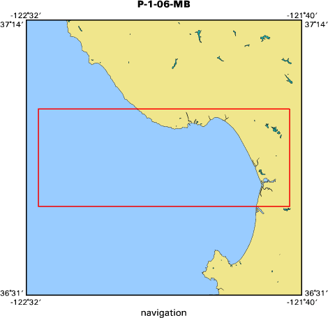
Pleasure Point, northern Monterey Bay
|
|
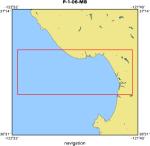
Location map
|
|
|
Bounding Coordinates
|
37.00000
-122.50000 -121.70000
36.75000
|
|
Ports
|
LEAVE Santa Cruz small craft harbor
ARRIVE Santa Cruz small craft harbor
|
|
Dates
|
04/10/2006 (JD 100) to 04/28/2006 (JD 118)
|
|
Analog Materials
|
No analog holdings.
|
|
Index map
|
|
|
Information Specialist
|
|
|
Crew
|
|
Curt Storlazzi
|
chief scientist, USGS
|
|
Gerry Hatcher
|
electronics technician, USGS
|
|
Mike Boyle
|
electronics technician, USGS
|
|
Andrew Stevenson
|
geophysicist, USGS
|
|
Jared Figurski
|
vessel captain, UCSC
|
|
Jamie Grover
|
vessel captain, UCSC
|
|
|
Equipment Used
|
|
|
Purpose
|
|
re-map area surveyed in October 2005 to detect winter storm-induced change
|
|
|
Information to be Derived
|
|
water depth, acoustic backscatter, sound velocity
|
|
|
Notes
|
|
|
Publications
|
|
Storlazzi, C.D., Barnard, P.L., Collins, B.D., Finlayson, D.P., Golden, N.E.,
|
|
Hatcher, G.A., Kayen, R.E., and Ruggiero, Peter, 2007, High-Resolution
|
|
Topographic, Bathymetric, and Oceanographic Data for the Pleasure Point Area,
|
|
Santa Cruz County, California: 2005-2007, U.S. Geological Survey Open File
|
|
Report 2007-1270, available on line at:
|
|
http://pubs.usgs.gov/of
|
|
/2007/1270/
|
|
|
Got Help?
|
For P-1-06-MB, we would appreciate any information on -- analog materials, chief scientist, contract, days at sea, dive count, funding, kms of navigation, national plan, NGDC Info, owner, project number, scanned materials, seismic description, station count, station description, submersible, summary, tabulated info.
|
|


