- Identification_Information:
-
- Citation:
-
- Citation_Information:
-
- Originator: U.S. Geological Survey (USGS), Coastal and Marine Geology (CMG)
- Publication_Date: 20081216
- Title:
-
Geological and Geophysical data of field activity S-4-78-NC
in San Francisco to Monterey, Northern California from
06/01/1978 to 06/05/1978
- Publication_Information:
-
- Publisher: U.S. Geological Survey (USGS), Coastal and Marine Geology (CMG)
- Online_Linkage: <http://walrus.wr.usgs.gov/infobank/gos/s-4-78-nc.fmeta.xml>
- Online_Linkage:
-
<http://walrus.wr.usgs.gov/infobank/s/s478nc/html/s-4-78-nc.meta.html>
- Description:
-
- Abstract:
-
Chief Scientist: Gary Greene. Geological and Geophysical
data (3dot5khz, 12khz, magnetics, airgunarcer,
integratednavigation, RhoRho, miniranger, underwatercamera,
chaindredge, sidescansonar, uniboom) of field activity
S-4-78-NC in San Francisco to Monterey, Northern California
from 06/01/1978 to 06/05/1978,
<http://walrus.wr.usgs.gov/infobank/s/s478nc/html/s-4-78-nc.meta.html>.
- Purpose:
-
These data and information are intended for science
researchers, students from elementary through
college, policy makers, and general public.
- Supplemental_Information:
-
Equipment Used -
3dot5khz
12khz
magnetics shipboard magnetometer
airgunarcer single-channel arcer
integratednavigation
RhoRho Loran-C Rho-Rho
miniranger
underwatercamera
chaindredge
sidescansonar
uniboom
Similar information is available for thousands
of other USGS/CMG-related Activities.
If known, available are Activity-specific
navigation, gravity, magnetics, bathymetry,
seismic, and sampling data; track maps; and
equipment information; as well as summary
overviews, crew lists, and information
about analog materials.
If available, access to physical samples is
described in the "WR CMG Sample Distribution
Policy" at:
<http://walrus.wr.usgs.gov/infobank/programs/html/main/sample-dist-policy.html>
Primary access to the USGS/CMG Information
Bank's digital data, analog data, and
metadata is provided through...
<http://walrus.wr.usgs.gov/infobank/>
This page accomodates a variety of search
approaches (e.g., by platform, by region,
by scientist, by equipment type, etc.).
- Time_Period_of_Content:
-
- Time_Period_Information:
-
- Range_of_Dates/Times:
-
- Beginning_Date: 19780601
- Ending_Date: 19780605
- Currentness_Reference: ground condition
- Status:
-
- Progress: Complete
- Maintenance_and_Update_Frequency: As needed
- Spatial_Domain:
-
- Bounding_Coordinates:
-
- West_Bounding_Coordinate: -123.55732
- East_Bounding_Coordinate: -121.79665
- North_Bounding_Coordinate: 37.80967
- South_Bounding_Coordinate: 36.60675
- Keywords:
-
- Theme:
-
- Theme_Keyword_Thesaurus: ISO 19115 Topic Category
- Theme_Keyword: geoscientificinformation
- Theme_Keyword: oceans
- Theme:
-
- Theme_Keyword_Thesaurus: USGS CMG InfoBank
- Theme_Keyword: Marine Geology
- Theme_Keyword: Marine Geophysics
- Theme_Keyword: Marine Magnetic Field
- Theme_Keyword: Magnetic Anomalies
- Theme_Keyword: Bathymetry
- Theme_Keyword: Water Depth
- Theme_Keyword: Seafloor Topography
- Theme_Keyword: Marine Seismic
- Place:
-
- Place_Keyword_Thesaurus: USGS CMG InfoBank
- Place_Keyword: CA
- Place_Keyword: Central California
- Place_Keyword: North Pacific Ocean
- Place_Keyword: Northern California
- Place_Keyword: Northern Pacific Ocean
- Place_Keyword: San Francisco to Monterey, Northern California
- Place_Keyword: USA
- Access_Constraints:
-
Physical materials are under controlled on-site access.
If available, access to physical samples is described
in the "WR CMG Sample Distribution Policy" at:
<http://walrus.wr.usgs.gov/infobank/programs/html/main/sample-dist-policy.html>
- Use_Constraints:
-
Please recognize the U.S. Geological Survey (USGS) as
the source of this information.
Physical materials are under controlled on-site access.
Some USGS information accessed through this means
may be preliminary in nature and presented without
the approval of the Director of the USGS. This
information is provided with the understanding
that it is not guaranteed to be correct or complete
and conclusions drawn from such information are
the responsibility of the user.
This information is not intended for navigational
purposes.
Any use of trade, firm, or product names is for
descriptive purposes only and does not imply
endorsement by the U.S. Government.
- Point_of_Contact:
-
- Contact_Information:
-
- Contact_Organization_Primary:
-
- Contact_Organization: U.S. Geological Survey (USGS), Coastal and Marine Geology (CMG)
- Contact_Person: Clint Steele
- Contact_Position: Data Acquisition, Processing, and Storage (DAPS) Group Leader
- Contact_Address:
-
- Address_Type: mailing and physical address
- Address: USGS, MailStop 999, 345 Middlefield Road
- City: Menlo Park
- State_or_Province: CA
- Postal_Code: 94025-3561
- Country: USA
- Contact_Voice_Telephone: (650) 329-5055
- Contact_Facsimile_Telephone: (650) 329-5190
- Contact_Electronic_Mail_Address: csteele@usgs.gov
- Browse_Graphic:
-
- Browse_Graphic_File_Name:
-
<http://walrus.wr.usgs.gov/infobank/s/s478nc/html/s-4-78-nc.nav.gif>
- Browse_Graphic_File_Description: Trackline map of S-4-78-NC
- Browse_Graphic_File_Type: GIF
- Browse_Graphic:
-
- Browse_Graphic_File_Name:
-
<http://walrus.wr.usgs.gov/infobank/s/s478nc/html/s-4-78-nc.bath.gif>
- Browse_Graphic_File_Description: Bathymetry data trackline map of S-4-78-NC
- Browse_Graphic_File_Type: GIF
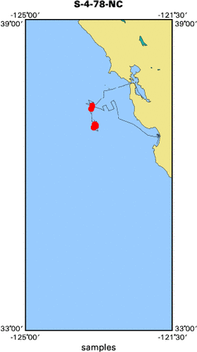
- Browse_Graphic:
-
- Browse_Graphic_File_Name:
-
<http://walrus.wr.usgs.gov/infobank/s/s478nc/html/s-4-78-nc.samp.gif>
- Browse_Graphic_File_Description: Sampling locations map of S-4-78-NC
- Browse_Graphic_File_Type: GIF
- Data_Set_Credit:
-
Adolf Oliver (Watchstander);
Al McClenaghan (Ship Captain);
Andy Stevenson (Mechanical Technician, USGS Western Region);
Bill Lansdown (Watchstander);
Brent Dalrymple (Geologist, USGS Western Region);
Carol Madison (Navigator, USGS Western Region);
Cheryl Price (Dafe Curator, USGS Western Region);
Dave Clague (Geologist, USGS Western Region);
David Perry (Watchstander);
Gary Greene (Chief Scientist, USGS Western Region);
Glen Barker (Mechanical Technician);
Jack Schoellhamer (Geologist);
Jennifer Rego (Watchstander);
John Laingor (Chief Mate);
John Saladin (Electronics Technician);
Mike Boyle (Electronics Technician, USGS Western Region);
Pat McCrory (Navigator, USGS Western Region);
Bill Soule (Chief Engineer)
- Native_Data_Set_Environment: Digital, ASCII
- Cross_Reference:
-
- Citation_Information:
-
- Originator: U.S. Geological Survey (USGS), Coastal and Marine Geology (CMG)
- Publication_Date: Unknown
- Title: USGS/CMG Information Bank
- Publication_Information:
-
- Publisher: U.S. Geological Survey (USGS), Coastal and Marine Geology (CMG)
- Other_Citation_Details: Updated daily
- Online_Linkage: <http://walrus.wr.usgs.gov/infobank/>
- Data_Quality_Information:
-
- Attribute_Accuracy:
-
- Attribute_Accuracy_Report: Identified as best available version.
- Logical_Consistency_Report: Unspecified
- Completeness_Report:
-
Start and end date/times of data
Navigation Data (s-4-78-nc.010 [DRS])
YYYYMMDDHHMMSST    YYYYMMDDHHMMSST
197806011912130    197806012124010
197806012132040    197806020129010
197806020141480    197806021611150
197806021617410    197806031308580
197806031314030    197806031416210
197806031436210    197806031440200
197806031448200    197806040001080
197806040009070    197806040145080
197806040151080    197806040224080
197806040230060    197806040409030
197806040420350    197806040424350
197806040434330    197806041441040
197806041451030    197806041638240
197806041648240    197806041758120
197806041806140    197806041938170
197806041944190    197806042235150
197806042246250    197806050340220
197806050350230    197806050451080
197806050457050    197806050625200
197806050631220    197806050653240
197806050705250    197806050745390
197806050751250    197806051052080
197806051058080    197806051230100
197806051240090    197806051532120
197806051546140    197806051958140
197806052012150    197806052030190
YYYYMMDDHHMMSST    YYYYMMDDHHMMSST
Bathymetry Data (s-4-78-nc.330_010)
YYYYMMDDHHMMSST    YYYYMMDDHHMMSST
197806021801000    197806021901000
197806022000000    197806022128000
197806022149000    197806022327000
197806022345000    197806030000000
197806030146000    197806030308000
YYYYMMDDHHMMSST    YYYYMMDDHHMMSST
- Positional_Accuracy:
-
- Horizontal_Positional_Accuracy:
-
- Horizontal_Positional_Accuracy_Report: Unspecified
- Vertical_Positional_Accuracy:
-
- Vertical_Positional_Accuracy_Report: Unspecified
- Lineage:
-
- Process_Step:
-
- Process_Description:
-
Navigation Data
Converted to time format with year at start.

05/13/85 KAYE USR$DISK:[KAYE.COASTAL]NEW.010;
USR$DISK:[DRS.REFMT]REFORMAT.EXE;4
Original filename s478nc.drcpx1._ from VAM232
- Process_Date: 19951206
- Process_Contact:
-
- Contact_Information:
-
- Contact_Organization_Primary:
-
- Contact_Organization: U.S. Geological Survey (USGS), Coastal and Marine Geology (CMG)
- Contact_Person: Clint Steele
- Contact_Position: Data Acquisition, Processing, and Storage (DAPS) Group Leader
- Contact_Address:
-
- Address_Type: mailing and physical address
- Address: USGS, MailStop 999, 345 Middlefield Road
- City: Menlo Park
- State_or_Province: CA
- Postal_Code: 94025-3561
- Country: USA
- Contact_Voice_Telephone: (650) 329-5055
- Contact_Facsimile_Telephone: (650) 329-5190
- Contact_Electronic_Mail_Address: csteele@usgs.gov
- Process_Step:
-
- Process_Description:
-
Bathymetry Data
10/31/1998  /tiger/s/s478nc/bath/s-4-78-nc.330_010
/bear/programs/edit/automerge/automerge

Input was...
Converted to time format with year at start.

11/30/90 CAROLYN DUA0:[DRS.NGDC.CDWORK]S478NC.330;1
DUA0:[DRS.BAT]BATRED.EXE;2
Edited bathymetry data
using velocity = 1463.0 m/sec for MGD-77 format

02/27/86 BECKIE DISK$USERDISK:[CLINT.BECKIE]S478NC.305;
DRB0:[DRS.REFMT]REFORMAT.EXE;5
I believe this file was hand-digetized in meters.

Input was...
Converted to time format with year at start.

05/13/85 KAYE USR$DISK:[KAYE.COASTAL]NEW.010;
USR$DISK:[DRS.REFMT]REFORMAT.EXE;4
Original filename s478nc.drcpx1._ from VAM232

time, lat, long, time(sec) to nearest nav fix, data values
- Process_Date: 19981031
- Process_Contact:
-
- Contact_Information:
-
- Contact_Organization_Primary:
-
- Contact_Organization: U.S. Geological Survey (USGS), Coastal and Marine Geology (CMG)
- Contact_Person: Clint Steele
- Contact_Position: Data Acquisition, Processing, and Storage (DAPS) Group Leader
- Contact_Address:
-
- Address_Type: mailing and physical address
- Address: USGS, MailStop 999, 345 Middlefield Road
- City: Menlo Park
- State_or_Province: CA
- Postal_Code: 94025-3561
- Country: USA
- Contact_Voice_Telephone: (650) 329-5055
- Contact_Facsimile_Telephone: (650) 329-5190
- Contact_Electronic_Mail_Address: csteele@usgs.gov
- Spatial_Data_Organization_Information:
-
- Indirect_Spatial_Reference: San Francisco to Monterey, Northern California
- Direct_Spatial_Reference_Method: Point
- Point_and_Vector_Object_Information:
-
- SDTS_Terms_Description:
-
- SDTS_Point_and_Vector_Object_Type: Point
- Spatial_Reference_Information:
-
- Horizontal_Coordinate_System_Definition:
-
- Geographic:
-
- Latitude_Resolution: 0.00001
- Longitude_Resolution: 0.00001
- Geographic_Coordinate_Units: Decimal degrees
- Geodetic_Model:
-
- Horizontal_Datum_Name: North American Datum of 1927
- Ellipsoid_Name: Clarke 1866
- Semi-major_Axis: 6378206.4
- Denominator_of_Flattening_Ratio: 294.98
- Vertical_Coordinate_System_Definition:
-
- Depth_System_Definition:
-
- Depth_Datum_Name: Local surface
- Depth_Resolution: 0.1
- Depth_Distance_Units: meters
- Depth_Encoding_Method: Attribute values
- Entity_and_Attribute_Information:
-
- Overview_Description:
-
- Entity_and_Attribute_Overview: Bathymetry with Time Stamp
- Entity_and_Attribute_Detail_Citation:
-
Edited bathymetry data
Mnemonic:       (Year, Day, Hour, Min, Sec, Tenths, 2WayTravelTime, UncorrDepth)
FORTRAN format: (i4.4, i3.3, 3i2.2, i1.1, t16, f7.4, t23, f7.1)
C format:       (%4.4i%3.3i3%2.2i%1.1i %7.4f %7.1f\\n)
Naming:         .330
- Overview_Description:
-
- Entity_and_Attribute_Overview: Navigation with Time Stamp
- Entity_and_Attribute_Detail_Citation:
-
Dead reckoning data
Mnemonic:       (Year, Day, Hour, Min, Sec, Tenths, Latitude, Longitude)
FORTRAN format: (i4.4, i3.3, 3i2.2, i1.1, t16, f9.5, t26, f10.5)
C format:       (%4.4i%3.3i3%2.2i%1.1i %9.5f %10.5f\\n)
Naming:         .010
- Distribution_Information:
-
- Distributor:
-
- Contact_Information:
-
- Contact_Organization_Primary:
-
- Contact_Organization: U.S. Geological Survey (USGS), Coastal and Marine Geology (CMG)
- Contact_Person: Clint Steele
- Contact_Position: Data Acquisition, Processing, and Storage (DAPS) Group Leader
- Contact_Address:
-
- Address_Type: mailing and physical address
- Address: USGS, MailStop 999, 345 Middlefield Road
- City: Menlo Park
- State_or_Province: CA
- Postal_Code: 94025-3561
- Country: USA
- Contact_Voice_Telephone: (650) 329-5055
- Contact_Facsimile_Telephone: (650) 329-5190
- Contact_Electronic_Mail_Address: csteele@usgs.gov
- Resource_Description: Downloadable Data S-4-78-NC data set
- Distribution_Liability:
-
Please recognize the U.S. Geological Survey (USGS) as
the source of this information.
Physical materials are under controlled on-site access.
Some USGS information accessed through this means
may be preliminary in nature and presented without
the approval of the Director of the USGS. This
information is provided with the understanding
that it is not guaranteed to be correct or complete
and conclusions drawn from such information are
the responsibility of the user.
This information is not intended for navigational
purposes.
Any use of trade, firm, or product names is for
descriptive purposes only and does not imply
endorsement by the U.S. Government.
- Standard_Order_Process:
-
- Digital_Form:
-
- Digital_Transfer_Information:
-
- Format_Name: ASCII
- File_Decompression_Technique: No compression applied
- Transfer_Size: 0.1
- Digital_Transfer_Option:
-
- Online_Option:
-
- Computer_Contact_Information:
-
- Network_Address:
-
- Network_Resource_Name:
-
<http://walrus.wr.usgs.gov/infobank/s/s478nc/html/s-4-78-nc.nav.html>
- Digital_Form:
-
- Digital_Transfer_Information:
-
- Format_Name: ASCII
- File_Decompression_Technique: No compression applied
- Transfer_Size: 0.0
- Digital_Transfer_Option:
-
- Online_Option:
-
- Computer_Contact_Information:
-
- Network_Address:
-
- Network_Resource_Name:
-
<http://walrus.wr.usgs.gov/infobank/s/s478nc/html/s-4-78-nc.bath.html>
- Fees: None
- Metadata_Reference_Information:
-
- Metadata_Date: 20081216
- Metadata_Contact:
-
- Contact_Information:
-
- Contact_Organization_Primary:
-
- Contact_Organization: U.S. Geological Survey (USGS), Coastal and Marine Geology (CMG)
- Contact_Person: Clint Steele
- Contact_Position: Data Acquisition, Processing, and Storage (DAPS) Group Leader
- Contact_Address:
-
- Address_Type: mailing and physical address
- Address: USGS, MailStop 999, 345 Middlefield Road
- City: Menlo Park
- State_or_Province: CA
- Postal_Code: 94025-3561
- Country: USA
- Contact_Voice_Telephone: (650) 329-5055
- Contact_Facsimile_Telephone: (650) 329-5190
- Contact_Electronic_Mail_Address: csteele@usgs.gov
- Metadata_Standard_Name: FGDC Content Standards for Digital Geospatial Metadata
- Metadata_Standard_Version: FGDC-STD-001-1998
- Metadata_Time_Convention: universal time
- Metadata_Access_Constraints: none
- Metadata_Use_Constraints: none
|


