- Identification_Information:
-
- Citation:
-
- Citation_Information:
-
- Originator: U.S. Geological Survey (USGS), Coastal and Marine Geology (CMG)
- Publication_Date: 20090107
- Title:
-
Coring data of field activity H-1-02-NC in Englebright Lake,
California from 10/03/2002 to 10/11/2002
- Publication_Information:
-
- Publisher: U.S. Geological Survey (USGS), Coastal and Marine Geology (CMG)
- Online_Linkage: <http://walrus.wr.usgs.gov/infobank/gos/h-1-02-nc.fmeta.xml>
- Online_Linkage:
-
<http://walrus.wr.usgs.gov/infobank/h/h102nc/html/h-1-02-nc.meta.html>
- Description:
-
- Abstract:
-
United States Geological Survey, Menlo Park,
California,United States Geological Survey, Water Resources
Division, Sacramento. Chief Scientist: Charles Alpers. Coring
data (boxcore, gravitycore) of field activity H-1-02-NC in
Englebright Lake, California from 10/03/2002 to 10/11/2002,
<http://walrus.wr.usgs.gov/infobank/h/h102nc/html/h-1-02-nc.meta.html>.
- Purpose:
-
These data and information are intended for science
researchers, students from elementary through
college, policy makers, and general public.
- Supplemental_Information:
-
Equipment Used -
boxcore
gravitycore
Publications -
Snyder, N.P., Allen, J.R., Dare, C., Hampton, M.A., Schneider, G.,
Wooley, R.J., Alpers, C.N., and Marvin-DiPasquale, M.C.,
2003,
Sediment Grain-Size and Loss-on-Ignition Analyses
from 2002 Englebright Lake Coring and Sampling Campaigns:
U.S. Geological Survey Open-File Report 2004-1080, 46 p.
<BR>
[<A HREF="<http://pubs.usgs.gov/of/2004/1080/>">
<http://pubs.usgs.gov/of/2004/1080/>
</A>]
Similar information is available for thousands
of other USGS/CMG-related Activities.
If known, available are Activity-specific
navigation, gravity, magnetics, bathymetry,
seismic, and sampling data; track maps; and
equipment information; as well as summary
overviews, crew lists, and information
about analog materials.
If available, access to physical samples is
described in the "WR CMG Sample Distribution
Policy" at:
<http://walrus.wr.usgs.gov/infobank/programs/html/main/sample-dist-policy.html>
Primary access to the USGS/CMG Information
Bank's digital data, analog data, and
metadata is provided through...
<http://walrus.wr.usgs.gov/infobank/>
This page accomodates a variety of search
approaches (e.g., by platform, by region,
by scientist, by equipment type, etc.).
- Time_Period_of_Content:
-
- Time_Period_Information:
-
- Range_of_Dates/Times:
-
- Beginning_Date: 20021003
- Ending_Date: 20021011
- Currentness_Reference: ground condition
- Status:
-
- Progress: Complete
- Maintenance_and_Update_Frequency: As needed
- Spatial_Domain:
-
- Bounding_Coordinates:
-
- West_Bounding_Coordinate: -121.26950
- East_Bounding_Coordinate: -121.22852
- North_Bounding_Coordinate: 39.28420
- South_Bounding_Coordinate: 39.24555
- Keywords:
-
- Theme:
-
- Theme_Keyword_Thesaurus: ISO 19115 Topic Category
- Theme_Keyword: geoscientificinformation
- Theme_Keyword: oceans
- Theme:
-
- Theme_Keyword_Thesaurus: USGS CMG InfoBank
- Theme_Keyword: Marine Geology
- Place:
-
- Place_Keyword_Thesaurus: USGS CMG InfoBank
- Place_Keyword: CA
- Place_Keyword: Englebright Lake, California
- Place_Keyword: North Pacific Ocean
- Place_Keyword: Northern California
- Place_Keyword: Northern Pacific Ocean
- Place_Keyword: USA
- Access_Constraints:
-
Physical materials are under controlled on-site access.
If available, access to physical samples is described
in the "WR CMG Sample Distribution Policy" at:
<http://walrus.wr.usgs.gov/infobank/programs/html/main/sample-dist-policy.html>
- Use_Constraints:
-
Please recognize the U.S. Geological Survey (USGS) as
the source of this information.
Physical materials are under controlled on-site access.
Some USGS information accessed through this means
may be preliminary in nature and presented without
the approval of the Director of the USGS. This
information is provided with the understanding
that it is not guaranteed to be correct or complete
and conclusions drawn from such information are
the responsibility of the user.
This information is not intended for navigational
purposes.
Any use of trade, firm, or product names is for
descriptive purposes only and does not imply
endorsement by the U.S. Government.
- Point_of_Contact:
-
- Contact_Information:
-
- Contact_Organization_Primary:
-
- Contact_Organization: U.S. Geological Survey (USGS), Coastal and Marine Geology (CMG)
- Contact_Person: Clint Steele
- Contact_Position: Data Acquisition, Processing, and Storage (DAPS) Group Leader
- Contact_Address:
-
- Address_Type: mailing and physical address
- Address: USGS, MailStop 999, 345 Middlefield Road
- City: Menlo Park
- State_or_Province: CA
- Postal_Code: 94025-3561
- Country: USA
- Contact_Voice_Telephone: (650) 329-5055
- Contact_Facsimile_Telephone: (650) 329-5190
- Contact_Electronic_Mail_Address: csteele@usgs.gov
- Browse_Graphic:
-
- Browse_Graphic_File_Name:
-
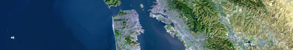
<http://walrus.wr.usgs.gov/infobank/h/h102nc/html/h-1-02-nc.nav.gif>
- Browse_Graphic_File_Description: Trackline map of H-1-02-NC
- Browse_Graphic_File_Type: GIF
- Browse_Graphic:
-
- Browse_Graphic_File_Name:
-
<http://walrus.wr.usgs.gov/infobank/h/h102nc/html/h-1-02-nc.samp.gif>
- Browse_Graphic_File_Description: Sampling locations map of H-1-02-NC
- Browse_Graphic_File_Type: GIF
- Data_Set_Credit:
-
Charles Alpers (Chief Scientist, USGS WRD Sacramento);
Noah Snyder (Scientist, USGS Santa Cruz)
- Native_Data_Set_Environment: Digital, ASCII
- Cross_Reference:
-
- Citation_Information:
-
- Originator: U.S. Geological Survey (USGS), Coastal and Marine Geology (CMG)
- Publication_Date: Unknown
- Title: USGS/CMG Information Bank
- Publication_Information:
-
- Publisher: U.S. Geological Survey (USGS), Coastal and Marine Geology (CMG)
- Other_Citation_Details: Updated daily
- Online_Linkage: <http://walrus.wr.usgs.gov/infobank/>
- Other_Citation_Details:
-
Snyder, N.P., Allen, J.R., Dare, C., Hampton, M.A., Schneider, G.,
Wooley, R.J., Alpers, C.N., and Marvin-DiPasquale, M.C.,
2003,
Sediment Grain-Size and Loss-on-Ignition Analyses
from 2002 Englebright Lake Coring and Sampling Campaigns:
U.S. Geological Survey Open-File Report 2004-1080, 46 p.
[<A HREF="<http://pubs.usgs.gov/of/2004/1080/>">
<http://pubs.usgs.gov/of/2004/1080/>
</A>]
- Data_Quality_Information:
-
- Attribute_Accuracy:
-
- Attribute_Accuracy_Report: Identified as best available version.
- Logical_Consistency_Report: Unspecified
- Completeness_Report:
-
Start and end date/times of data
Navigation Data (h-1-02-nc.060 [GPS])
YYYYMMDDHHMMSST    YYYYMMDDHHMMSST
200210030001000    200210030001000
200210040001000    200210040004000
200210070001000    200210070004000
200210080001000    200210080007000
200210090001000    200210090005000
200210100001000    200210100001000
200210110001000    200210110006000
YYYYMMDDHHMMSST    YYYYMMDDHHMMSST
- Positional_Accuracy:
-
- Horizontal_Positional_Accuracy:
-
- Horizontal_Positional_Accuracy_Report: Unspecified
- Vertical_Positional_Accuracy:
-
- Vertical_Positional_Accuracy_Report: Unspecified
- Lineage:
-
- Process_Step:
-
- Process_Description:
-
Navigation Data
DUMMY TIMES FOR REPORTED LATITUDE AND LONGITUDE, FROM DGPS
345678901234567890123456789012345678901234567890123456789012345678901234567890123456789012345678901234567890
- Process_Date: 20040224
- Process_Contact:
-
- Contact_Information:
-
- Contact_Organization_Primary:
-
- Contact_Organization: U.S. Geological Survey (USGS), Coastal and Marine Geology (CMG)
- Contact_Person: Clint Steele
- Contact_Position: Data Acquisition, Processing, and Storage (DAPS) Group Leader
- Contact_Address:
-
- Address_Type: mailing and physical address
- Address: USGS, MailStop 999, 345 Middlefield Road
- City: Menlo Park
- State_or_Province: CA
- Postal_Code: 94025-3561
- Country: USA
- Contact_Voice_Telephone: (650) 329-5055
- Contact_Facsimile_Telephone: (650) 329-5190
- Contact_Electronic_Mail_Address: csteele@usgs.gov
- Spatial_Data_Organization_Information:
-
- Indirect_Spatial_Reference: Englebright Lake, California
- Direct_Spatial_Reference_Method: Point
- Point_and_Vector_Object_Information:
-
- SDTS_Terms_Description:
-
- SDTS_Point_and_Vector_Object_Type: Point
- Spatial_Reference_Information:
-
- Horizontal_Coordinate_System_Definition:
-
- Geographic:
-
- Latitude_Resolution: 0.00001
- Longitude_Resolution: 0.00001
- Geographic_Coordinate_Units: Decimal degrees
- Geodetic_Model:
-
- Horizontal_Datum_Name: North American Datum of 1983
- Ellipsoid_Name: Geodetic Reference System 80
- Semi-major_Axis: 6378137
- Denominator_of_Flattening_Ratio: 298.257
- Vertical_Coordinate_System_Definition:
-
- Depth_System_Definition:
-
- Depth_Datum_Name: Local surface
- Depth_Resolution: 0.1
- Depth_Distance_Units: meters
- Depth_Encoding_Method: Attribute values
- Entity_and_Attribute_Information:
-
- Overview_Description:
-
- Entity_and_Attribute_Overview: Navigation with Time Stamp
- Entity_and_Attribute_Detail_Citation:
-
Global positioning system (GPS) data
Mnemonic:       (Year, Day, Hour, Min, Sec, Tenths, Latitude, Longitude)
FORTRAN format: (i4.4, i3.3, 3i2.2, i1.1, t16, f9.5, t26, f10.5)
C format:       (%4.4i%3.3i3%2.2i%1.1i %9.5f %10.5f\\n)
Naming:         .060
- Distribution_Information:
-
- Distributor:
-
- Contact_Information:
-
- Contact_Organization_Primary:
-
- Contact_Organization: U.S. Geological Survey (USGS), Coastal and Marine Geology (CMG)
- Contact_Person: Clint Steele
- Contact_Position: Data Acquisition, Processing, and Storage (DAPS) Group Leader
- Contact_Address:
-
- Address_Type: mailing and physical address
- Address: USGS, MailStop 999, 345 Middlefield Road
- City: Menlo Park
- State_or_Province: CA
- Postal_Code: 94025-3561
- Country: USA
- Contact_Voice_Telephone: (650) 329-5055
- Contact_Facsimile_Telephone: (650) 329-5190
- Contact_Electronic_Mail_Address: csteele@usgs.gov
- Resource_Description: Downloadable Data H-1-02-NC data set
- Distribution_Liability:
-
Please recognize the U.S. Geological Survey (USGS) as
the source of this information.
Physical materials are under controlled on-site access.
Some USGS information accessed through this means
may be preliminary in nature and presented without
the approval of the Director of the USGS. This
information is provided with the understanding
that it is not guaranteed to be correct or complete
and conclusions drawn from such information are
the responsibility of the user.
This information is not intended for navigational
purposes.
Any use of trade, firm, or product names is for
descriptive purposes only and does not imply
endorsement by the U.S. Government.
- Standard_Order_Process:
-
- Digital_Form:
-
- Digital_Transfer_Information:
-
- Format_Name: ASCII
- File_Decompression_Technique: No compression applied
- Transfer_Size: 0.1
- Digital_Transfer_Option:
-
- Online_Option:
-
- Computer_Contact_Information:
-
- Network_Address:
-
- Network_Resource_Name:
-
<http://walrus.wr.usgs.gov/infobank/h/h102nc/html/h-1-02-nc.nav.html>
- Fees: None
- Metadata_Reference_Information:
-
- Metadata_Date: 20090107
- Metadata_Contact:
-
- Contact_Information:
-
- Contact_Organization_Primary:
-
- Contact_Organization: U.S. Geological Survey (USGS), Coastal and Marine Geology (CMG)
- Contact_Person: Clint Steele
- Contact_Position: Data Acquisition, Processing, and Storage (DAPS) Group Leader
- Contact_Address:
-
- Address_Type: mailing and physical address
- Address: USGS, MailStop 999, 345 Middlefield Road
- City: Menlo Park
- State_or_Province: CA
- Postal_Code: 94025-3561
- Country: USA
- Contact_Voice_Telephone: (650) 329-5055
- Contact_Facsimile_Telephone: (650) 329-5190
- Contact_Electronic_Mail_Address: csteele@usgs.gov
- Metadata_Standard_Name: FGDC Content Standards for Digital Geospatial Metadata
- Metadata_Standard_Version: FGDC-STD-001-1998
- Metadata_Time_Convention: universal time
- Metadata_Access_Constraints: none
- Metadata_Use_Constraints: none
|


