- Identification_Information:
-
- Citation:
-
- Citation_Information:
-
- Originator: U.S. Geological Survey (USGS), Coastal and Marine Geology (CMG)
- Publication_Date: 20081216
- Title:
-
Geophysical data of field activity S-1-78-SC in Southern
California from 04/17/1978 to 04/29/1978
- Publication_Information:
-
- Publisher: U.S. Geological Survey (USGS), Coastal and Marine Geology (CMG)
- Online_Linkage: <http://walrus.wr.usgs.gov/infobank/gos/s-1-78-sc.fmeta.xml>
- Online_Linkage:
-
<http://walrus.wr.usgs.gov/infobank/s/s178sc/html/s-1-78-sc.meta.html>
- Description:
-
- Abstract:
-
Chief Scientist: Dave Cacchione. Geophysical data (12khz,
3dot5khz, underwatercamera, underwatertelevision,
sidescansonar, Geoprobe, CTDmeter, Hydroproducts,
instrumentmooring, transmissometer, integratednavigation,
miniranger, transitsatellite, boxcore, Soutargrab,
VanDornbottle, waterbucket, uniboom) of field activity
S-1-78-SC in Southern California from 04/17/1978 to
04/29/1978,
<http://walrus.wr.usgs.gov/infobank/s/s178sc/html/s-1-78-sc.meta.html>.
- Purpose:
-
These data and information are intended for science
researchers, students from elementary through
college, policy makers, and general public.
- Supplemental_Information:
-
Equipment Used -
12khz 12 khz bathymetry
3dot5khz 3.5 khz bathymetry
underwatercamera
underwatertelevision
sidescansonar
Geoprobe
CTDmeter
Hydroproducts
instrumentmooring
transmissometer
integratednavigation
miniranger
transitsatellite
boxcore
Soutargrab
VanDornbottle
waterbucket
uniboom
Similar information is available for thousands
of other USGS/CMG-related Activities.
If known, available are Activity-specific
navigation, gravity, magnetics, bathymetry,
seismic, and sampling data; track maps; and
equipment information; as well as summary
overviews, crew lists, and information
about analog materials.
If available, access to physical samples is
described in the "WR CMG Sample Distribution
Policy" at:
<http://walrus.wr.usgs.gov/infobank/programs/html/main/sample-dist-policy.html>
Primary access to the USGS/CMG Information
Bank's digital data, analog data, and
metadata is provided through...
<http://walrus.wr.usgs.gov/infobank/>
This page accomodates a variety of search
approaches (e.g., by platform, by region,
by scientist, by equipment type, etc.).
- Time_Period_of_Content:
-
- Time_Period_Information:
-
- Range_of_Dates/Times:
-
- Beginning_Date: 19780417
- Ending_Date: 19780429
- Currentness_Reference: ground condition
- Status:
-
- Progress: Complete
- Maintenance_and_Update_Frequency: As needed
- Spatial_Domain:
-
- Bounding_Coordinates:
-
- West_Bounding_Coordinate: -119.06589
- East_Bounding_Coordinate: -117.91488
- North_Bounding_Coordinate: 33.91684
- South_Bounding_Coordinate: 33.52976
- Keywords:
-
- Theme:
-
- Theme_Keyword_Thesaurus: ISO 19115 Topic Category
- Theme_Keyword: geoscientificinformation
- Theme_Keyword: oceans
- Theme:
-
- Theme_Keyword_Thesaurus: USGS CMG InfoBank
- Theme_Keyword: Marine Geology
- Theme_Keyword: Marine Geophysics
- Theme_Keyword: Bathymetry
- Theme_Keyword: Water Depth
- Theme_Keyword: Seafloor Topography
- Theme_Keyword: Marine Seismic
- Theme_Keyword: Marine Metering
- Theme_Keyword: Current Meters
- Theme_Keyword: Hydrologic Current Meter
- Theme_Keyword: Instrument Packages
- Theme_Keyword: CTD Meter
- Theme_Keyword: Conductivity / Temperature / Depth (CDT) Meter
- Theme_Keyword: Geoprobe
- Theme_Keyword: Instrument Mooring
- Theme_Keyword: Turbidity Meters
- Theme_Keyword: Transmissometer
- Place:
-
- Place_Keyword_Thesaurus: USGS CMG InfoBank
- Place_Keyword: CA
- Place_Keyword: North Pacific Ocean
- Place_Keyword: Northern Pacific Ocean
- Place_Keyword: Southern California
- Place_Keyword: USA
- Access_Constraints:
-
Physical materials are under controlled on-site access.
If available, access to physical samples is described
in the "WR CMG Sample Distribution Policy" at:
<http://walrus.wr.usgs.gov/infobank/programs/html/main/sample-dist-policy.html>
- Use_Constraints:
-
Please recognize the U.S. Geological Survey (USGS) as
the source of this information.
Physical materials are under controlled on-site access.
Some USGS information accessed through this means
may be preliminary in nature and presented without
the approval of the Director of the USGS. This
information is provided with the understanding
that it is not guaranteed to be correct or complete
and conclusions drawn from such information are
the responsibility of the user.
This information is not intended for navigational
purposes.
Any use of trade, firm, or product names is for
descriptive purposes only and does not imply
endorsement by the U.S. Government.
- Point_of_Contact:
-
- Contact_Information:
-
- Contact_Organization_Primary:
-
- Contact_Organization: U.S. Geological Survey (USGS), Coastal and Marine Geology (CMG)
- Contact_Person: Clint Steele
- Contact_Position: Data Acquisition, Processing, and Storage (DAPS) Group Leader
- Contact_Address:
-
- Address_Type: mailing and physical address
- Address: USGS, MailStop 999, 345 Middlefield Road
- City: Menlo Park
- State_or_Province: CA
- Postal_Code: 94025-3561
- Country: USA
- Contact_Voice_Telephone: (650) 329-5055
- Contact_Facsimile_Telephone: (650) 329-5190
- Contact_Electronic_Mail_Address: csteele@usgs.gov
- Browse_Graphic:
-
- Browse_Graphic_File_Name:
-
<http://walrus.wr.usgs.gov/infobank/s/s178sc/html/s-1-78-sc.nav.gif>
- Browse_Graphic_File_Description: Trackline map of S-1-78-SC
- Browse_Graphic_File_Type: GIF
- Browse_Graphic:
-
- Browse_Graphic_File_Name:
-
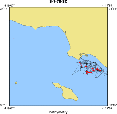
<http://walrus.wr.usgs.gov/infobank/s/s178sc/html/s-1-78-sc.bath.gif>
- Browse_Graphic_File_Description: Bathymetry data trackline map of S-1-78-SC
- Browse_Graphic_File_Type: GIF
- Browse_Graphic:
-
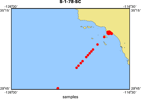
- Browse_Graphic_File_Name:
-
<http://walrus.wr.usgs.gov/infobank/s/s178sc/html/s-1-78-sc.samp.gif>
- Browse_Graphic_File_Description: Sampling locations map of S-1-78-SC
- Browse_Graphic_File_Type: GIF
- Data_Set_Credit:
-
Brian Edwards (Oceanographer, USGS Western Region);
Carol Madison (Navigator, USGS Western Region);
Chuck Totman (Watchstander, USGS Western Region);
Dave Cacchione (Chief Scientist, USGS Western Region);
Dave Drake (Oceanographer, USGS Western Region);
Ed Clukey (Watchstander, USGS Western Region);
George Tate (Watchstander, USGS Western Region);
Herman Karl (Oceanographer, USGS Western Region);
J. Bassin (Watchstander, USGS Western Region);
Jim Nicholson (Electronics Technician, USGS Western Region);
Neal Barnes (Watchstander, USGS Western Region);
Pat Wiberg (Dafe Curator, USGS Western Region);
S. Thornton (Watchstander, USGS Western Region)
- Native_Data_Set_Environment: Digital, ASCII
- Cross_Reference:
-
- Citation_Information:
-
- Originator: U.S. Geological Survey (USGS), Coastal and Marine Geology (CMG)
- Publication_Date: Unknown
- Title: USGS/CMG Information Bank
- Publication_Information:
-
- Publisher: U.S. Geological Survey (USGS), Coastal and Marine Geology (CMG)
- Other_Citation_Details: Updated daily
- Online_Linkage: <http://walrus.wr.usgs.gov/infobank/>
- Data_Quality_Information:
-
- Attribute_Accuracy:
-
- Attribute_Accuracy_Report: Identified as best available version.
- Logical_Consistency_Report: Unspecified
- Completeness_Report:
-
Start and end date/times of data
Navigation Data (s-1-78-sc.010 [DRS])
YYYYMMDDHHMMSST    YYYYMMDDHHMMSST
197804172201300    197804172202060
197804172209060    197804172211060
197804180204150    197804182118040
197804182124040    197804191633200
197804191639200    197804191803200
197804191849070    197804191855070
197804191905090    197804191933280
197804191943280    197804192229190
197804192241240    197804202040070
197804202100040    197804202100040
197804202125250    197804231732410
197804231750420    197804250211020
197804250217030    197804261125070
197804261130520    197804290022090
197804290028030    197804290201040
YYYYMMDDHHMMSST    YYYYMMDDHHMMSST
Bathymetry Data (s-1-78-sc.330_010)
YYYYMMDDHHMMSST    YYYYMMDDHHMMSST
197804172201300    197804172201300
197804180204150    197804180214170
197804180232050    197804180245320
197804191233170    197804191241160
197804191503180    197804191503180
197804191539170    197804191615180
197804191633200    197804191633200
197804191639200    197804191715200
197804191733200    197804191803200
197804191913090    197804191915090
197804191933280    197804191933280
197804192047280    197804192047280
197804192249240    197804192251240
197804200257010    197804200307010
197804201203470    197804201215470
197804201235240    197804201315190
197804201333230    197804201414120
197804201433050    197804201459290
197804210141040    197804210214020
197804210232020    197804210314020
197804210547590    197804210547590
197804210733590    197804210815080
197804210833130    197804210915130
197804211402480    197804211412480
197804211432480    197804211515360
197804211533370    197804211601390
197804211609390    197804211613390
197804211632120    197804211652120
197804211658120    197804211714120
197804211732140    197804211734140
YYYYMMDDHHMMSST    YYYYMMDDHHMMSST
- Positional_Accuracy:
-
- Horizontal_Positional_Accuracy:
-
- Horizontal_Positional_Accuracy_Report: Unspecified
- Vertical_Positional_Accuracy:
-
- Vertical_Positional_Accuracy_Report: Unspecified
- Lineage:
-
- Process_Step:
-
- Process_Description:
-
Navigation Data
Converted to time format with year at start.

01/16/86 KAYE DUA0:[DATA.S178SC.N]S178SC.010;
DRB0:[DRS.REFMT]REFORMAT.EXE;5
- Process_Date: 19951206
- Process_Contact:
-
- Contact_Information:
-
- Contact_Organization_Primary:
-
- Contact_Organization: U.S. Geological Survey (USGS), Coastal and Marine Geology (CMG)
- Contact_Person: Clint Steele
- Contact_Position: Data Acquisition, Processing, and Storage (DAPS) Group Leader
- Contact_Address:
-
- Address_Type: mailing and physical address
- Address: USGS, MailStop 999, 345 Middlefield Road
- City: Menlo Park
- State_or_Province: CA
- Postal_Code: 94025-3561
- Country: USA
- Contact_Voice_Telephone: (650) 329-5055
- Contact_Facsimile_Telephone: (650) 329-5190
- Contact_Electronic_Mail_Address: csteele@usgs.gov
- Process_Step:
-
- Process_Description:
-
Bathymetry Data
10/31/1998  /tiger/s/s178sc/bath/s-1-78-sc.330_010
/bear/programs/edit/automerge/automerge

Input was...
Converted to time format with year at start.

11/30/90 CAROLYN DUA0:[DRS.NGDC.CDWORK]S178SC.330;1
DUA0:[DRS.BAT]BATRED.EXE;2
Edited bathymetry data
using velocity = 1463.0 m/sec for MGD-77 format

02/13/86 BECKIE DISK$USERDISK:[CLINT.BECKIE]S178SC.301;
DRB0:[DRS.REFMT]REFORMAT.EXE;5
This is digitrack bathy of dubious quality.

Input was...
Converted to time format with year at start.

01/16/86 KAYE DUA0:[DATA.S178SC.N]S178SC.010;
DRB0:[DRS.REFMT]REFORMAT.EXE;5

time, lat, long, time(sec) to nearest nav fix, data values
- Process_Date: 19981031
- Process_Contact:
-
- Contact_Information:
-
- Contact_Organization_Primary:
-
- Contact_Organization: U.S. Geological Survey (USGS), Coastal and Marine Geology (CMG)
- Contact_Person: Clint Steele
- Contact_Position: Data Acquisition, Processing, and Storage (DAPS) Group Leader
- Contact_Address:
-
- Address_Type: mailing and physical address
- Address: USGS, MailStop 999, 345 Middlefield Road
- City: Menlo Park
- State_or_Province: CA
- Postal_Code: 94025-3561
- Country: USA
- Contact_Voice_Telephone: (650) 329-5055
- Contact_Facsimile_Telephone: (650) 329-5190
- Contact_Electronic_Mail_Address: csteele@usgs.gov
- Spatial_Data_Organization_Information:
-
- Indirect_Spatial_Reference: Southern California
- Direct_Spatial_Reference_Method: Point
- Point_and_Vector_Object_Information:
-
- SDTS_Terms_Description:
-
- SDTS_Point_and_Vector_Object_Type: Point
- Spatial_Reference_Information:
-
- Horizontal_Coordinate_System_Definition:
-
- Geographic:
-
- Latitude_Resolution: 0.00001
- Longitude_Resolution: 0.00001
- Geographic_Coordinate_Units: Decimal degrees
- Geodetic_Model:
-
- Horizontal_Datum_Name: North American Datum of 1927
- Ellipsoid_Name: Clarke 1866
- Semi-major_Axis: 6378206.4
- Denominator_of_Flattening_Ratio: 294.98
- Vertical_Coordinate_System_Definition:
-
- Depth_System_Definition:
-
- Depth_Datum_Name: Local surface
- Depth_Resolution: 0.1
- Depth_Distance_Units: meters
- Depth_Encoding_Method: Attribute values
- Entity_and_Attribute_Information:
-
- Overview_Description:
-
- Entity_and_Attribute_Overview: Bathymetry with Time Stamp
- Entity_and_Attribute_Detail_Citation:
-
Edited bathymetry data
Mnemonic:       (Year, Day, Hour, Min, Sec, Tenths, 2WayTravelTime, UncorrDepth)
FORTRAN format: (i4.4, i3.3, 3i2.2, i1.1, t16, f7.4, t23, f7.1)
C format:       (%4.4i%3.3i3%2.2i%1.1i %7.4f %7.1f\\n)
Naming:         .330
- Overview_Description:
-
- Entity_and_Attribute_Overview: Navigation with Time Stamp
- Entity_and_Attribute_Detail_Citation:
-
Dead reckoning data
Mnemonic:       (Year, Day, Hour, Min, Sec, Tenths, Latitude, Longitude)
FORTRAN format: (i4.4, i3.3, 3i2.2, i1.1, t16, f9.5, t26, f10.5)
C format:       (%4.4i%3.3i3%2.2i%1.1i %9.5f %10.5f\\n)
Naming:         .010
- Distribution_Information:
-
- Distributor:
-
- Contact_Information:
-
- Contact_Organization_Primary:
-
- Contact_Organization: U.S. Geological Survey (USGS), Coastal and Marine Geology (CMG)
- Contact_Person: Clint Steele
- Contact_Position: Data Acquisition, Processing, and Storage (DAPS) Group Leader
- Contact_Address:
-
- Address_Type: mailing and physical address
- Address: USGS, MailStop 999, 345 Middlefield Road
- City: Menlo Park
- State_or_Province: CA
- Postal_Code: 94025-3561
- Country: USA
- Contact_Voice_Telephone: (650) 329-5055
- Contact_Facsimile_Telephone: (650) 329-5190
- Contact_Electronic_Mail_Address: csteele@usgs.gov
- Resource_Description: Downloadable Data S-1-78-SC data set
- Distribution_Liability:
-
Please recognize the U.S. Geological Survey (USGS) as
the source of this information.
Physical materials are under controlled on-site access.
Some USGS information accessed through this means
may be preliminary in nature and presented without
the approval of the Director of the USGS. This
information is provided with the understanding
that it is not guaranteed to be correct or complete
and conclusions drawn from such information are
the responsibility of the user.
This information is not intended for navigational
purposes.
Any use of trade, firm, or product names is for
descriptive purposes only and does not imply
endorsement by the U.S. Government.
- Standard_Order_Process:
-
- Digital_Form:
-
- Digital_Transfer_Information:
-
- Format_Name: ASCII
- File_Decompression_Technique: No compression applied
- Transfer_Size: 0.3
- Digital_Transfer_Option:
-
- Online_Option:
-
- Computer_Contact_Information:
-
- Network_Address:
-
- Network_Resource_Name:
-
<http://walrus.wr.usgs.gov/infobank/s/s178sc/html/s-1-78-sc.nav.html>
- Digital_Form:
-
- Digital_Transfer_Information:
-
- Format_Name: ASCII
- File_Decompression_Technique: No compression applied
- Transfer_Size: 0.0
- Digital_Transfer_Option:
-
- Online_Option:
-
- Computer_Contact_Information:
-
- Network_Address:
-
- Network_Resource_Name:
-
<http://walrus.wr.usgs.gov/infobank/s/s178sc/html/s-1-78-sc.bath.html>
- Fees: None
- Metadata_Reference_Information:
-
- Metadata_Date: 20081216
- Metadata_Contact:
-
- Contact_Information:
-
- Contact_Organization_Primary:
-
- Contact_Organization: U.S. Geological Survey (USGS), Coastal and Marine Geology (CMG)
- Contact_Person: Clint Steele
- Contact_Position: Data Acquisition, Processing, and Storage (DAPS) Group Leader
- Contact_Address:
-
- Address_Type: mailing and physical address
- Address: USGS, MailStop 999, 345 Middlefield Road
- City: Menlo Park
- State_or_Province: CA
- Postal_Code: 94025-3561
- Country: USA
- Contact_Voice_Telephone: (650) 329-5055
- Contact_Facsimile_Telephone: (650) 329-5190
- Contact_Electronic_Mail_Address: csteele@usgs.gov
- Metadata_Standard_Name: FGDC Content Standards for Digital Geospatial Metadata
- Metadata_Standard_Version: FGDC-STD-001-1998
- Metadata_Time_Convention: universal time
- Metadata_Access_Constraints: none
- Metadata_Use_Constraints: none
|


