|
|
|
Metadata
|
|
ID
|
P-1-95-MB
|
|
Abstract
|
Chief Scientist: Steve Eittreim. Data (multibeam, GPS,
CTDmeter) of field activity P-1-95-MB in Monterey Bay from
07/29/1995 to 08/02/1995
|
|
Project/Theme
|
Monterey Bay National Marine Sanctuary
|
|
National Plan
|
Environment
|
|
Chief Scientist
|
Steve Eittreim
|
|
Platform
|
Pacific Hunter
|
|
Area of Operation
|
Monterey Bay
|
|
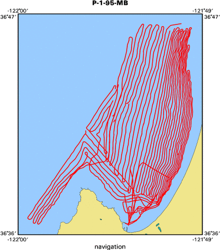
Location map
|

|
|
Bounding Coordinates
|
36.77509
-121.99269 -121.82182
36.60737
|
|
Dates
|
07/29/1995 (JD 210) to 08/02/1995 (JD 214)
|
|
Analog Materials
|
list
|
|
Index map
|
|
|
Crew
|
|
Steve Eittreim
|
Chief Scientist, USGS Western Region
|
|
|
Equipment Used
|
|
|
Purpose
|
|
Seafloor mapping in the offshore Ft Ord region
|
|
to characterize the nature of the seafloor morphology and geology
|
|
|
Information to be Derived
|
|
2-m bathymetry and acoustic imagery
|
|
|
Summary
|
|
175 square kilometers were swath-mapped covering most of the southern
|
|
Monterey Bay shelf with the exception of the outer shelf beyond 95 m water
|
|
depths; coverage included the shelf northwest of Monterey Peninsula. The data is
|
|
hampered by some noise problems due to rough weather and to patchiness in water
|
|
velocity distributions and to wave motion of the transducer vertically through
|
|
the thermocline. 2-meter, shaded-relief contour maps at 1:5000 have been
|
|
produced and the backscatter imagery maps are still in the data-processing
|
|
stage.
|
|
|
Notes
|
|
Associated activities:
|
|
|
M-1-93-MB
|
|
|
J-1-94-MB
|
|
|
J-2-95-MB
|
|
J-6-95-MB
|
|
M-2-95-MB
|
|
P-1-95-MB
|
|
P-3-95-MB
|
|
R-1-95-MB
|
|
|
M-1-96-MB
|
|
|
J-1-97-MB
|
|
J-3-97-MB
|
|
|
A-4-98-MB
|
|
J-3-98-MB
|
|
J-4-98-MB
|
|
|
(from USGS Bulletin 8/18/95)
|
|
The Monterey Bay National Marine Sanctuary Project
|
|
was the beneficiary of a high-resolution multibeam bathymetric
|
|
survey last week as Humboldt State University's R/V PACIFIC
|
|
HUNTER mowed the grass on the southern Monterey Bay shelf. The 5-
|
|
day survey revealed a new trend of seafloor mounds in a north-south
|
|
alignment northward out from the Peninsula. A relationship to the
|
|
Monterey Bay fault zone is suggested by the linear edges of some of
|
|
these mounds, parallel to the Monterey Bay fault zone. Both swath
|
|
bathymetry and backscatter imagery were collected and gave
|
|
complimentary information about the seafloor geology. The
|
|
nearshore sand-bands/ribbons, previously mapped by Hunter et al,
|
|
were imaged in detail, as was the major pipeline south of the
|
|
Salinas River. Our crew of Steve Eittreim, Andy Stevenson and
|
|
Roberto Anima were coached by the visiting dean of multibeam,
|
|
Larry Mayer of the Univ. of New Brunswick, Canada. The Simrad EM-
|
|
1000 system, apparently the state of the art in multibeam bathy,
|
|
was in some contrast to the platform used: The PACIFIC HUNTER is a
|
|
1927 refitted 125-foot coast guard cutter recently given a new life
|
|
as research vessel, thanks to gargantuan efforts on the part of folks
|
|
at HSU. She will be berthed at Redwood City for a couple of weeks
|
|
before repair of one engine and the trek back to Humboldt Bay.
|
|
|
Publications
|
|
Eittreim, Stephen L., and Noble, Marlene, editors, 2002, Seafloor geology and
|
|
natural environment of the Monterey Bay National Marine Sanctuary: Marine Geology, v
|
|
. 181
|
|
http://www.sciencedirect.com/
|
|
|
Journals > m > Marine Geology > Volumes 181 - 190 > Volume 181, Issues 1-3
|
|
|
|
Wong, F.L., and Eittreim, S.L., 2001, Continental Shelf GIS for the Monterey
|
|
Bay National Marine Sanctuary: U.S. Geological Survey Open-file Report 01-179,
|
|
1 CDROM,
|
|
http://geopubs.wr.usgs.gov/
|
open-file/of01-179/
|
|
|
Got Help?
|
For P-1-95-MB, we would appreciate any information on -- activity type, contract, days at sea, dive count, funding, information specialist, kms of navigation, NGDC Info, organization, owner, ports, project number, scanned materials, seismic description, station count, station description, submersible, tabulated info.
|
|


