Identification_Information:
Citation:
Citation_Information:
Originator: U.S. Geological Survey (USGS), Coastal and Marine Geology (CMG)
Publication_Date: 20090107
Title:
Geophysical data of field activity B-P-70-AR in Harrison Bay
from 00/00/1970 to 00/00/1970
Publication_Information:
Publisher: U.S. Geological Survey (USGS), Coastal and Marine Geology (CMG)
Online_Linkage: http://walrus.wr.usgs.gov/infobank/gos/b-p-70-ar.fmeta.xml
Online_Linkage: http://walrus.wr.usgs.gov/infobank/b/bp70ar/html/b-p-70-ar.meta.html
Description:
Abstract:
British Petroleum. Geophysical data of field activity
B-P-70-AR in Harrison Bay from 00/00/1970 to 00/00/1970,
http://walrus.wr.usgs.gov/infobank/b/bp70ar/html/b-p-70-ar.meta.html.
Purpose:
These data and information are intended for science
researchers, students from elementary through
college, policy makers, and general public.
Supplemental_Information:
Notes -
Line names: DM-1 and DM-3
Source of processed data loaded to, and copied from: SeisScan Geodata SEG-Y data for DM-1, 3
Tape data available: field data tapes for DM-1, 3 (no processed data tapes)
reproducible media available: mylar films for DM-1, 3
cartography file available: al2ddm.utm6
Similar information is available for thousands
of other USGS/CMG-related Activities.
If known, available are Activity-specific
navigation, gravity, magnetics, bathymetry,
seismic, and sampling data; track maps; and
equipment information; as well as summary
overviews, crew lists, and information
about analog materials.
If available, access to physical samples is
described in the "WR CMG Sample Distribution
Policy" at:
http://walrus.wr.usgs.gov/infobank/programs/html/main/sample-dist-policy.html
Primary access to the USGS/CMG Information
Bank's digital data, analog data, and
metadata is provided through...
http://walrus.wr.usgs.gov/infobank/
This page accomodates a variety of search
approaches (e.g., by platform, by region,
by scientist, by equipment type, etc.).
Time_Period_of_Content:
Time_Period_Information:
Range_of_Dates/Times:
Beginning_Date: 19700000
Ending_Date: 19700000
Currentness_Reference: ground condition
Status:
Progress: Complete
Maintenance_and_Update_Frequency: As needed
Spatial_Domain:
Bounding_Coordinates:
West_Bounding_Coordinate: -151.77855
East_Bounding_Coordinate: -151.04696
North_Bounding_Coordinate: 70.70934
South_Bounding_Coordinate: 70.49735
Keywords:
Theme:
Theme_Keyword_Thesaurus: ISO 19115 Topic Category
Theme_Keyword: geoscientificinformation
Theme_Keyword: oceans
Theme:
Theme_Keyword_Thesaurus: USGS CMG InfoBank
Theme_Keyword: Marine Geology
Theme_Keyword: Marine Geophysics
Theme_Keyword: Marine Seismic
Place:
Place_Keyword_Thesaurus: USGS CMG InfoBank
Place_Keyword: AK
Place_Keyword: Alaska
Place_Keyword: Arctic
Place_Keyword: Arctic Ocean
Place_Keyword: Beaufort Sea
Place_Keyword: Harrison Bay
Access_Constraints:
Physical materials are under controlled on-site access.
If available, access to physical samples is described
in the "WR CMG Sample Distribution Policy" at:
http://walrus.wr.usgs.gov/infobank/programs/html/main/sample-dist-policy.html
Use_Constraints:
Please recognize the U.S. Geological Survey (USGS) as
the source of this information.
Physical materials are under controlled on-site access.
Some USGS information accessed through this means
may be preliminary in nature and presented without
the approval of the Director of the USGS. This
information is provided with the understanding
that it is not guaranteed to be correct or complete
and conclusions drawn from such information are
the responsibility of the user.
This information is not intended for navigational
purposes.
Any use of trade, firm, or product names is for
descriptive purposes only and does not imply
endorsement by the U.S. Government.
Point_of_Contact:
Contact_Information:
Contact_Organization_Primary:
Contact_Organization: U.S. Geological Survey (USGS), Coastal and Marine Geology (CMG)
Contact_Person: Clint Steele
Contact_Position: Data Acquisition, Processing, and Storage (DAPS) Group Leader
Contact_Address:
Address_Type: mailing and physical address
Address: USGS, MailStop 999, 345 Middlefield Road
City: Menlo Park
State_or_Province: CA
Postal_Code: 94025-3561
Country: USA
Contact_Voice_Telephone: (650) 329-5055
Contact_Facsimile_Telephone: (650) 329-5190
Contact_Electronic_Mail_Address: csteele@usgs.gov
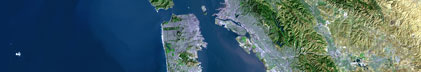
Browse_Graphic:
Browse_Graphic_File_Name: http://walrus.wr.usgs.gov/infobank/b/bp70ar/html/b-p-70-ar.nav.gif
Browse_Graphic_File_Description: Trackline map of B-P-70-AR
Browse_Graphic_File_Type: GIF
Native_Data_Set_Environment: Digital, ASCII
Cross_Reference:
Citation_Information:
Originator: U.S. Geological Survey (USGS), Coastal and Marine Geology (CMG)
Publication_Date: Unknown
Title: USGS/CMG Information Bank
Publication_Information:
Publisher: U.S. Geological Survey (USGS), Coastal and Marine Geology (CMG)
Other_Citation_Details: Updated daily
Online_Linkage: http://walrus.wr.usgs.gov/infobank/
Data_Quality_Information:
Attribute_Accuracy:
Attribute_Accuracy_Report: Identified as best available version.
Logical_Consistency_Report: Unspecified
Completeness_Report:
Start and end date/times of data
>Navigation Data (b-p-70-ar.051 [SINS])
>YYYYMMDDHHMMSST YYYYMMDDHHMMSST
>197001010000001 197001010000136
>197001020000001 197001020000125
>YYYYMMDDHHMMSST YYYYMMDDHHMMSST
>Seismic Shots Data (b-p-70-ar.420_051)
>YYYYMMDDHHMMSST YYYYMMDDHHMMSST
>197001010000001 197001010000136
>197001020000001 197001020000125
>YYYYMMDDHHMMSST YYYYMMDDHHMMSST
Positional_Accuracy:
Horizontal_Positional_Accuracy:
Horizontal_Positional_Accuracy_Report: Unspecified
Vertical_Positional_Accuracy:
Vertical_Positional_Accuracy_Report: Unspecified
Lineage:
Process_Step:
Process_Description:
Navigation Data
>11/28/2007 clint b-p-70-ar.051
>/infobank/programs/time/lines2times/lines2times
>Integrated navigation (SINS) data
>
Process_Date: 20071205
Process_Contact:
Contact_Information:
Contact_Organization_Primary:
Contact_Organization: U.S. Geological Survey (USGS), Coastal and Marine Geology (CMG)
Contact_Person: Clint Steele
Contact_Position: Data Acquisition, Processing, and Storage (DAPS) Group Leader
Contact_Address:
Address_Type: mailing and physical address
Address: USGS, MailStop 999, 345 Middlefield Road
City: Menlo Park
State_or_Province: CA
Postal_Code: 94025-3561
Country: USA
Contact_Voice_Telephone: (650) 329-5055
Contact_Facsimile_Telephone: (650) 329-5190
Contact_Electronic_Mail_Address: csteele@usgs.gov
Spatial_Data_Organization_Information:
Indirect_Spatial_Reference: Harrison Bay
Direct_Spatial_Reference_Method: Point
Point_and_Vector_Object_Information:
SDTS_Terms_Description:
SDTS_Point_and_Vector_Object_Type: Point
Spatial_Reference_Information:
Horizontal_Coordinate_System_Definition:
Geographic:
Latitude_Resolution: 0.00001
Longitude_Resolution: 0.00001
Geographic_Coordinate_Units: Decimal degrees
Geodetic_Model:
Horizontal_Datum_Name: North American Datum of 1927
Ellipsoid_Name: Clarke 1866
Semi-major_Axis: 6378206.4
Denominator_of_Flattening_Ratio: 294.98
Vertical_Coordinate_System_Definition:
Depth_System_Definition:
Depth_Datum_Name: Local surface
Depth_Resolution: 0.1
Depth_Distance_Units: meters
Depth_Encoding_Method: Attribute values
Entity_and_Attribute_Information:
Overview_Description:
Entity_and_Attribute_Overview: Navigation with Time Stamp
Entity_and_Attribute_Detail_Citation:
Integrated navigation (SINS) data
>Mnemonic: (Year, Day, Hour, Min, Sec, Tenths, Latitude, Longitude)
>FORTRAN format: (i4.4, i3.3, 3i2.2, i1.1, t16, f9.5, t26, f10.5)
>C format: (%4.4i%3.3i3%2.2i%1.1i %9.5f %10.5f\\n)
>Naming: .050
Overview_Description:
Entity_and_Attribute_Overview: Seismic Shots with Time Stamp
Entity_and_Attribute_Detail_Citation:
Edited seismic shot point data
>Mnemonic: (Year, Day, Hour, Min, Sec, Tenths, Line, Shot)
>FORTRAN format: (i4.4, i3.3, 3i2.2, i1.1, t16, a5, t22, i5)
>C format: (%4.4i%3.3i3%2.2i%1.1i %5s %5i\\n)
>Naming: .420
Distribution_Information:
Distributor:
Contact_Information:
Contact_Organization_Primary:
Contact_Organization: U.S. Geological Survey (USGS), Coastal and Marine Geology (CMG)
Contact_Person: Clint Steele
Contact_Position: Data Acquisition, Processing, and Storage (DAPS) Group Leader
Contact_Address:
Address_Type: mailing and physical address
Address: USGS, MailStop 999, 345 Middlefield Road
City: Menlo Park
State_or_Province: CA
Postal_Code: 94025-3561
Country: USA
Contact_Voice_Telephone: (650) 329-5055
Contact_Facsimile_Telephone: (650) 329-5190
Contact_Electronic_Mail_Address: csteele@usgs.gov
Resource_Description: Downloadable Data B-P-70-AR data set
Distribution_Liability:
Please recognize the U.S. Geological Survey (USGS) as
the source of this information.
Physical materials are under controlled on-site access.
Some USGS information accessed through this means
may be preliminary in nature and presented without
the approval of the Director of the USGS. This
information is provided with the understanding
that it is not guaranteed to be correct or complete
and conclusions drawn from such information are
the responsibility of the user.
This information is not intended for navigational
purposes.
Any use of trade, firm, or product names is for
descriptive purposes only and does not imply
endorsement by the U.S. Government.
Standard_Order_Process:
Digital_Form:
Digital_Transfer_Information:
Format_Name: ASCII
File_Decompression_Technique: No compression applied
Transfer_Size: 0.0
Digital_Transfer_Option:
Online_Option:
Computer_Contact_Information:
Network_Address:
Network_Resource_Name: http://walrus.wr.usgs.gov/infobank/b/bp70ar/html/b-p-70-ar.nav.html
Digital_Form:
Digital_Transfer_Information:
Format_Name: ASCII
File_Decompression_Technique: No compression applied
Transfer_Size: 0.0
Digital_Transfer_Option:
Online_Option:
Computer_Contact_Information:
Network_Address:
Network_Resource_Name: http://walrus.wr.usgs.gov/infobank/b/bp70ar/html/b-p-70-ar.seis.html
Fees: None
Metadata_Reference_Information:
Metadata_Date: 20090107
Metadata_Contact:
Contact_Information:
Contact_Organization_Primary:
Contact_Organization: U.S. Geological Survey (USGS), Coastal and Marine Geology (CMG)
Contact_Person: Clint Steele
Contact_Position: Data Acquisition, Processing, and Storage (DAPS) Group Leader
Contact_Address:
Address_Type: mailing and physical address
Address: USGS, MailStop 999, 345 Middlefield Road
City: Menlo Park
State_or_Province: CA
Postal_Code: 94025-3561
Country: USA
Contact_Voice_Telephone: (650) 329-5055
Contact_Facsimile_Telephone: (650) 329-5190
Contact_Electronic_Mail_Address: csteele@usgs.gov
Metadata_Standard_Name: FGDC Content Standards for Digital Geospatial Metadata
Metadata_Standard_Version: FGDC-STD-001-1998
Metadata_Time_Convention: universal time
Metadata_Access_Constraints: none
Metadata_Use_Constraints: none
|