Identification_Information:
Citation:
Citation_Information:
Originator: U.S. Geological Survey (USGS), Coastal and Marine Geology (CMG)
Publication_Date: 20081216
Title:
Geophysical data of field activity S-2-86-AT in Atlantic
Ocean from 07/29/1986 to 08/04/1986
Publication_Information:
Publisher: U.S. Geological Survey (USGS), Coastal and Marine Geology (CMG)
Online_Linkage: http://walrus.wr.usgs.gov/infobank/gos/s-2-86-at.fmeta.xml
Online_Linkage: http://walrus.wr.usgs.gov/infobank/s/s286at/html/s-2-86-at.meta.html
Description:
Abstract:
Chief Scientist: John Gann. Geophysical data (gravity,
dopplersonar, GPS, integratednavigation, RhoRho,
transitsatellite) of field activity S-2-86-AT in Atlantic
Ocean from 07/29/1986 to 08/04/1986,
http://walrus.wr.usgs.gov/infobank/s/s286at/html/s-2-86-at.meta.html.
Purpose:
These data and information are intended for science
researchers, students from elementary through
college, policy makers, and general public.
Supplemental_Information:
Equipment Used -
gravity
dopplersonar
GPS
integratednavigation
RhoRho
transitsatellite
Similar information is available for thousands
of other USGS/CMG-related Activities.
If known, available are Activity-specific
navigation, gravity, magnetics, bathymetry,
seismic, and sampling data; track maps; and
equipment information; as well as summary
overviews, crew lists, and information
about analog materials.
If available, access to physical samples is
described in the "WR CMG Sample Distribution
Policy" at:
http://walrus.wr.usgs.gov/infobank/programs/html/main/sample-dist-policy.html
Primary access to the USGS/CMG Information
Bank's digital data, analog data, and
metadata is provided through...
http://walrus.wr.usgs.gov/infobank/
This page accomodates a variety of search
approaches (e.g., by platform, by region,
by scientist, by equipment type, etc.).
Time_Period_of_Content:
Time_Period_Information:
Range_of_Dates/Times:
Beginning_Date: 19860729
Ending_Date: 19860804
Currentness_Reference: ground condition
Status:
Progress: Complete
Maintenance_and_Update_Frequency: As needed
Spatial_Domain:
Bounding_Coordinates:
West_Bounding_Coordinate: -73.98477
East_Bounding_Coordinate: -67.05460
North_Bounding_Coordinate: 42.69719
South_Bounding_Coordinate: 39.94947
Keywords:
Theme:
Theme_Keyword_Thesaurus: ISO 19115 Topic Category
Theme_Keyword: geoscientificinformation
Theme_Keyword: oceans
Theme:
Theme_Keyword_Thesaurus: USGS CMG InfoBank
Theme_Keyword: Marine Geology
Theme_Keyword: Marine Geophysics
Theme_Keyword: Marine Gravity Field
Theme_Keyword: Bathymetry
Theme_Keyword: Water Depth
Theme_Keyword: Seafloor Topography
Place:
Place_Keyword_Thesaurus: USGS CMG InfoBank
Place_Keyword: Atlantic Ocean
Place_Keyword: East Coast US
Access_Constraints:
Physical materials are under controlled on-site access.
If available, access to physical samples is described
in the "WR CMG Sample Distribution Policy" at:
http://walrus.wr.usgs.gov/infobank/programs/html/main/sample-dist-policy.html
Use_Constraints:
Please recognize the U.S. Geological Survey (USGS) as
the source of this information.
Physical materials are under controlled on-site access.
Some USGS information accessed through this means
may be preliminary in nature and presented without
the approval of the Director of the USGS. This
information is provided with the understanding
that it is not guaranteed to be correct or complete
and conclusions drawn from such information are
the responsibility of the user.
This information is not intended for navigational
purposes.
Any use of trade, firm, or product names is for
descriptive purposes only and does not imply
endorsement by the U.S. Government.
Point_of_Contact:
Contact_Information:
Contact_Organization_Primary:
Contact_Organization: U.S. Geological Survey (USGS), Coastal and Marine Geology (CMG)
Contact_Person: Clint Steele
Contact_Position: Data Acquisition, Processing, and Storage (DAPS) Group Leader
Contact_Address:
Address_Type: mailing and physical address
Address: USGS, MailStop 999, 345 Middlefield Road
City: Menlo Park
State_or_Province: CA
Postal_Code: 94025-3561
Country: USA
Contact_Voice_Telephone: (650) 329-5055
Contact_Facsimile_Telephone: (650) 329-5190
Contact_Electronic_Mail_Address: csteele@usgs.gov
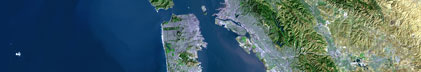
Browse_Graphic:
Browse_Graphic_File_Name: http://walrus.wr.usgs.gov/infobank/s/s286at/html/s-2-86-at.nav.gif
Browse_Graphic_File_Description: Trackline map of S-2-86-AT
Browse_Graphic_File_Type: GIF
Browse_Graphic:
Browse_Graphic_File_Name: http://walrus.wr.usgs.gov/infobank/s/s286at/html/s-2-86-at.grav.gif
Browse_Graphic_File_Description: Gravity data trackline map of S-2-86-AT
Browse_Graphic_File_Type: GIF
Browse_Graphic:
Browse_Graphic_File_Name: http://walrus.wr.usgs.gov/infobank/s/s286at/html/s-2-86-at.bath.gif
Browse_Graphic_File_Description: Bathymetry data trackline map of S-2-86-AT
Browse_Graphic_File_Type: GIF
Data_Set_Credit:
Carol Renaud (Watchstander, WHOI);
John Gann (Chief Scientist);
Nancy Soderberg (Watchstander, WHOI);
Pat Crocker (Watchstander);
Steve Robbins (Watchstander, WHOI)
Native_Data_Set_Environment: Digital, ASCII
Cross_Reference:
Citation_Information:
Originator: U.S. Geological Survey (USGS), Coastal and Marine Geology (CMG)
Publication_Date: Unknown
Title: USGS/CMG Information Bank
Publication_Information:
Publisher: U.S. Geological Survey (USGS), Coastal and Marine Geology (CMG)
Other_Citation_Details: Updated daily
Online_Linkage: http://walrus.wr.usgs.gov/infobank/
Data_Quality_Information:
Attribute_Accuracy:
Attribute_Accuracy_Report: Identified as best available version.
Logical_Consistency_Report: Unspecified
Completeness_Report:
Start and end date/times of data
>Navigation Data (s-2-86-at.072)
>YYYYMMDDHHMMSST YYYYMMDDHHMMSST
>198607291814270 198607301106270
>198607301505070 198607311347270
>198607311815480 198607311818280
>198607312134280 198608010105280
>198608010337480 198608010704080
>198608011021080 198608012147480
>198608021946480 198608030923080
>198608031210280 198608031834080
>198608032004080 198608032218480
>198608040050480 198608040410480
>198608040649080 198608041218480
>YYYYMMDDHHMMSST YYYYMMDDHHMMSST
>Gravity Data (s-2-86-at.150_072)
>YYYYMMDDHHMMSST YYYYMMDDHHMMSST
>198607291844000 198607301025400
>198607301519000 198607301712400
>198607301838000 198607310024000
>198607310125000 198607310649400
>198607310805000 198607311000000
>198607311009200 198607311331400
>198607312156000 198608010055400
>198608010400000 198608010645400
>198608011101000 198608012129400
>198608021955000 198608022320400
>198608030034000 198608030409400
>198608030541000 198608030904400
>198608031238000 198608031809400
>198608032018000 198608032203400
>198608040104000 198608040339400
>198608040702000 198608041154400
>YYYYMMDDHHMMSST YYYYMMDDHHMMSST
>Bathymetry Data (s-2-86-at.302_072)
>YYYYMMDDHHMMSST YYYYMMDDHHMMSST
>198607291845079 198607300947276
>198607300957472 198607301035269
>198607301505269 198607301723473
>198607301838086 198607310026483
>198607310126079 198607310655275
>198607310805489 198607311345492
>198607312156281 198608010101287
>198608010400096 198608010657288
>198608011101489 198608012147276
>198608021949096 198608022330096
>198608030034298 198608030420489
>198608030541299 198608030916287
>198608031238297 198608031818274
>198608032008297 198608032218291
>198608040104491 198608040402478
>198608040649289 198608041039084
>198608041044301 198608041215096
>YYYYMMDDHHMMSST YYYYMMDDHHMMSST
Positional_Accuracy:
Horizontal_Positional_Accuracy:
Horizontal_Positional_Accuracy_Report: Unspecified
Vertical_Positional_Accuracy:
Vertical_Positional_Accuracy_Report: Unspecified
Lineage:
Process_Step:
Process_Description:
Navigation Data
>Converted to time format with year at start.
>
>08/13/86 CAROLYN DRS$DATA:[S286AT.N]S286AT.072;
>DRB0:[DRS.FILT]FILTER.EXE;1
>low=0;upper=.02222;Gibbs=50;order=70
>
>Input was...
>08/13/86 CAROLYN DRS$DATA:[S286AT.N]S286AT.070;
>DRB0:[DRS.NAV]EOTCSSP.EXE;
>
>08/13/86 CAROLYN DRS$DATA:[S286AT.N]S286AT.070;
>DRB0:[DRS.EDIT]MERGEIT.EXE;1
>
>08/13/86 CAROLYN DRS$DATA:[S286AT.N]S286AT.070;
>DRB0:[DRS.EDIT]SKIPNSAVE.EXE;
>
>08/13/86 CAROLYN DRS$DATA:[S286AT.N]CHECKSPD.130;
>DRB0:[DRS.NAV]PSKIPSPD.EXE;
>
>08/13/86 CAROLYN DRS$DATA:[S286AT.N]CHECKSPD.070;
>DRB0:[DRS.EDIT]SKIPNSAVE.EXE;
>
>08/13/86 CAROLYN DRS$DATA:[S286AT.M26]S286ATM26.130;
>DRB0:[DRS.REFMT]REFORMAT.EXE;5
>hand typed by CDegnan, 8/13/86
>for GRAVITY METER S26
>
>08/13/86 CAROLYN DRS$DATA:[S286AT.N]S286AT.070;
>DRB0:[DRS.NAV]EOTCSSP.EXE;
>
>08/13/86 CAROLYN DRS$DATA:[S286AT.N]S286AT.070;
>DRB0:[DRS.EDIT]MERGEIT.EXE;1
>
>08/13/86 CLINT DUA0:[DATA.S286AT.N]S286AT.070;
>DRB0:[DRS.NAV]EOTCSSP.EXE;
>
Process_Date: 19951206
Process_Contact:
Contact_Information:
Contact_Organization_Primary:
Contact_Organization: U.S. Geological Survey (USGS), Coastal and Marine Geology (CMG)
Contact_Person: Clint Steele
Contact_Position: Data Acquisition, Processing, and Storage (DAPS) Group Leader
Contact_Address:
Address_Type: mailing and physical address
Address: USGS, MailStop 999, 345 Middlefield Road
City: Menlo Park
State_or_Province: CA
Postal_Code: 94025-3561
Country: USA
Contact_Voice_Telephone: (650) 329-5055
Contact_Facsimile_Telephone: (650) 329-5190
Contact_Electronic_Mail_Address: csteele@usgs.gov
Process_Step:
Process_Description:
Gravity Data
>10/28/2008 carolyn s-2-86-at.150_072
>/infobank/programs/edit/automerge/automerge
>
>Input was...
>Converted to time format with year at start.
>
>08/15/86 CAROLYN DRS$DATA:[S286AT.M26]S286ATM26.150;
>DRB0:[DRS.EDIT]SKIPNSAVE.EXE;
>
>08/13/86 CAROLYN DRS$DATA:[S286AT.M26]S286ATM26.130;
>DRB0:[DRS.REFMT]REFORMAT.EXE;5
>hand typed by CDegnan, 8/13/86
>for GRAVITY METER S26
>edited according to instructions from Chuck Heywood, 8/14/86
>
>08/13/86 CAROLYN DRS$DATA:[S286AT.M26]S286ATM26.160;
>DRB0:[DRS.GRV]GRAVRED.EXE;2
>
>08/01/86 CAROLYN DRS$DATA:[S286AT]S286ATM26.140;
>DRB0:[DRS.REFMT]REFORMAT.EXE;5
>gravity meter S26
>calculated from land tie worksheets from Byron's shop
>
>08/12/86 EDM DRS$DATA:[S286AT.M26]S286AT.101;
>DRB0:[DRS.GRV]VALIDGRAV.EXE;
>
>08/13/86 CAROLYN DRS$DATA:[S286AT.N]S286AT.072;
>DRB0:[DRS.FILT]FILTER.EXE;1
>low=0;upper=.02222;Gibbs=50;order=70
>
>08/13/86 CAROLYN DRS$DATA:[S286AT.N]S286AT.070;
>DRB0:[DRS.NAV]EOTCSSP.EXE;
>
>08/13/86 CAROLYN DRS$DATA:[S286AT.N]S286AT.070;
>DRB0:[DRS.EDIT]MERGEIT.EXE;1
>
>08/13/86 CAROLYN DRS$DATA:[S286AT.N]S286AT.070;
>DRB0:[DRS.EDIT]SKIPNSAVE.EXE;
>
>08/13/86 CAROLYN DRS$DATA:[S286AT.N]CHECKSPD.130;
>DRB0:[DRS.NAV]PSKIPSPD.EXE;
>
>08/13/86 CAROLYN DRS$DATA:[S286AT.N]CHECKSPD.070;
>DRB0:[DRS.EDIT]SKIPNSAVE.EXE;
>
>08/13/86 CAROLYN DRS$DATA:[S286AT.M26]S286ATM26.130;
>DRB0:[DRS.REFMT]REFORMAT.EXE;5
>hand typed by CDegnan, 8/13/86
>for GRAVITY METER S26
>
>08/13/86 CAROLYN DRS$DATA:[S286AT.N]S286AT.070;
>DRB0:[DRS.NAV]EOTCSSP.EXE;
>
>08/13/86 CAROLYN DRS$DATA:[S286AT.N]S286AT.070;
>DRB0:[DRS.EDIT]MERGEIT.EXE;1
>
>08/13/86 CLINT DUA0:[DATA.S286AT.N]S286AT.070;
>DRB0:[DRS.NAV]EOTCSSP.EXE;
>
>Input was...
>Converted to time format with year at start.
>
>08/13/86 CAROLYN DRS$DATA:[S286AT.N]S286AT.072;
>DRB0:[DRS.FILT]FILTER.EXE;1
>low=0;upper=.02222;Gibbs=50;order=70
>
>08/13/86 CAROLYN DRS$DATA:[S286AT.N]S286AT.070;
>DRB0:[DRS.NAV]EOTCSSP.EXE;
>
>08/13/86 CAROLYN DRS$DATA:[S286AT.N]S286AT.070;
>DRB0:[DRS.EDIT]MERGEIT.EXE;1
>
>08/13/86 CAROLYN DRS$DATA:[S286AT.N]S286AT.070;
>DRB0:[DRS.EDIT]SKIPNSAVE.EXE;
>
>08/13/86 CAROLYN DRS$DATA:[S286AT.N]CHECKSPD.130;
>DRB0:[DRS.NAV]PSKIPSPD.EXE;
>
>08/13/86 CAROLYN DRS$DATA:[S286AT.N]CHECKSPD.070;
>DRB0:[DRS.EDIT]SKIPNSAVE.EXE;
>
>08/13/86 CAROLYN DRS$DATA:[S286AT.M26]S286ATM26.130;
>DRB0:[DRS.REFMT]REFORMAT.EXE;5
>hand typed by CDegnan, 8/13/86
>for GRAVITY METER S26
>
>08/13/86 CAROLYN DRS$DATA:[S286AT.N]S286AT.070;
>DRB0:[DRS.NAV]EOTCSSP.EXE;
>
>08/13/86 CAROLYN DRS$DATA:[S286AT.N]S286AT.070;
>DRB0:[DRS.EDIT]MERGEIT.EXE;1
>
>08/13/86 CLINT DUA0:[DATA.S286AT.N]S286AT.070;
>DRB0:[DRS.NAV]EOTCSSP.EXE;
>
>time, lat, long, time(sec) to nearest nav fix, data values
Process_Date: 20081028
Process_Contact:
Contact_Information:
Contact_Organization_Primary:
Contact_Organization: U.S. Geological Survey (USGS), Coastal and Marine Geology (CMG)
Contact_Person: Clint Steele
Contact_Position: Data Acquisition, Processing, and Storage (DAPS) Group Leader
Contact_Address:
Address_Type: mailing and physical address
Address: USGS, MailStop 999, 345 Middlefield Road
City: Menlo Park
State_or_Province: CA
Postal_Code: 94025-3561
Country: USA
Contact_Voice_Telephone: (650) 329-5055
Contact_Facsimile_Telephone: (650) 329-5190
Contact_Electronic_Mail_Address: csteele@usgs.gov
Process_Step:
Process_Description:
Bathymetry Data
>10/31/1998 /tiger/s/s286at/bath/s-2-86-at.302_072
>/bear/programs/edit/automerge/automerge
>
>Input was...
>Converted to time format with year at start.
>
>08/13/86 CAROLYN DRS$DATA:[S286AT.B]S286AT.302;
>DRB0:[DRS.EDIT]SKIPNSAVE.EXE;
>
>08/13/86 CAROLYN DRS$DATA:[S286AT.B]S286ATBAT.380;
>DRB0:[DRS.REFMT]REFORMAT.EXE;5
>hand typed by CDegnan, 8/13/86
>for BATHYMETRY
>
>08/13/86 CAROLYN DRS$DATA:[S286AT.B]S286AT.301;
>DRB0:[DRS.DSMPL]DESAMTIME.EXE;1
>
>Input was...
>Converted to time format with year at start.
>
>08/13/86 CAROLYN DRS$DATA:[S286AT.N]S286AT.072;
>DRB0:[DRS.FILT]FILTER.EXE;1
>low=0;upper=.02222;Gibbs=50;order=70
>
>08/13/86 CAROLYN DRS$DATA:[S286AT.N]S286AT.070;
>DRB0:[DRS.NAV]EOTCSSP.EXE;
>
>08/13/86 CAROLYN DRS$DATA:[S286AT.N]S286AT.070;
>DRB0:[DRS.EDIT]MERGEIT.EXE;1
>
>08/13/86 CAROLYN DRS$DATA:[S286AT.N]S286AT.070;
>DRB0:[DRS.EDIT]SKIPNSAVE.EXE;
>
>08/13/86 CAROLYN DRS$DATA:[S286AT.N]CHECKSPD.130;
>DRB0:[DRS.NAV]PSKIPSPD.EXE;
>
>08/13/86 CAROLYN DRS$DATA:[S286AT.N]CHECKSPD.070;
>DRB0:[DRS.EDIT]SKIPNSAVE.EXE;
>
>08/13/86 CAROLYN DRS$DATA:[S286AT.M26]S286ATM26.130;
>DRB0:[DRS.REFMT]REFORMAT.EXE;5
>hand typed by CDegnan, 8/13/86
>for GRAVITY METER S26
>
>08/13/86 CAROLYN DRS$DATA:[S286AT.N]S286AT.070;
>DRB0:[DRS.NAV]EOTCSSP.EXE;
>
>08/13/86 CAROLYN DRS$DATA:[S286AT.N]S286AT.070;
>DRB0:[DRS.EDIT]MERGEIT.EXE;1
>
>08/13/86 CLINT DUA0:[DATA.S286AT.N]S286AT.070;
>DRB0:[DRS.NAV]EOTCSSP.EXE;
>
>time, lat, long, time(sec) to nearest nav fix, data values
Process_Date: 19981031
Process_Contact:
Contact_Information:
Contact_Organization_Primary:
Contact_Organization: U.S. Geological Survey (USGS), Coastal and Marine Geology (CMG)
Contact_Person: Clint Steele
Contact_Position: Data Acquisition, Processing, and Storage (DAPS) Group Leader
Contact_Address:
Address_Type: mailing and physical address
Address: USGS, MailStop 999, 345 Middlefield Road
City: Menlo Park
State_or_Province: CA
Postal_Code: 94025-3561
Country: USA
Contact_Voice_Telephone: (650) 329-5055
Contact_Facsimile_Telephone: (650) 329-5190
Contact_Electronic_Mail_Address: csteele@usgs.gov
Spatial_Data_Organization_Information:
Indirect_Spatial_Reference: Atlantic Ocean
Direct_Spatial_Reference_Method: Point
Point_and_Vector_Object_Information:
SDTS_Terms_Description:
SDTS_Point_and_Vector_Object_Type: Point
Spatial_Reference_Information:
Horizontal_Coordinate_System_Definition:
Geographic:
Latitude_Resolution: 0.00001
Longitude_Resolution: 0.00001
Geographic_Coordinate_Units: Decimal degrees
Vertical_Coordinate_System_Definition:
Depth_System_Definition:
Depth_Datum_Name: Local surface
Depth_Resolution: 0.1
Depth_Distance_Units: meters
Depth_Encoding_Method: Attribute values
Entity_and_Attribute_Information:
Overview_Description:
Entity_and_Attribute_Overview: Bathymetry with Time Stamp
Entity_and_Attribute_Detail_Citation:
Raw depth (bathymetry) data
>Mnemonic: (Year, Day, Hour, Min, Sec, Tenths, UncorrDepth)
>FORTRAN format: (i4.4, i3.3, 3i2.2, i1.1, t16, f7.1)
>C format: (%4.4i%3.3i3%2.2i%1.1i %7.1f\\n)
>Naming: .300
Overview_Description:
Entity_and_Attribute_Overview: Gravity with Time Stamp
Entity_and_Attribute_Detail_Citation:
SKIPNSAVED Free Air Anomaly data
>Mnemonic: (Year, Day, Hour, Min, Sec, Tenths, Eotvos, ObsGrv, TheoGrv, FAA)
>FORTRAN format: (i4.4, i3.3, 3i2.2, i1.1, t16, f6.1, t23, f9.1, t33, f9.1, t43, f8.1)
>C format: (%4.4i%3.3i3%2.2i%1.1i %6.1f %9.1f %9.1f %8.1f\\n)
>Naming: .150
Overview_Description:
Entity_and_Attribute_Overview: Navigation with Time Stamp
Entity_and_Attribute_Detail_Citation:
Eotvos/course/speed/distance data
>Mnemonic: (Year, Day, Hour, Min, Sec, Tenths, Lat, Long, Eotvos, Course, Speed, Distance)
>FORTRAN format: (i4.4, i3.3, 3i2.2, i1.1, t16, f9.5, t26, f10.5, t37, f8.2, t46, f6.2, t53, f6.2, t60, f7.2)
>C format: (%4.4i%3.3i3%2.2i%1.1i %9.5f %10.5f %8.2f %6.2f %6.2f %7.2f\\n)
>Naming: .070
Distribution_Information:
Distributor:
Contact_Information:
Contact_Organization_Primary:
Contact_Organization: U.S. Geological Survey (USGS), Coastal and Marine Geology (CMG)
Contact_Person: Clint Steele
Contact_Position: Data Acquisition, Processing, and Storage (DAPS) Group Leader
Contact_Address:
Address_Type: mailing and physical address
Address: USGS, MailStop 999, 345 Middlefield Road
City: Menlo Park
State_or_Province: CA
Postal_Code: 94025-3561
Country: USA
Contact_Voice_Telephone: (650) 329-5055
Contact_Facsimile_Telephone: (650) 329-5190
Contact_Electronic_Mail_Address: csteele@usgs.gov
Resource_Description: Downloadable Data S-2-86-AT data set
Distribution_Liability:
Please recognize the U.S. Geological Survey (USGS) as
the source of this information.
Physical materials are under controlled on-site access.
Some USGS information accessed through this means
may be preliminary in nature and presented without
the approval of the Director of the USGS. This
information is provided with the understanding
that it is not guaranteed to be correct or complete
and conclusions drawn from such information are
the responsibility of the user.
This information is not intended for navigational
purposes.
Any use of trade, firm, or product names is for
descriptive purposes only and does not imply
endorsement by the U.S. Government.
Standard_Order_Process:
Digital_Form:
Digital_Transfer_Information:
Format_Name: ASCII
File_Decompression_Technique: No compression applied
Transfer_Size: 1.1
Digital_Transfer_Option:
Online_Option:
Computer_Contact_Information:
Network_Address:
Network_Resource_Name: http://walrus.wr.usgs.gov/infobank/s/s286at/html/s-2-86-at.nav.html
Digital_Form:
Digital_Transfer_Information:
Format_Name: ASCII
File_Decompression_Technique: No compression applied
Transfer_Size: 1.2
Digital_Transfer_Option:
Online_Option:
Computer_Contact_Information:
Network_Address:
Network_Resource_Name: http://walrus.wr.usgs.gov/infobank/s/s286at/html/s-2-86-at.grav.html
Digital_Form:
Digital_Transfer_Information:
Format_Name: ASCII
File_Decompression_Technique: No compression applied
Transfer_Size: 0.4
Digital_Transfer_Option:
Online_Option:
Computer_Contact_Information:
Network_Address:
Network_Resource_Name: http://walrus.wr.usgs.gov/infobank/s/s286at/html/s-2-86-at.bath.html
Fees: None
Metadata_Reference_Information:
Metadata_Date: 20081216
Metadata_Contact:
Contact_Information:
Contact_Organization_Primary:
Contact_Organization: U.S. Geological Survey (USGS), Coastal and Marine Geology (CMG)
Contact_Person: Clint Steele
Contact_Position: Data Acquisition, Processing, and Storage (DAPS) Group Leader
Contact_Address:
Address_Type: mailing and physical address
Address: USGS, MailStop 999, 345 Middlefield Road
City: Menlo Park
State_or_Province: CA
Postal_Code: 94025-3561
Country: USA
Contact_Voice_Telephone: (650) 329-5055
Contact_Facsimile_Telephone: (650) 329-5190
Contact_Electronic_Mail_Address: csteele@usgs.gov
Metadata_Standard_Name: FGDC Content Standards for Digital Geospatial Metadata
Metadata_Standard_Version: FGDC-STD-001-1998
Metadata_Time_Convention: universal time
Metadata_Access_Constraints: none
Metadata_Use_Constraints: none
|