|
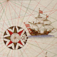
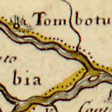
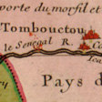
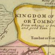
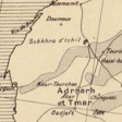
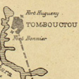
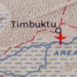
Timbuktu flourished because it was a center for transportation and overland trade. Situated at the edge of the Sahara Desert, it was both the first place that trans-Saharan caravans coming from the north stopped and the jump-off place for caravans traveling north across the desert to the Mediterranean basin. Due to the significance of its location, Timbuktu appears on maps made in Europe beginning in the 16th century. The earliest maps in this online presentation focus on Timbuktu’s position on the various land routes across the Sahara and up from sub-Saharan Africa. Timbuktu is depicted as an important city in a continental overland system of travel. Beginning in the 16th century, the Portugese, followed by other European powers, began sailing along the Atlantic coast of Africa and trading European goods for African products. This Atlantic orientation resulted in new maps of Africa with a strong focus on the sea routes to West Africa. As detailed charts of the coastal regions were created, Timbuktu and other interior cities became less well-known to the cartographers and were often mapped far-out of position. This situation continued until the 19th century when, as a service to France’s colonial empire, French cartographers created new detailed maps showing the correct locations of inland cities, including Timbuktu. Islamic Manuscripts from Mali also includes a modern map of this nation state. Accurate and detailed maps present physical features such as mountains, cities, and rivers, and information about climate, vegetation, and population, as well as many other aspects of life. |
KEYS:
| ||||||||||||