|
|
|
Metadata
|
|
ID
|
A-6-02-HW
|
|
Abstract
|
United States Geological Survey, Menlo Park, California.
Chief Scientist: Curt Storlazzi. Tripod Redeployment data
(ADP, opticalbackscattersensor, wavepressure, ADV, CTmeter)
of field activity A-6-02-HW in West Maui, Hawaii, USA from
05/14/2002 to 05/17/2002
|
|
Organization
|
United States Geological Survey, Menlo Park, California
|
|
Project/Theme
|
Coral Reefs
|
|
Chief Scientist
|
Curt Storlazzi
|
|
Activity Type
|
Tripod Redeployment
|
|
Platform
|
Alyce C
|
|
Area of Operation
|
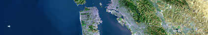
West Maui, Hawaii, USA
|
|
Location map
|

|
|
Bounding Coordinates
|
20.98252
-156.68112 -156.68112
20.98252
|
|
Ports
|
leave Lahaina, Maui, Hawaii, USA
arrive Lahaina, Maui, Hawaii, USA
|
|
Dates
|
05/14/2002 (JD 134) to 05/17/2002 (JD 137)
|
|
Analog Materials
|
No analog holdings.
|
|
Index map

|
|
|
Information Specialist
|
|
|
Crew
|
|
Mike Field
|
Geologist, USGS Western Region
|
|
Curt Storlazzi
|
Oceanographer/Geologist, USGS Western Region
|
|
Bruce Jaffe
|
Oceanographer, USGS Western Region
|
|
Josh Logan
|
GIS Specialist, USGS Western Region
|
|
Eric Grossman
|
Geologist, USGS Western Region
|
|
Tom Reiss
|
Oceanographer, USGS Western Region
|
|
Rebecca Stamski
|
Graduate Student, UC Santa Cruz, Earth Science Dept.
|
|
Joe Reich
|
Vessel captain,
|
|
|
Equipment Used
|
|
ADP
|
|
opticalbackscattersensor
|
|
wavepressure
|
|
ADV
|
|
CTmeter
|
|
|
Purpose
|
|
Oceanographic instrument package recovery and redeployment
|
|
|
Information to be Derived
|
|
Current speed and direction, temperature, salinity, water depth,
|
|
acoustic backscatter, optical backscatter
|
|
|
Summary
|
|
Maui instrument tripod will be recovered from location using the vessel
|
|
Alyce C. Data from the previous deployment will be downloaded at the Maui Ocean
|
|
Center. The instruments will be redeployed at the same location for further
|
|
measurements.
|
|
|
Publications
|
|
|
Got Help?
|
For A-6-02-HW, we would appreciate any information on -- analog materials, contract, days at sea, dive count, funding, kms of navigation, national plan, NGDC Info, notes, owner, project number, scanned materials, seismic description, station count, station description, submersible, tabulated info.
|
|