|
|
|
Metadata
|
|
ID
|
94024
|
|
Also Known As
|
94024
ASTR94-4
A-4-94-BH
|
|
Abstract
|
United States Geological Survey, Woods Hole, Massachusetts.
Chief Scientists: Bill Danforth, Jane Denny. Data
(navigation) of field activity 94024 (A-4-94-BH) in
Massachusetts Boston Harbor from 07/05/1994 to 07/08/1994
|
|
Organization
|
United States Geological Survey, Woods Hole, Massachusetts
|
|
Chief Scientist
|
Bill Danforth
Jane Denny
|
|
Platform
|
Asterias
|
|
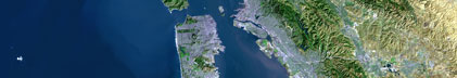
Area of Operation
|
Massachusetts Boston Harbor
|
|
Location map
|
|
|
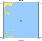
Bounding Coordinates
|
42.39771
-70.83201 -70.82117
42.38231
|
|
Dates
|
07/05/1994 (JD 186) to 07/08/1994 (JD 189)
|
|
Analog Materials
|
No analog holdings.
|
|
Index map

|
|
|
Crew
|
|
Bill Danforth
|
Chief Scientist, USGS Woods Hole
|
|
Jane Denny
|
Chief Scientist, USGS Woods Hole
|
|
Dave Olmstead
|
Captain, WHOI
|
|
Tom O'Brien
|
Unspecified, USGS Woods Hole
|
|
Rick Rendigs
|
Unspecified, USGS Woods Hole
|
|
Chuck Denham
|
Unspecified, USGS Woods Hole
|
|
Brian Wilson
|
Unspecified, Datasonics
|
|
|
Equipment Used
|
|
|
Purpose
|
|
|
Publications
|
|
Cruise Report exists at Woods Hole
|
|
|
Got Help?
|
For 94024, we would appreciate any information on -- activity type, analog materials, contract, days at sea, dive count, funding, information specialist, information to be derived, kms of navigation, national plan, NGDC Info, notes, owner, ports, project, project number, scanned materials, seismic description, station count, station description, submersible, summary, tabulated info.
|
|