|
|
|
Metadata
|
|
ID
|
A-1-98-PC
|
|
Abstract
|
National Oceanic and Atmospheric Administration. Airborne
Topographic data (LIDAR) of field activity A-1-98-PC in West
Coast from 04/08/1998 to 04/28/1998
|
|
Organization
|
National Oceanic and Atmospheric Administration
|
|
Project/Theme
|
Spring 1998 West Coast: Post-El Nino
|
|
Activity Type
|
Airborne Topographic
|
|
Platform
|
Airplane
|
|
Area of Operation
|
West Coast
|
|
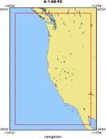
Location map
|
|
|
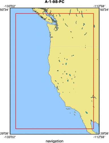
Bounding Coordinates
|
49.75000
-131.75000 -114.25000
30.25000
|
|
Dates
|
04/08/1998 (JD 098) to 04/28/1998 (JD 118)
|
|
Analog Materials
|
No analog holdings.
|
|
Index map
|
|
|
Information Specialist
|
|
Lynne Dingerson, NOAA
|
|
Ann Gibbs, USGS
|
|
|
Equipment Used
|
|
|
Purpose
|
|
This data was collected as part of an effort to map beach topography
|
|
efficiently and cheaply.
|
|
|
Notes
|
|
The Airborne LIDAR Assessment of Coastal Erosion (ALACE)
|
|
project was a partnership between NOAA, NASA, and U.S. Geological
|
|
Survery (USGS). It has been collecting baseline coastal topographic
|
|
data for the conterminous U.S. since 1996. NOAA left the partnership
|
|
after the fall 2000 season, but USGS and NASA continue to collect data
|
|
for research purposes. This data may eventually be available via LDART.
|
|
The ALACE collections are typically targeted at a narrow strip of sandy
|
|
beach and are usually a kilometer or less in width. Many areas have
|
|
both baseline data and post-storm data. In general, this data has not
|
|
been checked with ground control, but has undergone internal
|
|
consistency checks.
|
|
|
Publications
|
|
Coastal Erosion Along the U.S. West Coast During the 1997-98 El Nino:
|
|
Expectations and Observations, available on-line at:
|
|
|
|
http://coastal.er.usgs.gov/lidar/AGU_fall98/
|
|
|
Storlazzi, C.D., Barnard, P.L., Collins, B.D., Finlayson, D.P., Golden, N.E.,
|
|
Hatcher, G.A., Kayen, R.E., and Ruggiero, Peter, 2007, High-Resolution
|
|
Topographic, Bathymetric, and Oceanographic Data for the Pleasure Point Area,
|
|
Santa Cruz County, California: 2005-2007, U.S. Geological Survey Open File
|
|
Report 2007-1270, available on line at:
|
|
http://pubs.usgs.gov/of/2007/1270/
|
|
|
Got Help?
|
For A-1-98-PC, we would appreciate any information on -- analog materials, chief scientist, contract, crew, days at sea, dive count, funding, information to be derived, kms of navigation, national plan, NGDC Info, owner, ports, project number, scanned materials, seismic description, station count, station description, submersible, summary, tabulated info.
|
|