|
|
|
Metadata
|
|
ID
|
07025
|
|
Also Known As
|
A-1-07-CD
07025
|
|
Abstract
|
United States Geological Survey, Woods Hole, Massachusetts.
Chief Scientists: Sandy Baldwin, USGS, Timothy McCobb, USGS,
WRD. Data (SCUBA) of field activity 07025 (A-1-07-CD) in
Buzzards Bay, Cape Cod, Massachusetts, United States, North
America, North Atlantic Ashumet Pond, Falmouth,
Massachusetts, United States, North America from 07/13/2007
to 07/13/2007
|
|
Organization
|
United States Geological Survey, Woods Hole, Massachusetts
|
|
Chief Scientist
|
Sandy Baldwin
Timothy McCobb
|
|
Area of Operation
|
Buzzards Bay, Cape Cod, Massachusetts, United States, North America, North Atlantic Ashumet Pond, Falmouth, Massachusetts, United States, North America
|
|
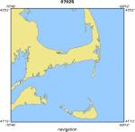
Location map
|
|
|
Bounding Coordinates
|
41.63333
-70.75000 -69.75000
41.62500
|
|
Ports
|
LEAVE
ARRIVE
|
|
Dates
|
07/13/2007 (JD 194) to 07/13/2007 (JD 194)
|
|
Analog Materials
|
No analog holdings.
|
|
Index map

|
|
|
Information Specialist
|
|
|
Crew
|
|
Sandy Baldwin
|
|
|
Timothy McCobb
|
USGS, WRD, Chief Scientist
|
|
Michael Casso
|
|
|
|
Equipment Used
|
|
|
Purpose
|
|
Michael Casso and Sandy Baldwin will be assisting Timothy
|
|
McCobb from USGS Northborough, Ma. in sampling ground water at
|
|
Ashumet Pond. Woods Hole divers will connect sampling tubes to
|
|
underwater piezometers located off-shore at Ashumet Pond.
|
|
|
Summary
|
|
Divers were used to connect ground water sampling wells
|
|
with the pump tubing used to sample them.
|
|
|
Notes
|
|
|
Funding
|
|
|
Got Help?
|
For 07025, we would appreciate any information on -- activity type, analog materials, contract, days at sea, dive count, information to be derived, kms of navigation, national plan, NGDC Info, owner, platform, project, project number, publications, scanned materials, seismic description, station count, station description, submersible, tabulated info.
|
|


