|
|
|
Metadata
|
|
ID
|
B-1-99-SC
|
|
Abstract
|
United States Geological Survey, Menlo Park, California.
Chief Scientist: Guy Cochrane. Sidescan Sonar data
(Kleinsidescan) of field activity B-1-99-SC in Northern
Channel Islands, California from 03/01/1999 to 03/11/1999
|
|
Organization
|
United States Geological Survey, Menlo Park, California
|
|
Project/Theme
|
Nearshore Benthic Habitats Project
|
|
National Plan
|
Environmental Quality And Preservation
|
|
Chief Scientist
|
Guy Cochrane
|
|
Activity Type
|
Sidescan Sonar
|
|
Platform
|
Ballena
|
|
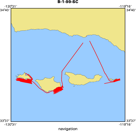
Area of Operation
|
Northern Channel Islands, California
|
|
Location map
|

|
|
Bounding Coordinates
|
34.40606
-120.46137 -119.32756
33.87998
|
|
Ports
|
leave Santa Barbara, CA
arrive Santa Barbara, CA
|
|
Dates
|
03/01/1999 (JD 060) to 03/11/1999 (JD 070)
|
|
Analog Materials
|
list
|
|
Index map
|
|
|
Information Specialist
|
|
|
Crew
|
|
Guy Cochrane
|
Chief Scientist, USGS Western Region
|
|
Mike Boyle
|
Electronic Technician, USGS Western Region
|
|
Mat Curto
|
First Captain, CINMS
|
|
Ron Hart
|
Second Captain, CINMS
|
|
Adam
|
Mate, Petuskey
|
|
|
Equipment Used
|
|
|
Purpose
|
|
|
Information to be Derived
|
|
|
Summary
|
|
Collected data south of Anacapa, Santa Rosa, and San Miguel Islands. Possibly as much as 25% of the data is low quality due to weather and kelp problems.
|
|
|
Notes
|
|
|
Publications
|
|
Cochrane, G.R., N.M. Nasby, J.A. Reid, B. Waltenberger, K.M. Lee, 2003.
|
|
Nearshore Benthic Habitat GIS for the Channel Islands National Marine Sanctuary
|
|
and Southern California State Fisheries Reserves Volume 1, U.S. Geological
|
|
Survey Open-file Report 03-85:
|
geopubs.wr.usgs.gov/open-file/of03-85/
|
|
|
|
Got Help?
|
For B-1-99-SC, we would appreciate any information on -- contract, days at sea, dive count, funding, kms of navigation, NGDC Info, owner, project number, scanned materials, seismic description, station count, station description, submersible, tabulated info.
|
|


