|
|
|
Metadata
|
|
ID
|
A-1-98-SC
|
|
Abstract
|
United States Geological Survey, Menlo Park, California.
Chief Scientist: Bill Normark. Geophysical data (Huntec,
24channel) of field activity A-1-98-SC in Southern California
from 08/09/1998 to 08/23/1998
|
|
Organization
|
United States Geological Survey, Menlo Park, California
|
|
Project/Theme
|
Southern California Seismic Hazards Project
|
|
National Plan
|
Earthquake Hazards
|
|
Chief Scientist
|
Bill Normark
|
|
Activity Type
|
Geophysical
|
|
Platform
|
Auriga
|
|
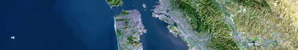
Area of Operation
|
Southern California
|
|
Location map
|
|
|
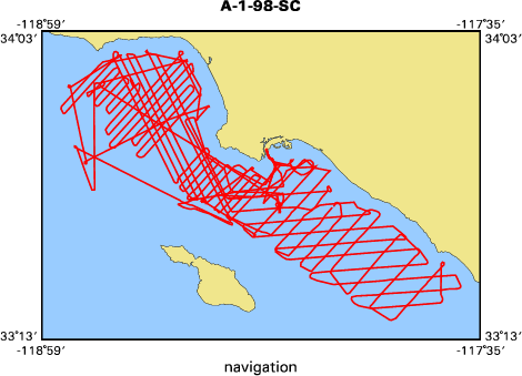
Bounding Coordinates
|
34.00136
-118.92695 -117.64443
33.27702
|
|
Ports
|
leave Redwood City, CA
arrive Fish Harbor, CA
|
|
Dates
|
08/09/1998 (JD 221) to 08/23/1998 (JD 235)
|
|
Analog Materials
|
list
|
|
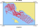
Index map
|
|
|
Crew
|
|
Bill Normark
|
Chief Scientist, USGS Western Region
|
|
Ray Sliter
|
Geophysicist, USGS Western Region
|
|
Bob Bohannon
|
Geophysicist, USGS Western Region
|
|
Gita Dunhill
|
Geologist, USGS Western Region
|
|
Dave Scholl
|
Geologist, USGS Western Region
|
|
Jane Laursen
|
Geologist, Aarhus Univ. Denmark
|
|
Fred Payne
|
Electronic Tech, USGS Western Region
|
|
Larry Kooker
|
Electronic Tech, USGS Western Region
|
|
Graham Standan
|
Tech Rep, Geoforce
|
|
Hal Williams
|
Mechanical Tech, USGS Western Region
|
|
Walt Olson
|
Mechanical Tech, USGS Western Region
|
|
Lisa Schlender
|
Marine Biologist, Cascadia Research
|
|
Jen Quan
|
Marine Biologist, Cascadia Research
|
|
Kevin Blakley
|
Mate, Auriga
|
|
Russ Brisendine
|
Engineer, Auriga
|
|
Dick Corrigan
|
Captain, Auriga
|
|
Marcus Ballweber
|
Mate, Auriga
|
|
Paul Giron
|
Ab, Auriga
|
|
Ricky Labrador
|
Chef, Auriga
|
|
|
Equipment Used
|
|
|
Purpose
|
|
To identify active faults on shelf and inner basin slopes between Point Dume and Dana Point.
|
|
|
Information to be Derived
|
|
Define active faults and potentially active faults that would affect Los Angeles
|
|
|
Summary
|
|
Obtain multichannel and high resolution seismic data
|
|
throughout study area.
|
|
|
Publications
|
|
Normark, William R., Bohannon, Robert G., Sliter, Ray, Dunhill, Gita,
|
|
Scholl, David W., Laursen, Jane, Reid, Jane A., and Holton, David, 1999,
|
|
Cruise report for A1-98-SC Southern California earthquake project: U.S.
|
|
Geological Survey Open-File Report OF 99-152: |
|
HREF="http://geopubs.wr.usgs.gov/open-file/of99-152/">http://geopubs.wr.usgs.go
|
/open-file/of99-152/
|
|
|
Fisher, Michael, Normark, William, Langenheim, Victoria, Calvert, Andrew
|
|
and Sliter, Ray, 2004, Marine geology and earthquake hazards of the San Pedro
|
|
shelf region, Southern California: U.S. Geological Survey Professional Paper
|
1687.
|
|
|
Got Help?
|
For A-1-98-SC, we would appreciate any information on -- contract, days at sea, dive count, funding, information specialist, kms of navigation, NGDC Info, notes, owner, project number, scanned materials, seismic description, station count, station description, submersible, tabulated info.
|
|