|
|
|
Metadata
|
|
ID
|
C-P1-99-MB
|
|
Abstract
|
Chief Scientist: Tom Reiss. Geodetic data (geodetic,
navigation) of field activity C-P1-99-MB in Capitola Beach,
Capitola, CA from 01/13/1999 to 01/13/1999
|
|
Project/Theme
|
Metropolitan Santa Cruz Beach Surveys
|
|
Chief Scientist
|
Tom Reiss
|
|
Activity Type
|
Geodetic
|
|
Area of Operation
|
Capitola Beach, Capitola, CA
|
|
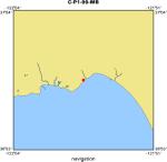
Location map
|
|
|
Bounding Coordinates
|
36.96971
-121.95564 -121.95564
36.96971
|
|
Dates
|
01/13/1999 (JD 013) to 01/13/1999 (JD 013)
|
|
Analog Materials
|
No analog holdings.
|
|
Index map

|
|
|
Crew
|
|
Tom Reiss
|
Chief Scientist, USGS Western Region
|
|
Gretchen Luepke
|
Unspecified, USGS Western Region
|
|
Justin Friesner
|
Unspecified, USGS Western Region
|
|
Kristin Brown
|
Unspecified, U.C. Santa Cruz
|
|
|
Equipment Used
|
|
|
Summary
|
|
A beach and nearshore topographic survey consisting of three
|
|
shore-normal profiles and one shore-parallel line (wet/dry line) was conducted.
|
|
The profiles were extended offshore into the surf zone utilizing a swimming
|
|
rodman. The total station was set up on Control Point 11201 "GL SETUP". This
|
|
location, although very distant from the beach, has a commanding view of the
|
|
entire beach and nearshore region. The HA reference was set to 000deg relative
|
|
to Control Point 11205 "Esplanade". The SECO level rods, in conjunction with the
|
|
level-rod support tripods were placed on the control points and pointed towards
|
|
the total station.
|
|
|
Notes
|
|
Program 10 (site setup) was performed on the total station
|
|
|
|
Program 20 (station establishment) was performed on the total
|
|
station using option "Known Station Location", utilizing Control
|
|
Point 11201 as the station location and Control Point 11205 as the
|
|
known reference object.
|
|
|
|
Program 4 (UTM) was used to collect control and topo points
|
|
|
|
Control Points: 11205, 11202, and 11204 were surveyed
|
|
(Fast Standard mode)
|
|
|
|
The Profile SN2 was surveyed using the EXP3 stadia rod
|
|
(Tracking mode) and carried offshore into the surf zone. Due to
|
|
the gently sloping nature of the offshore bathymetry, the profile
|
|
was terminated at the intermediate maximum limit of the EXP3
|
|
stadia rod.
|
|
|
|
The Wet/Dry line was surveyed using the EXP3 stadia rod
|
|
(Tracking mode)
|
|
|
|
The Profiles SN1A and SN1 were surveyed using the EXP3 stadia rod
|
|
(Tracking mode) and carried offshore into the surf zone. Due to the
|
|
gently sloping nature of the offshore bathymetry, the profile was
|
|
terminated at the intermediate maximum limit of the EXP3 stadia rod.
|
|
|
|
Gretchen Luepke sketched the beach and assisted with the control points.
|
|
|
|
Thomas E. Reiss took written notes and photographed the area.
|
|
|
|
Kristin M. Brown operated the total station.
|
|
|
|
Justin Friesner was the rodman.
|
|
Date field data collection started --- 13 January 1999, 1130 (PST)
|
|
|
|
Date field data collection ended --- 13 January 1999, 1230 (PST)
|
|
|
Got Help?
|
For C-P1-99-MB, we would appreciate any information on -- analog materials, contract, days at sea, dive count, funding, information specialist, information to be derived, kms of navigation, national plan, NGDC Info, organization, owner, platform, ports, project number, publications, purpose, scanned materials, seismic description, station count, station description, submersible, tabulated info.
|
|