
Gaza Strip
August 2005
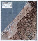
Gaza Strip, 2005
Enlarge
Covering a land area of 360 sq. km (approximately twice the size of Washington, DC) with a population of nearly 1.4 million, the Gaza Strip is a narrow sliver of land in the westernmost portion of the Palestinian territories in Southwest Asia and borders Egypt, Israel, and the Mediterranean Sea. This region has a temperate climate with mild winters and dry, warm to hot summers. The terrain consists of flat to rolling, sand-and-dune covered coastal plains.
The Gaza Strip's borders were originally defined by the armistice lines between Egypt and Israel after the 1948 Arab-Israeli War. The Gaza Strip was occupied by Egyptian forces until the region was captured by Israel in the 1967 Six-Day War. In 1993, after the Palestinian-Israeli agreements known as the Oslo Accords, much of the Strip came under limited Palestinian Authority control. In February 2005, the Israeli government voted to implement plans for unilateral disengagement from the Gaza Strip beginning on August 15, 2005.
CIA World Factbook, 09/2005