Link to USGS home page
USGS Home
Contact USGS
Search USGS
Coastal & Marine Geology InfoBank

USGS CMG F-1-84-SC Metadata

Skip navigational links
Search InfoBank
Home tab FACS tab Activities tab Atlas tab Geology School tab More tab More tab Activities tabs
   
Activities: by ID   by Platform   by Year   by Region   by Participant   by Organization   by Project/Theme   with Incomplete IDs   Disclaimer  
Activity First Letter: A   B   C   D   E   F   G   H   I   J   K   L   M   N   O   P   Q   R   S   T   U   V   W   X   Y   Z   0   1   2   3   4   5   6   7   8   9  
Virtual Globes: Atlas  (GE)    Samples  (GE)    Illuminate Oceans  (GE)    Earthquakes  (GE)    Get GE    InfoBank examples    State Waters
F-1-84-SC links...
Metadata & Data: Bathymetry   Imagery   Magnetics   Metadata   Navigation   Seismic   bath (GE GM)   imag (GE GM)   mag (GE GM)   nav (GE GM)   times (GE GM)  
Formal Metadata: Frequently-Anticipated Questions   Outline   Parseable Text   XML  
   
   
Metadata
ID F-1-84-SC
Also Known As F184COW
F184SC
Abstract Chief Scientists: Mike Field, Brian Edwards. Geophysical data (LoranC, 3dot5khz, magnetics, airgun, Gloriasidescan, sidescansonar, transitsatellite) of field activity F-1-84-SC in Southern California from 04/26/1984 to 05/21/1984
Project/Theme Geological Long-Range Inclined Asdic (GLORIA)
National Plan Resources
Chief Scientist Mike Field
Brian Edwards
Activity Type Geophysical
Platform Farnella
Area of Operation
Southern California
Location map F-1-84-SC location map of where navigation equipment operated
Bounding Coordinates 34.58120
-124.80900    -117.13780
31.33770
Ports leave San Diego, CA
arrive Long Beach, CA
Dates 04/26/1984 (JD 117) to 05/21/1984 (JD 142)
Analog Materials list
Index map

F-1-84-SC map of where navigation equipment operated

Crew
Mike Field Chief Scientist, USGS Western Region
Brian Edwards Chief Scientist, USGS Western Region
Equipment Used
LoranC
3dot5khz
magnetics
airgun
Gloriasidescan
sidescansonar
transitsatellite
Notes
Associated cruises:

  F-1-84-SC
  F-2-84-NC
  F-3-84-NC
  F-4-84-WO
NGDC Overview
! Converted to time format with year at start.
!
DATA COLLECTION OVERVIEW (use NGDC GEODAS CD to retrieve data)
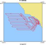
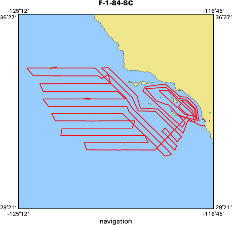
MCG Data Collection ID --- F184SC
Institution Data Collection ID --- F184SC
NGDC ID --- 06780003
Funding --- (unspecified)
Project, Cruise & Leg --- Brian Edwards
Study region --- +35.00000,+30.00000,-126.00000,-117.00000
Chief Scientist(s) --- Mike Field
Name of vessel --- Farnella (surface ship)
Date field data collection started --- 04/26/84 LV SAN DIEGO START CRUZ
Date field data collection ended --- 08/14/84 AV LONG BEACH END CRUISE
Parameters surveyed ---
Bathymetry: surveyed, contained in data file
Magnetics: surveyed, contained in data file
Gravity: (unspecified)
High-resolution seismics: (unspecified)
Deep penetration seismics: (unspecified)
Format --- (I1,A8,F5.2,4I2,F5.3,F8.5,F9.5,I1,F6.4,F6.1,I2,i1,3F6.1,I1,F5.1,F6.0,F7.1,F6.1,F5.1,A8,4I1)
Date of data input to NGDC --- 08/05/87
Contributing institution --- USGS Branch of Pacific Marine Geology
Country --- United States
Navigation instrumentation --- SATELLITE NAVIGATION LORAN C NAVIGATION
Position determination method --- (unspecified)
Bathymetry instrumentation --- 3.5 KHZ BATHY
Additional forms of bathymetric data --- (unspecified)
General rate of bathymetry in file --- 3.5 minutes
General collection rate of bathymetry --- (unspecified)
Assumed sound velocity --- (unspecified)
Bathymetric datum code --- No correction applied (sea level)
Bathmetry interpolation scheme --- (unspecified)
Magnetics instrumentation --- MAGNETOMETER PROTON MAGGIE/BATHY/NAV
Additional forms of magnetics data --- (unspecified)
General rate of magnetics in file --- 3.6 minutes
General collection rate of magnetics --- (unspecified)
Magnetic sensor tow distance --- (unspecified)
Magnetic sensor depth --- (unspecified)
Two sensor horizontal separation --- (unspecified)
Residual magnetics reference field --- (unspecified)
Method of applying residual field --- (unspecified)
Gravity instrumentation --- (unspecified)
Additional forms of gravity data --- (unspecified)
General rate of gravity in file --- (unspecified)
General collection rate of gravity --- (unspecified)
Theoretical gravity formula --- (unspecified)
Reference system --- (unspecified)
Corrections applied --- (unspecified)
Starting land tie --- (unspecified)
Ending land tie --- (unspecified)
Seismic instrumentation --- SING CHAN AIR GUN 160IN3
Formats of seismic data --- (unspecified)
Publications
Edwards, Brian D., Field, Michael E., Carlson, Paul R., and Kenyon, Neil H., 1985,
Geomorphic features off Southern California as seen by GLORIA side-scan sonar system, in
American Association of Petroleum Geologists annual convention with divisions Society
For Sedimentary Geology/EMD/DPA: American Association of Petroleum Geologists Bulletin,
v. 69, no. 2, p. 251.

EEZ-SCAN 84 Scientific Staff, 1985, MV Farnella cruises 1/84 to 4/84,
26 April to 15 August 1984; GLORIA studies of the Exclusive Economic Zone off
the western United States between 30 degrees 30' and 48 degrees 30' N,
available on line at:
target ="of">http://pubs.er.usgs.gov/usgspubs/ofr/ofr85508
Got Help? For F-1-84-SC, we would appreciate any information on -- contract, days at sea, dive count, funding, information specialist, information to be derived, kms of navigation, organization, owner, project number, purpose, scanned materials, seismic description, station count, station description, submersible, summary, tabulated info.


Skip footer navigational links


InfoBank   Menlo Park & Santa Cruz Centers   St. Petersburg Center   Woods Hole Center   Coastal and Marine Geology Program   Geologic Information   Ask-A-Geologist   USGS Disclaimer  

FirstGov button   Take Pride in America button