| Projects & Studies
|
| »
|
Critical Infrastructure Security Program (CISP)
|
| »
|
Dam Bridge and Gate Painting: Upper St. Anthony Falls through Lock and Dam 10
|
| »
|
East Two Rivers at Tower, Minnesota
|
| »
|
Effects of Recreational Boating on the Upper Mississippi River System
|
| »
|
General Investigations: Federal Energy Regulatory Commission(FERC) Licensing
|
| »
|
General Investigations: Hydropower, Crown Hydro, Minneapolis, Minnesota
|
| »
|
General Investigations: Hydropower, Ford Plant, Minneapolis, Minnesota
|
| »
|
Hydropower, LSAF Hydro, Minneapolis, Minnesota
|
| »
|
Hydropower, Lock and Dam 2, Hastings, Minnesota
|
| »
|
Hydropower, Upper St. Anthony Falls, Minneapolis, Minnesota
|
| »
|
Integrated Watershed Study: Minnesota River Basin in Minnesota, South Dakota, North Dakota and Iowa
|
| »
|
Lock & Dam 10 Stage 2
|
| »
|
Lock Tow Haulage Units
|
| »
|
Lock and Dam 4 Embankment Environmental Assessment
|
| »
|
Locks and Dams 2 - 10, Embankment Maintenance Study
|
| »
|
Lower Pool 4 Channel and Dredged Material Management Study
|
| »
|
McMillan Island, Mississippi River Channel Maintenance
|
| »
|
Minnesota River Navigation Project
|
| »
|
Mississippi Headwaters Reservoirs Dam Safety Issues
|
| »
|
Mississippi Headwaters Reservoirs Project Sites
|
| »
|
Mississippi River Locks and Dams Nos. 2-10 Embankment Rehabilitation
|
| »
|
Mississippi River Major Maintenance / Rehabilitation
|
| »
|
Mississippi River: Lock & Dam 3 Navigation Safety and Embankments, Minnesota and Wisconsin
|
| »
|
Navigation and Environmental Sustainability Program (NESP)
|
| »
|
Navigation, Mississippi River, Lock Bulkheads and Slot Installation, Minn/Wisc/Iowa
|
| »
|
Operation and Maintenance, Lock and Dam 10 Stage 2
|
| »
|
Reconnaissance Study: Minnesota River Basin in MN, SD, IA and ND
|
| »
|
Recreational Boating Study of the Mississippi River, Pools 4 to 9, Summer 2003
|
| »
|
River Resource Values and Expectation
|
| »
|
Small-Boat Harbor Dredging, St. Paul, Minnesota (Harbor Dredging)
|
| »
|
St. Croix River: Endangered Mussel Conservation - Zebra Mussel Control
|
| »
|
Upper Mississippi River - Illinois Waterway System Navigation Study
|
| »
|
Upper Mississippi River 9-Foot Project - Locks & Dams
|
| »
|
Upper Mississippi River 9-Foot Project Channel Maintenance; MN, WI, IA
|
| »
|
Warroad Harbor and River Harbor Dredging
|
|
|
|
Navigation
|
Navigation Overview
|
Navigation is travel or transportation over water. Many different kinds of boats and vessels are used on rivers to move people and products from one place to another.
Navigation was extremely important for foreign and domestic trade and travel in the early days of our country before cars, trucks, trains and airplanes were invented. In those days, rivers were used as "roads" to connect inland settlements to river and coastal ports. Communities established at these ports became important economic, cultural and social hubs in the development of our nation.
Today, navigable inland waterways provide a cost-effective, fuel efficient means for moving major bulk commodities, such as grain, coal and
petroleum. Inland navigation is a key element of state and local government economic development and job-creation efforts,
and is essential in maintaining economic competitiveness and national security. For more information, view our brochure Inland Waterway Navigation Value to the Nation (PDF).
Navigation activities in the United States take place at thousands of ports and terminals along more than 25,000 miles of waterways. The U.S. Army Corps of Engineers is responsible for facilitating safe, reliable and economically efficient movement of vessels, and it does so by constructing and maintaining navigation channels and harbors, and regulating water levels
on inland waterways.
|
|
Locks and Dams
|
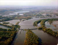
The Corps of Engineers maintains navigation channels, much like road crews maintain highways, and builds breakwaters or jetties to protect public property from shoreline erosion. A 9-foot navigation channel is maintained on the Upper Mississippi River, so river vessels can transport their goods north of St. Louis.
To achieve a 9-foot channel in the Upper Mississippi River, the construction of a system of navigation locks and dams was authorized in 1930. Dams are built on rivers to hold back water and form deeper navigation "pools." Most pools in the United States are maintained at a constant minimum water depth of 9 feet for safe navigation.
Dams make it necessary for river vessels to use a series of locks to "step" up or down the river from one water level to another. Additional benefits from the locks and dams include adding river recreational areas for public use, providing water supply for several river communities and serving as nesting grounds for migratory birds. The St. Paul District has jurisdiction over the 13 uppermost structures, from No. 10 at Guttenberg, Iowa, to Upper St. Anthony Falls Lock and Dam in Minneapolis, as well as 1,300 wing dams and 200 revetments.
|
|
Navigation Channel
|
Sedimentation in the channel is caused by the normal cycle of silt movement, erosion from high water or heavy rains and changes in river currents. To maintain the 9-foot navigation channel, material that settles in the channel area must be removed. Mechanical or hydraulic dredging are methods for the removal of that material. This material is placed in designated areas along the river. Some of these areas are beneficial use placement areas.
Beneficial use of dredged material is the productive use of the material by the public or private sectors. Examples of common beneficial uses of dredged material in the St. Paul District are upland habitat development, wetland creation, aquatic habitat enhancement, creation of areas for bird nesting, beach nourishment, winter road maintenance, levee repair and improvement, aggregate for concrete, lining fly ash pits, bank protection and general purpose fill. The district is responsible for maintaining 243.6 miles of navigation channel to a depth of at least 9 feet on the Mississippi River from Minneapolis at river mile 857.6 to Guttenberg, Iowa, at river mile 614.0, and 40.6 miles on three tributaries: the Minnesota, St. Croix and Black rivers.
|
|
NIC - Navigation Information Connection
|
Vessel location, lock conditions, river conditions, more....
|
|
River Information Line
|
The St. Paul District provides daily updates for water levels and flows at various points on the St. Croix, Minnesota and Upper Mississippi rivers on its River Information Line, 651-290-5861.
|
|
|
[Printable Copy]
|