The Soil, Water and Air (SWA) Program in Alaska supports the BLM’s multiple-use mission, while protecting and restoring the physical natural resources that maintain healthy watersheds.
The majority of program work supports water-related activities such as monitoring water quality and quantity, instream flow studies, climate and snowpack monitoring, cooperative watershed projects, and protecting/restoring water quality and water habitats.
Soil surveys and projects related to impacts from off-highway-vehicle (OHV) use are conducted in certain areas as needed. The program provides basic coordination for air issues, and site specific air quality studies are conducted as they relate to smoke from wildfire.
How large is the program?
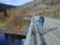
Field work in Alaska is challenging and expensive due to weather and the remote and scattered nature of BLM-managed public lands. The BLM manages approximately 85 million acres of surface land, or about one-fifth of the State of Alaska. These lands contain approximately 96,000 miles of perennial streams, 2.6 million lake surface acres, and innumerable wetland areas (approximately 45% of Alaska is classified as wetlands). The BLM manages more water bodies in Alaska than in the rest of the Lower 48 combined. In addition, the BLM manages almost 240 million acres of subsurface mineral estate in Alaska.
What are we aiming for?
The BLM sustains the health, diversity and productivity of the public lands, for the use and enjoyment of present and future generations. The people of the Soil, Water and Air Program in Alaska strive to support the BLM’s multiple-use mission while working to protect, maintain and restore physical natural resources through watershed-based ecosystem management.
Why do we do this?
The primary function of the program is to collect and analyze information on soil, water and air resources and provide direction necessary for:
• Compliance with laws, regulations and policies
• Mineral and energy development
• Land-use planning
• Fire management
• Monitoring the effectiveness of management actions
• Instream flow and other water rights applications
• Stream and watershed enhancement projects
• Protection of water quality and water habitats
• Climate change analysis
• Management of fish and wildlife resources for subsistence use
• Recreation management including OHV impacts
Related Links
Abandoned Mines Land
http://www.ak.blm.gov/ak940/aml/amlindex.html
Interagency Hydrology Committee for Alaska
http://ak.water.usgs.gov/ihca/
USFS Stream Systems Technology Center
http://www.stream.fs.fed.us/
USFWS Alaska Water Resources
http://alaska.fws.gov/water/index.htm
USGS Alaska
http://alaska.usgs.gov/science/water/index.php
NWS Alaska-Pacific River Forecast Center
http://aprfc.arh.noaa.gov/ak_ahps2.php
ARCADIAN – Current Streamflow Conditions in Alaska
http://www.thetent.com/thetent/aogcr/ak/aksf_index.htm
University of Alaska-Fairbanks – Water and Environmental Research Center
http://www.uaf.edu/water/
Natural Resources Conservation Service – Alaska Snow, Water and Climate Services
http://www.ambcs.org/
Alaska Ocean Observing System (AOOS) - Data Catalog Explorer
http://ak.aoos.org/op/data.php?region=AK&name=met