|
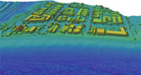
Coastal Evolution: Process-based Multi-scale Modelingsee: OverviewNatural and anthropogenic changes in Coastal regions significantly affect both property and life. Scientific understanding of the mechanisms causing Coastal change provides guidance for an appropriate societal response. Important goals of the Coastal and Marine Geology Program are to assess Coastal change vulnerability and conduct research to identify and quantify the processes and mechanisms that contribute to Coastal change. The Coastal intersection of land, sea, and air is a highly dynamic region that evolves in time and in space over a wide range of scales due to a variety of physical processes that operate over the various scales. Typical management scales of interest involve coast lengths of the order of 1 to 100 km, with corresponding time scales ranging from storm events (hours) to decades. These are the primary scales of societal interest, and are the focus of this project. Changes that occur on the management scale, however, are significantly influenced by processes at that occur at both larger and smaller scales (Carter and Woodroofe, 1994). For example, the sediment grain size, a small scale property that has a direct influence on grain-scale processes, also has a controlling effect upon Coastal geomorphology. Similarly, the large scale geologic framework provides strong contraints upon shorter scale Coastal Evolution. A critical scientific challenge of direct practical importance is to describe the physical mechanisms that operate at these various scales, and establish the interactions between the different scale processes. A high quality numerical model is the most appropriate and useful tool for this because it can incorporate scientific understanding and empirical observations, and be applied to specific regions and problems (Wilcock and Iverson, 2003). In addition to potentially providing predictive capabilies, Modeling is useful for developing, testing, and simplifying concepts, for suggesting new hypothesis and rejecting incorrect hypothesis, for conducing virtual experiments, and for directing emphasis for new observations. The broad scale range of the relevant physical processes causing Coastal Evolution motivates the development of a multi-scale Modeling system. For example, some of the different spatial scales of interest include the sediment grain scale (100 microns), the wave boundary layer scale (10 cm), the nearshore scale (100 m), and the regional scale (100 km). Models applicable to any of these scales would typically cover a range of one to two orders of magnitude less than and greater than the scale of interest, so for example, a particular nearshore scale model might cover scales from 10 m to 10 km. Each model would also cover a similar magnitude range in time scales, and should ideally overlap with the smaller and larger neighbor scale model by about an order of magnitude. It is through the overlap in scales that model components interact and permit the investigation of multiple-scale phenomena.
ObjectivesWe seek to develop a multi-scale numerical Modeling system for Coastal Evolution that incorporates physical processes and empirical knowledge. Newly discovered and newly appreciated processes studied through observational and theoretical investigations in regional investigations, national assessment programs, and by the research community at large will be continually incorporated into the dynamic Modeling system so that the model system remains at the forefront of scientific understanding. Model components will be calibrated and evaluated with data obtained from regional and other field investigations, and Modeling applications will be coordinated with program site specific investigations. ApproachA variety of Modeling approaches will be utilized to develop the multi-scale Modeling system. Both physics-based models at a smaller scales and rules based models at larger scales will be utilized. Models of the larger scales will be linked to smaller scale models by specifying boundary conditions for the smaller scale models. Smaller scale model results will be parameterized to be included effeciently in larger scale models. Model development will be closely integrated with regional and topical investigations of geologic framework and physical processes contributing toward Coastal change in a variety of environments. Data from site specific studies in S.W. Washington, Southern California, South Carolina, North Carolina, and other future studies will be utilized to guide model development and model validation. Cooperators
|
||||||||||||
|
||||||||||||

![]() U.S. Department of the Interior | U.S. Geological Survey
U.S. Department of the Interior | U.S. Geological Survey
URL: http://walrus.wr.usgs.gov/research/projects/CEM.html
Page Contact Information: Laura Zink Torresan
Page Last Modified: 23 September 2008 (lzt)