
 Feeds & Data
Magnitude 6.6 - NORTH OF MACQUARIE ISLAND
2007 November 10 01:13:34 UTC
Earthquake Details
| Magnitude | 6.6 |
|---|---|
| Date-Time |
|
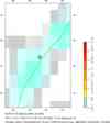
| Location | 52.158°S, 159.527°E |
| Depth | 10 km (6.2 miles) set by location program |
| Region | NORTH OF MACQUARIE ISLAND |
| Distances | 345 km (215 miles) WSW of Auckland Island, New Zealand 400 km (250 miles) NNE of Macquarie Island, Australia 1530 km (950 miles) SW of WELLINGTON, New Zealand 2025 km (1260 miles) SSE of CANBERRA, A.C.T., Australia |
| Location Uncertainty | horizontal +/- 10.9 km (6.8 miles); depth fixed by location program |
| Parameters | NST= 66, Nph= 66, Dmin=263.5 km, Rmss=1.11 sec, Gp= 50°, M-type=moment magnitude (Mw), Version=7 |
| Source |
|
| Event ID | us2007jnac |
- This event has been reviewed by a seismologist.
- Did you feel it? Report shaking and damage at your location. You can also view a map displaying accumulated data from your report and others.
Earthquake Summary


The following is a release by the United States Geological Survey, National Earthquake Information Center: An earthquake occurred about 485 km (300 miles) WSW of Auckland Island, New Zealand or about 1680 km (1040 miles) SW of WELLINGTON, New Zealand at 6:13 PM MST, Nov 9, 2007 (Nov 10 at 12:13 PM local time in New Zealand). The magnitude and location may be revised when additional data and further analysis results are available. No damage is expected.
Earthquake Maps


Scientific & Technical Information

- Preliminary Earthquake Report
- U.S. Geological Survey, National Earthquake Information Center:
World Data Center for Seismology, Denver
