
Magnitude 7.9 - TONGA
2006 May 3 15:26:39 UTC
Earthquake Details
| Magnitude | 7.9 |
|---|---|
| Date-Time |
= Coordinated Universal Time = local time at epicenter |
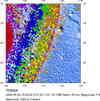
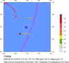
| Location | 20.130°S, 174.164°W |
| Depth | 55 km (34.2 miles) set by location program |
| Region | TONGA |
| Distances | 160 km (100 miles) NE of NUKU'ALOFA, Tonga 165 km (100 miles) S of Neiafu, Tonga 460 km (285 miles) S of Hihifo, Tonga 2145 km (1330 miles) NNE of Auckland, New Zealand |
| Location Uncertainty | horizontal +/- 5.3 km (3.3 miles); depth fixed by location program |
| Parameters | Nst=209, Nph=209, Dmin=732.7 km, Rmss=0.81 sec, Gp= 22°, M-type=teleseismic moment magnitude (Mw), Version=Q |
| Source | USGS NEIC (WDCS-D) |
| Event ID | usmgas |
- This event has been reviewed by a seismologist.
Did you feel it?
Report shaking and damage at your location. You can also view a map displaying accumulated data from your report and others.
Earthquake Summary


Felt Reports
One person injured, a church damaged, windows broken and items knocked from shelves (VII) at Nuku`alofa. Felt (VI) at Neiafu. Felt at Hihifo, Pangai and Vaini. Felt (III) at Apia, Samoa. Felt at Atiu and Avarua, Cook Islands; at Suva, Fiji; at Alofi, Niue; at Mulifanua, Samoa. Also felt at Auckland, Minginui, Napier, Wanganui, Wellington and Whakatane, New Zealand. A tsunami was generated with recorded wave heights in meters (peak-to-trough) at the following selected tide stations: 0.54 at Pago Pago, American Samoa; 0.10 at Tofino, British Columbia, Canada; 0.13 at Raratonga, Cook Islands; 0.07 at Suva, Fiji; 0.15 at Hanasaki, Japan; 0.48 at Noumea, New Caledonia; 0.15 at Jackson Bay, New Zealand; 0.42 on Niue; 0.42 at Apia, Samoa; 0.42 at Nuku`alofa, Tonga; 0.13 at King Cove, Alaska, 0.54 at Crescent City, California, 0.35 at Santa Barbara, California, 0.10 at San Francisco, California, 0.49 at Kahului, Hawaii, 0.12 at Portland, Oregon, 0.11 at La Push, Washington, U.S.A; 0.45 at Port Vila, Vanuatu.
Tectonic Summary
The broad-scale tectonics of the earthquake region are dominated by the relative convergence of the Pacific and Australia plates. The Pacific plate subducts westward beneath the Australia plate at the Tonga trench. At the latitude of the earthquake, the Pacific plate moves westward with respect to the interior of the Australia plate at a velocity of about 77 mm/year. The eastern edge of the broad Australia plate may itself be viewed as a collection of small plates or microplates that move with respect to each other and with respect to the Pacific plate and the Australia plate interior.
In terms of numbers of earthquakes, the broad-scale Australia/Pacific plate boundary is one of the most active in the world. Earthquakes occur on the thrust-fault boundary between the Australia and Pacific plates, within the Pacific plate, and within and on the boundaries of the small plates that together compose the eastern edge of the overall Australia plate. On the basis of currently available information, we infer that the earthquake of May 3, 2006, occurred within the subducted Pacific plate proper or on the interface between the Pacific plate and the Australia plate.
 Tsunami Information
- West Coast & Alaska Tsunami Warning Center
- Pacific Tsunami Warning Center
- Recent Tsunamis
- Tsunami Information Links
The earthquake locations and magnitudes cited in these bulletins are very preliminary, and may disagree with the more accurate USGS locations and magnitudes computed using more extensive data sets.


 Historic Moment Tensor Solutions
- Preliminary Earthquake Report
- U.S. Geological Survey, National Earthquake Information Center
World Data Center for Seismology, Denver
