
Magnitude 7.6 - BANDA SEA
2006 January 27 16:58:53 UTC
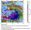
A major earthquake occurred at 16:58:53 (UTC) on Friday, January 27, 2006. The magnitude 7.6 event has been located in the BANDA SEA. (This event has been reviewed by a seismologist.)


Earthquake Details
| Magnitude | 7.6 |
|---|---|
| Date-Time |
= Coordinated Universal Time = local time at epicenter |
| Location | 5.482°S, 128.093°E |
| Depth | 397 km (246.7 miles) set by location program |
| Region | BANDA SEA |
| Distances | 200 km (125 miles) S of Ambon, Moluccas, Indonesia 445 km (275 miles) NE of DILI, East Timor 825 km (510 miles) NNW of DARWIN, Northern Territory, Australia 2370 km (1470 miles) E of JAKARTA, Java, Indonesia |
| Location Uncertainty | horizontal +/- 4.1 km (2.5 miles); depth fixed by location program |
| Parameters | Nst=258, Nph=258, Dmin=>999 km, Rmss=0.9 sec, Gp= 25°, M-type=teleseismic moment magnitude (Mw), Version=Q |
| Source | USGS NEIC (WDCS-D) |
| Event ID | usika7 |


 Historical Moment Tensor Solutions
- Preliminary Earthquake Report
- U.S. Geological Survey, National Earthquake Information Center
World Data Center for Seismology, Denver
