
Magnitude 7.5 - KEPULAUAN ALOR, INDONESIA
2004 November 11 21:26:41 UTC


Earthquake Details
| Magnitude | 7.5 (Major) |
|---|---|
| Date-Time |
= Coordinated Universal Time = local time at epicenter |
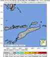
| Location | 8.172°S, 124.856°E |
| Depth | 10 km (6.2 miles) set by location program |
| Region | KEPULAUAN ALOR, INDONESIA |
| Distances | 90 km (55 miles) WNW of DILI, East Timor 260 km (160 miles) NNE of Kupang, Timor, Indonesia 360 km (225 miles) ENE of Ende, Flores, Indonesia 810 km (500 miles) NW of DARWIN, Northern Territory, Australia |
| Location Uncertainty | horizontal +/- 8.2 km (5.1 miles); depth fixed by location program |
| Parameters | Nst=186, Nph=186, Dmin=258 km, Rmss=1.19 sec, Gp= 36°, M-type=teleseismic moment magnitude (Mw), Version=S |
| Source | USGS NEIC (WDCS-D) |
| Event ID | usqsci |
- This event has been reviewed by a seismologist.
Did you feel it?
Report shaking and damage at your location. You can also view a map displaying accumulated data from your report and others.


- Preliminary Earthquake Report
- U.S. Geological Survey, National Earthquake Information Center
World Data Center for Seismology, Denver
