|
| Coastal & Marine Geology InfoBank |
|
|
|
Metadata
|
|
ID
|
91059
|
|
Also Known As
|
U-59-91-GM
91059
|
|
Abstract
|
United States Geological Survey, Woods Hole, Massachusetts.
Chief Scientist: William Strahle. Mooring work data
(Environmental Instrument Measuring Pole (EIMP)) of field
activity 91059 (U-59-91-GM) in upper Mobile Bay, Alabama,
Gulf of Mexico, United States, North America, North Atlantic
from 02/18/1991 to 02/18/1991
|
|
Organization
|
United States Geological Survey, Woods Hole, Massachusetts
|
|
Chief Scientist
|
William Strahle
|
|
Activity Type
|
Mooring work
|
|
Platform
|
Unknown
|
|
Area of Operation
|
upper Mobile Bay, Alabama, Gulf of Mexico, United States, North America, North Atlantic
|
|
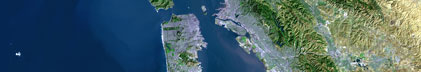
Location map
|

|
|
Bounding Coordinates
|
30.75000
-99.75000 -80.25000
17.25000
|
|
Dates
|
02/18/1991 (JD 049) to 02/18/1991 (JD 049)
|
|
Analog Materials
|
No analog holdings.
|
|
Index map

|
|
|
|
Crew
|
|
William Strahle
|
Chief Scientist
|
|
|
Equipment Used
|
|
Environmental Instrument
|
(Measuring Pole (EIMP))
|
|
|
Purpose
|
|
Recover EIMP, Mooring # 366, from upper Mobile Bay, AL.
|
|
|
Information to be Derived
|
|
|
Summary
|
|
Mooring recovered: 1 (#366, deployed FA 91002 DEBORAH B Jan. 22, 1991).
|
|
|
Notes
|
|
1 day at sea.
|
|
Occupied 1 station.
|
|
Related Web Sites:
|
|
Information derived from mooring log; no pre- or post-field
|
|
activity report found.
|
|
|
Project Number
|
|
|
Got Help?
|
For 91059, we would appreciate any information on -- analog materials, contract, days at sea, dive count, funding, kms of navigation, national plan, NGDC Info, owner, ports, project, publications, scanned materials, seismic description, station count, station description, submersible, tabulated info.
|