|
|
|
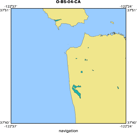
Metadata
|
|
ID
|
O-B5-04-CA
|
|
Abstract
|
United States Geological Survey, Pacific Science Center.
Geodetic data (GPS, ATV3) of field activity O-B5-04-CA in
Ocean Beach, CA from 10/13/2004 to 10/13/2004
|
|
Organization
|
United States Geological Survey, Pacific Science Center
|
|
Project/Theme
|
Coastal Evolution Modeling Project
Coastal Change Hazards
|
|
Activity Type
|
Geodetic
|
|
|
|
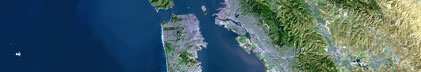
Area of Operation
|
Ocean Beach, CA
|
|
Location map
|

|
|
Bounding Coordinates
|
37.75944
-122.50973 -122.50972
37.75943
|
|
Dates
|
10/13/2004 (JD 287) to 10/13/2004 (JD 287)
|
|
Analog Materials
|
No analog holdings.
|
|
Index map
|
|
|
Information Specialist
|
|
|
Crew
|
|
|
Equipment Used
|
|
|
Publications
|
|
Barnard, P.L., Eshleman, Jodi, Erikson, Li,and Hanes, D.M., 2006, Coastal Processes Study at Ocean Beach,
|
|
San Francisco, CA: Summary of Data Collection 2004-2006, U.S. Geological Survey Open-File Report 2007-1217
|
|
available on-line at:
|
|
http://pubs.usgs.gov/of/2007/1217/
|
|
|
Got Help?
|
For O-B5-04-CA, we would appreciate any information on -- analog materials, chief scientist, contract, days at sea, dive count, funding, information to be derived, kms of navigation, national plan, NGDC Info, notes, owner, ports, project number, purpose, scanned materials, seismic description, station count, station description, submersible, summary, tabulated info.
|
|