
|
|
|
|
Metadata
|
|
ID
|
98GFP02
|
|
Also Known As
|
G-2-98-LA
|
|
Abstract
|
United States Geological Survey, St. Petersburg,
Florida,University of New Orleans,Lake Pontchartrain Basin
Foundation,National Oceanic and Atmospheric
Administration,Coalition to Restore Louisiana,United States
Army Corps of Engineers,Environmental Protection
Agency,University of Georgia. Chief Scientist: Jack
Kindinger. Geological and Geophysical data (boomer, GPS,
sidescansonar, GPS, depthsounder) of field activity 98GFP02
(G-2-98-LA) in Lake Pontchartrain, LA from 06/20/1998 to
06/25/1998
|
|
Organization
|
United States Geological Survey, St. Petersburg, Florida
University of New Orleans
Lake Pontchartrain Basin Foundation
National Oceanic and Atmospheric Administration
Coalition to Restore Louisiana
United States Army Corps of Engineers
Environmental Protection Agency
University of Georgia
|
|
Project/Theme
|
Lake Pontchartrain Geologic Framework and Coastal Processes Study
|
|
Chief Scientist
|
Jack Kindinger
|
|
Activity Type
|
Geological and Geophysical
|
|
Platform
|
Gilbert
|
|
Area of Operation
|
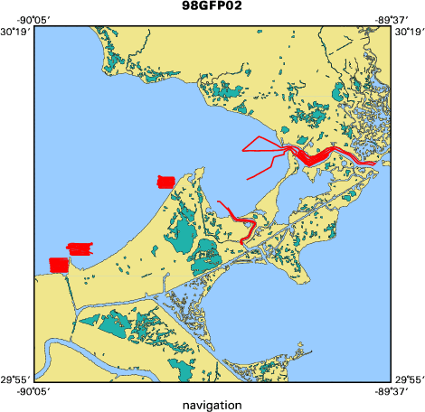
Lake Pontchartrain, LA
|
|
Location map
|

|
|
Bounding Coordinates
|
30.18962
-90.05583 -89.63275
30.03610
|
|
Ports
|
leave New Orleans Municipal Marina
arrive New Orleans Municipal Marina
|
|
Dates
|
06/20/1998 (JD 171) to 06/25/1998 (JD 176)
|
|
Analog Materials
|
list
|
|
Index map
|
|
|
Information Specialist
|
|
|
Crew
|
|
Jack Kindinger
|
Chief Scientist, USGS St. Petersburg, FL
|
|
Jim Flocks
|
Geologist, USGS St. Petersburg, FL
|
|
Dana Wiese
|
Electronics Technician, USGS St. Petersburg, FL
|
|
Shea Penland
|
Geologist, University of New Orleans
|
|
Rich Young
|
Boat Captain, USGS St. Petersburg, FL
|
|
|
Equipment Used
|
|
boomer
|
|
GPS
|
|
sidescansonar
|
|
GPS
|
|
depthsounder
|
|
|
Purpose
|
|
Geologic framework and coastal processes study.
|
|
|
Information to be Derived
|
|
|
Summary
|
|
Boomer (64 lines) (Jun 20-24), Sidescan (Jun 20-25),
|
|
Boxcore (Jun 22).
|
|
|
Notes
|
|
98GFP02 FACS logs were generated by Karynna Calderon in December of
|
|
2002 using the handwritten logbooks and personal accounts of the crew members.
|
|
|
Publications
|
|
Calderon, Karynna, Dadisman, Shawn V., Kindinger, Jack L., Williams, S.
|
|
Jeffress, Flocks, James G., Penland, Shea, and Wiese, Dana S., 2003, Archive
|
|
of digital boomer seismic reflection data collected during USGS cruises
|
|
94GFP01, 95GFP01, 96GFP01, 97GFP01, and 98GFP02 in lakes Pontchartrain, Borgne,
|
|
and Maurepas, Louisiana, 1994-1998: U.S. Geological Survey Open-File Report
|
03-497, CD-ROM.
|
|
|
Got Help?
|
For 98GFP02, we would appreciate any information on -- contract, days at sea, dive count, funding, kms of navigation, national plan, NGDC Info, owner, project number, scanned materials, seismic description, station count, station description, submersible, tabulated info.
|
|


