
|
|
|
|
Metadata
|
|
ID
|
93SSF01
|
|
Also Known As
|
G-1-93-FL
|
|
Abstract
|
University of South Florida,United States Geological Survey,
St. Petersburg, Florida,Eckerd College. Chief Scientists: Guy
Gelfenbaum, Gregg R. Brooks. Vibracoring data (vibratingcore,
GPS, penetrometer) of field activity 93SSF01 (G-1-93-FL) in
West-central Florida shelf; Anclote Key (north) and Venice
Inlet to thesouth, up to 30 km offshore. from 00/00/1993 to
00/00/1993
|
|
Organization
|
University of South Florida
United States Geological Survey, St. Petersburg, Florida
Eckerd College
|
|
Project/Theme
|
West-Central Florida Coastal Studies Project
|
|
Chief Scientist
|
Guy Gelfenbaum
Gregg R. Brooks
|
|
Activity Type
|
Vibracoring
|
|
Platform
|
Gilbert
|
|
Area of Operation
|
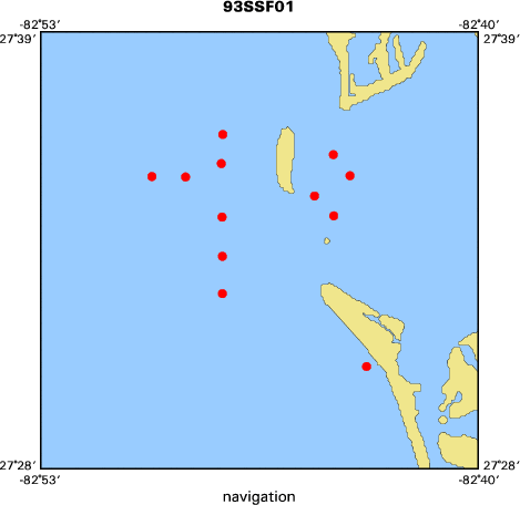
West-central Florida shelf; Anclote Key (north) and Venice Inlet to the
south, up to 30 km offshore.
|
|
Location map
|

|
|
Bounding Coordinates
|
27.60133
-82.82517 -82.72617
27.50583
|
|
Ports
|
leave Tampa Bay, FL
arrive Tampa Bay, FL
|
|
Dates
|
00/00/1993 (JD 000) to 00/00/1993 (JD 000)
|
|
Analog Materials
|
No analog holdings.
|
|
Index map
|
|
|
Information Specialist
|
|
|
Crew
|
|
Gregg Brooks
|
Chief Scientist, Eckerd College
|
|
Larry Doyle
|
Geologist, Univ. of South Florida
|
|
Beau Suthard
|
Field tech, USGS St. Petersburg
|
|
Nancy Dewitt
|
Field tech, USGS St. Petersburg
|
|
Greg Berman
|
Field tech, USGS St. Petersburg
|
|
Boudewijin Remick
|
Field tech, USGS St. Petersburg
|
|
|
Equipment Used
|
|
vibratingcore
|
|
GPS
|
|
penetrometer
|
|
|
Purpose
|
|
Understand the geologic evolution of the coast and inner cont. shelf
|
|
and aid in coastal management. By investigating the subsurface sediment facies
|
|
present on the shelf and determine the relationship among facies and with the
|
|
underlying carbonate platform.
|
|
|
Information to be Derived
|
|
Grain size, calcium carbonate content and total organic content for all
|
|
cores. Select samples mineralogy by XRD analysis and age dating by carbon 14 or
|
|
Sr-isotope ratio.
|
|
|
Summary
|
|
11 cores collected and analyzed under West Florida section of project.
|
|
|
Publications
|
Brooks, Gregg R., Doyle, Larry J., Suthard, Beau C., and DeWitt, Nancy T., 1999, Inner West-Central Florida continental shelf: sedimentary facies and facies associations: USGS Open File Report 98-796.
|
|
coastal.er.usgs.gov/wfla
|
|
|
Got Help?
|
For 93SSF01, we would appreciate any information on -- analog materials, contract, days at sea, dive count, funding, kms of navigation, national plan, NGDC Info, notes, owner, project number, scanned materials, seismic description, station count, station description, submersible, tabulated info.
|
|


