|
|
|
Metadata
|
|
ID
|
96LCA04
|
|
Also Known As
|
B-4-96-FL
DS 346
|
|
Abstract
|
United States Geological Survey, St. Petersburg, Florida.
Geophysical data of field activity 96LCA04 (B-4-96-FL) in
Lakes Mabel and Starr, Florida from 08/06/1996 to 08/07/1996
|
|
Organization
|
United States Geological Survey, St. Petersburg, Florida
|
|
Project/Theme
|
Lakes and Coastal Aquifers (LCA) and Central Highlands Lakes
|
|
Activity Type
|
Geophysical
|
|
Area of Operation
|
Lakes Mabel and Starr, Florida
|
|
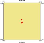
Location map
|
|
|
Bounding Coordinates
|
27.97310
-81.59289 -81.58315
27.95320
|
|
Ports
|
LEAVE Lake Mabel, FL
ARRIVE Lake Starr, FL
|
|
Dates
|
08/06/1996 (JD 219) to 08/07/1996 (JD 220)
|
|
Analog Materials
|
list
|
|
Scanned Materials
|
B-4-96-fl.cruise log (pdf)
|
|
Index map

|
|
|
Information Specialist
|
|
Dana Wiese
|
|
Arnell Harrison
|
|
|
Purpose
|
|
To describe the hydrogeologic setting of Lakes Mabel and Starr, and present a
|
|
lake water budget computed at weekly, monthly, and annual time intervals.
|
|
|
Publications
|
|
Harrison, A.S., Dadisman, S.V., Swancar, Amy, Tihansky, A.B., Flocks, J.G.,
|
|
and Wiese, D.S., 2008, Archive of Digital Boomer Seismic Reflection Data
|
|
Collected During USGS Field Activity 96LCA04 in Lakes Mabel and Starr,
|
|
Central Florida, August 1996, U.S. Geological Survey Data Series 346.
|
|
|
Got Help?
|
For 96LCA04, we would appreciate any information on -- chief scientist, contract, crew, days at sea, dive count, equipment used, funding, information to be derived, kms of navigation, national plan, NGDC Info, notes, owner, platform, project number, scanned materials, seismic description, station count, station description, submersible, summary, tabulated info.
|
|


