
U.S. DEPARTMENT OF THE INTERIOR
BUREAU OF LAND MANAGEMENT


California
|
Print Page | |||
| Eagle Lake Field Office | ||||
|
||||

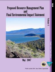 Eagle Lake Proposed Resource Management Plan and
Final Environmental Impact Statement
The Bureau of Land Management (BLM) has prepared this Proposed Resource Management Plan (PRMP) and Final Environmental Impact Statement (FEIS) to provide direction for managing public lands within the Eagle Lake Field Office planning area and to analyze the environmental effects resulting from implementing the Preferred Alternative.
The Eagle Lake Field Office includes approximately 1,022,767 acres of BLM-managed surface acres in northeastern California and northwest Nevada. The geographic area includes BLM-administered lands within the counties of Lassen, Plumas, Sierra, California, and Washoe, Nevada. BLM’s mission is to sustain the health, diversity, and productivity of the public lands it manages for the use and enjoyment of present and future generations. The Eagle Lake Proposed RMP was developed in coordination with the Alturas and Surprise Field Office Resource Management Plans (RMPs) to provide a consistent framework for managing public lands and resource uses in northeast California and northwest Nevada.
Bookmarks to each Section (PDF files):
Section by Section (PDF files):
Index and Table of Contents (1.8Mb)Chapter 1 - Purpose and Need (507Kb)Chapter 3 - Affected Environment (3.8Mb)Appendices (1.6Mb)Bibliography (173Kb)Comment Letters (37.3Mb)Abbreviations and Glossary (633Kb)Maps.pdf (23.3Mb)