
Columbia & Lower Willamette Navigation Project
 The Columbia River has been an important trade route for a long time. Long before eastern explorers moved into the Pacific Northwest, Native American tribes used the river to facilitate trade between the various bands, tribes and nations within the region. When American merchants and pioneers arrived in the Oregon Territory, they too recognized the river's great potential to help build and inhabit the region. Merchant ships regularly crossed the treacherous Columbia River bar in the early half of the 19th century to access the towns along the river.
The city of Portland was the first to move forward in an effort to improve the conditions of the lower river. Their early efforts, dating to 1865, included removing snags and dredging sand bars and shoals in the area of Swan Island and the confluence of the Willamette and Columbia rivers. The federal government's first actions in the river didn't occur until 1868. Their initial roles included surveying, dredging, and removing snags.
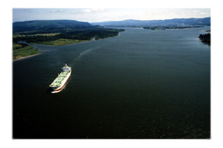
Much work has taken place in the Lower Columbia River since the first improvements were made. The river, once only 17 feet deep in certain places, now is maintained to a depth of 40 feet. This allows modern trade ships to transit as far upriver as Portland, Oregon and Vancouver, Washington. A proposal to deepen the river an additional 3 feet has been approved by Congress, and is scheduled for completion in 2010. (For more information on the Columbia River Channel Improvement Project, please click here.)
The current Corps of Engineers project begins at River Mile 3, near the mouth of the Columbia River, and extends to River Mile 106.5, near Vancouver, Washington. The Corps is also responsible for Willamette River up to River Mile 11 which is within the city limits of Portland, Oregon. The navigation channel is maintained to an average depth of 40 feet. The Corps has not dredged the Willamette River since 1997, due to it being designated a "Superfund Site" by the U.S. Environmental Protection Agency. The Willamette River is on the U.S. Environmental Protect Agency's National Priorities List.
Historic River Depth:
1860 - 17 feet
1878 - 20 feet
1899 - 25 feet
1935 - 35 feet
1976 - 40 feet
2005 - 43 feet