Whitney Point Lake, New York
 Whitney Point Lake is one
of 13 Corps of Engineers reservoir projects in the Susquehanna River watershed.
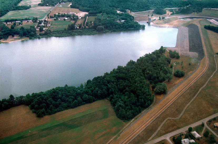
The reservoir is located on the Otselic River in Broome County, New York, and
controls a drainage area of 255 square miles. It is primarily operated for flood
control, but is also used for recreation and upland wildlife management. The
project provides flood damage reduction for the valley along the lower Tioughnioga River,
the lower Chenango River, and the Susquehanna River downstream of Binghamton. Whitney Point Lake is one
of 13 Corps of Engineers reservoir projects in the Susquehanna River watershed.
The reservoir is located on the Otselic River in Broome County, New York, and
controls a drainage area of 255 square miles. It is primarily operated for flood
control, but is also used for recreation and upland wildlife management. The
project provides flood damage reduction for the valley along the lower Tioughnioga River,
the lower Chenango River, and the Susquehanna River downstream of Binghamton.
Facilities:
The recreational facilities are operated by the Broome County Department
of Parks, Dorchester Park. Dorchester Park is a day use facility
with no entrance fee. The park has picnic facilities, restrooms,
water taps and fountains, two 100-person picnic shelters, and a
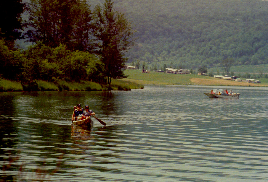
swimming beach with certified lifeguards and changing areas. Boats
are allowed on the lake but they are limited to a 25 hp motor and a
maximum speed of 10 mph. Unfortunately, these speeds do not
allow for water skiing. Dorchester Park rents canoes, rowboats,
paddleboats, sailboats and kayaks for a fee.
Additional information about the park and rental fees can be obtained
by calling the park at 607-692-4612 or logging on to their website at
http://www.gobroomecounty.com/community/ParksDorchester.php.
Operation:
-
Recreation: Memorial Day to Labor Day
-
Beach/Boat Ramp: Open through October
-
Campground: Open during hunting season
Local
Points of Interests:
For information regarding activities and events in the area, visit Broome
County's Chamber of Commerce web site at http://www.greaterbinghamtonchamber.com/.
Project Location: Whitney Point Lake is located on the
Otselic River in Broome County, N.Y. The dam forming the lake is three-quarters
of a mile above the village of Whitney Point, where the Otselic River
flows into the Tioughnioga River. About 9 miles below Whitney Point, the
Tioughnioga empties into the Chenango River which in turn flows into the
Susquehanna River at Binghamton, N.Y., 20 miles below the damsite. View
map here.
Authorization: The project is a unit of the comprehensive
flood control plan for the protection of communities in southern New York
and eastern Pennsylvania authorized by the Flood Control Act of June 22,
1936, as amended by the Flood Control Act of June 28, 1938, and is described
in House Document No. 702, 77th Congress, second session.
Cost: The federal cost of the project was $5,421,539.
Construction costs in constant dollars are estimated at $98,356,000.
Section 1135 Project Modification: See
current fact sheet
District Project Manager: George
Bielen, (570) 275-9505
|
